Category:Maps of the history of Algeria
Jump to navigation
Jump to search
Countries of Africa: Algeria · Angola · Benin · Botswana · Burkina Faso · Burundi · Cameroon · Central African Republic · Chad · Democratic Republic of the Congo · Republic of the Congo · Djibouti · Egypt‡ · Equatorial Guinea · Eritrea · Eswatini · Ethiopia · Gabon · The Gambia · Ghana · Guinea · Guinea-Bissau · Ivory Coast · Kenya · Lesotho · Liberia · Libya · Madagascar · Malawi · Mali · Mauritania · Morocco · Mozambique · Namibia · Niger · Nigeria · Rwanda · Senegal · Sierra Leone · Somalia · South Africa · South Sudan · Sudan · Tanzania · Togo · Tunisia · Uganda · Zambia · Zimbabwe
Limited recognition: Ambazonia · Azawad · Somaliland – Other areas: Canary Islands · Ceuta · Melilla · Réunion · Western Sahara
‡: partly located in Africa
Limited recognition: Ambazonia · Azawad · Somaliland – Other areas: Canary Islands · Ceuta · Melilla · Réunion · Western Sahara
‡: partly located in Africa
Subcategories
This category has the following 20 subcategories, out of 20 total.
!
A
- Maps of Almoravid dynasty (48 F)
F
H
M
- Maps of Algerian War (14 F)
- Maps of Ottoman Algeria (36 F)
- Maps of the Aghlabid Emirate (19 F)
- Maps of the Hafsid dynasty (19 F)
- Maps of the Hammadid dynasty (40 F)
- Maps of the Idrisid dynasty (16 F)
- Maps of the Marinid dynasty (23 F)
- Maps of the Rustamid dynasty (27 F)
- Maps of the Zayyanid dynasty (26 F)
- Maps of the Zirid dynasty (48 F)
N
O
P
- Ptolemy's 2nd African Map (45 F)
Media in category "Maps of the history of Algeria"
The following 134 files are in this category, out of 134 total.
-
Alger arrondissement 1963 1974.png 800 × 390; 52 KB
-
Aekstate.png 420 × 269; 67 KB
-
Algerian massacres 1997-1998.png 800 × 454; 83 KB
-
Algiers and Kabylia Map.png 1,200 × 1,050; 338 KB
-
Arab Islamic Republic.png 604 × 404; 3 KB
-
Argel - btv1b84938393.jpg 8,259 × 6,163; 8.05 MB
-
Aïn Mahdi 1838.JPG 2,680 × 3,150; 721 KB
-
Aïn Sefra territory 1934-1955 map-fr.svg 1,287 × 1,278; 1.84 MB
-
Batalla de Mostaganem (1558)-hu.svg 1,077 × 1,180; 60 KB
-
Batalla de Mostaganem (1558).svg 1,077 × 1,180; 44 KB
-
Berber Revolt West.png 2,495 × 1,247; 604 KB
-
Beylik de l’Ouest carte.jpg 1,024 × 509; 80 KB
-
Beylik de l’ouest de l’Algérie.jpg 1,024 × 509; 80 KB
-
Campañas mediterráneas de Pero Niño 03.png 1,200 × 1,001; 81 KB
-
Capsian Culture.jpg 622 × 314; 25 KB
-
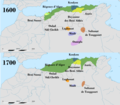
Carte d'Algérie de 1600 et de 1700.png 17,197 × 15,047; 7.88 MB
-
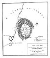
Carte de la Kalaa Beni Abbès.png 9,655 × 8,419; 3.66 MB
-
Carte de la régence d'Alger v2.png 6,665 × 4,437; 4.03 MB
-
Carte de la régence d'Alger.jpg 750 × 664; 26 KB
-
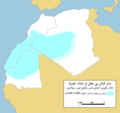
Carte des Banu Maqil-ar.png 2,230 × 2,100; 354 KB
-
Carte des Banu Maqil.png 2,230 × 2,100; 325 KB
-
Carte des Beni Amer.jpg 1,080 × 910; 353 KB
-
Carte des Royaumes antiques Berbères.jpg 2,182 × 1,208; 848 KB
-
Carte Iflissen.jpg 2,048 × 1,550; 302 KB
-
Carte répartition gravures ruesptres bubale Atlas saharien.jpg 2,318 × 1,699; 649 KB
-
Conquêtes des Saadiens1592.png 624 × 600; 71 KB
-
Crown of Castile 1580 loc map.svg 826 × 571; 415 KB
-
Emir Abdelkader reached its greatest extent.png 830 × 482; 16 KB
-
Emirat Hafside de Béjaïa.jpg 1,200 × 654; 46 KB
-
Emirate of tlemcen map.png 1,000 × 618; 35 KB
-
Exarchat von Karthago.jpg 1,324 × 852; 130 KB
-
Eyalet Algeria in 1560.png 2,068 × 1,428; 1.53 MB
-
Eyalet Algeria in 1771.png 1,034 × 834; 65 KB
-
Eyalet of Algéria in the 1700.png 8,234 × 4,096; 1.06 MB
-
Fall of the Aghlabid Emirate-es.svg 1,483 × 701; 486 KB
-
Fall of the Aghlabid Emirate.svg 1,483 × 701; 464 KB
-
French Algeria evolution map 1830-1962 ar.svg 1,287 × 1,278; 1.86 MB
-
Gravures préhistoriques du Sud-oranais (Algérie), carte.jpg 5,456 × 3,792; 5.92 MB
-
Hammadids map XIIth century fr.svg 1,100 × 500; 37 KB
-
Hispania 476 AD he.svg 6,349 × 6,349; 1.28 MB
-
Hispania 476 AD.PNG 2,500 × 2,500; 287 KB
-
Hispania 476 AD.svg 6,349 × 6,349; 1.24 MB
-
Historical map of algeria.png 1,000 × 618; 28 KB
-
History of Algeria.jpg 1,797 × 2,294; 653 KB
-
I54489847949844984984984494895464.jpg 640 × 584; 106 KB
-
Iberomaurisiense-Capsiense-ar.png 786 × 396; 92 KB
-
Iberomaurisiense-Capsiense-ca.png 1,217 × 614; 439 KB
-
Iberomaurisiense-Capsiense.png 1,217 × 614; 34 KB
-
Ifran Dynasty.jpg 1,125 × 1,071; 365 KB
-
Ifranids of Tlemcen.jpg 1,125 × 1,017; 413 KB
-
Ifrenid kingdom & Fatimide caliphate.png 1,280 × 940; 149 KB
-
Ifrenide kingdom.png 1,280 × 940; 148 KB
-
Kab 1500-1750.png 6,792 × 4,427; 2.9 MB
-
Kabylestatesp.png 1,544 × 856; 399 KB
-
Kingdom of Beni Abbas.jpg 1,125 × 1,132; 756 KB
-
Kingdom of kuku.png 720 × 879; 337 KB
-
Ksours of Algeria.png 655 × 743; 30 KB
-
L'Algérie au début du XVIe siècle.png 5,798 × 3,084; 711 KB
-
L'Algérie pendant l'ère Sulaymanides.jpg 1,942 × 1,810; 335 KB
-
L'Algérie pendant la première partie coloniale.png 797 × 437; 900 KB
-
L'Etat d'Alger dès la fin du XVIIe siècle.png 1,436 × 1,004; 1.07 MB
-
La Régence d'Alger en 1771.png 1,034 × 834; 64 KB
-
Labes Kingdom Animated.gif 442 × 430; 27 KB
-
Les provinces de la Régence d'Alger en 1700.png 8,234 × 4,096; 1.09 MB
-
Les provinces de la Régence d'Alger-ar.svg 8,326 × 4,142; 267 KB
-
Les provinces de la Régence d'Alger.svg 8,326 × 4,142; 62 KB
-
LocationByzantineEmpire 550.png 1,075 × 700; 21 KB
-
Maghraoua.jpg 2,048 × 1,504; 213 KB
-
Maghrawa Dynasty.jpg 1,125 × 1,072; 296 KB
-
Maghrawi dynasty.jpg 640 × 468; 113 KB
-
Maghrawis empire.jpg 640 × 584; 88 KB
-
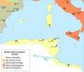
Maghreb central 1600.PNG 657 × 340; 13 KB
-
Maghreb central.jpg 752 × 956; 550 KB
-
Magrèb (sègle IX).png 919 × 414; 78 KB
-
Magrèb (sègle XVI).png 1,154 × 455; 78 KB
-
Magrèb en 1100.png 1,076 × 745; 107 KB
-
Magrèb en 1670.png 1,141 × 360; 74 KB
-
Magrèb sègle IXv3.svg 3,882 × 1,428; 892 KB
-
Map of Eyalet of Algeria circa 1700.png 8,234 × 4,096; 1.1 MB
-
Map of Hafsids of Béjaïa.svg 1,536 × 819; 1.07 MB
-
Map of ibn Abi Mahalli State - Arabic.svg 746 × 580; 306 KB
-
Map of North and West Africa in 1815 AD.png 7,816 × 3,960; 1.71 MB
-
Map of the ifranide dynasty.png 1,000 × 618; 31 KB
-
Map of the ifrinide dynasty in tlemcen, Algeria.png 1,000 × 618; 31 KB
-
Map of the Regency of Algiers.jpg 1,125 × 987; 267 KB
-
Map of the sultanate of touggourt.jpg 5,000 × 2,592; 387 KB
-
Mediterranean-sea-526-ca.svg 999 × 843; 184 KB
-
Mediterranean-sea-526-es.svg 1,066 × 899; 174 KB
-
Mediterranean-sea-526-pt.svg 999 × 843; 20 KB
-
Mediterraneans 1328.png 806 × 454; 39 KB
-
Megalitismo Europa.svg 1,188 × 1,500; 190 KB
-
Megawal31.jpg 305 × 251; 13 KB
-
Moulouya-Frontière.GIF 976 × 134; 23 KB
-
Nord d Algerie.png 632 × 524; 92 KB
-
Oqba Ibn Naafi en Afrique du nord ARABE.svg 1,160 × 658; 94 KB
-
Ottoman Algeria.png 2,631 × 2,162; 824 KB
-
Ouled sidi el shiek.png 500 × 280; 79 KB
-
Regency of Algiers 15th-18th Century.jpg 2,250 × 1,974; 1.34 MB
-
Regency of Algiers in 1792.jpg 1,125 × 1,557; 262 KB
-
Repartition maghrawas.jpg 828 × 410; 68 KB
-
Ruines romaines Ammi Moussa.jpg 1,733 × 1,393; 3.72 MB
-
Rustamid Dynasty.761.png 1,280 × 940; 131 KB
-
Régence d'Alger 1700 map-es.svg 1,220 × 610; 276 KB
-
Régence d'Alger 1700 map-fr.svg 1,220 × 610; 271 KB
-
Régence d'Alger 1700 map-pt.svg 1,220 × 610; 275 KB
-
Régence d'Alger en Afrique du Nord (17e-18e siècle).png 9,739 × 6,185; 7.26 MB
-
Répartition des Beni Amer.jpg 1,080 × 910; 230 KB
-
Répartition des Berbères Maghraouas.jpg 828 × 410; 66 KB
-
Sanhadja 7th.jpg 728 × 685; 32 KB
-
Scission des lignées zirides, Hammadides-Badicides-Zawides.PNG 596 × 430; 16 KB
-
Tagdemt 1838.JPG 2,800 × 3,300; 949 KB
-
Tribu Beni Abbès.png 3,873 × 2,233; 1.04 MB
-
Tribus de l'ouest algérien.jpg 1,043 × 709; 225 KB
-
Tribus de Relizane.jpg 688 × 645; 96 KB
-
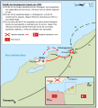
Tunis campaign (1694).png 1,200 × 1,048; 138 KB
-
Vandal alan kingdom 526 fr.png 1,036 × 900; 94 KB
-
Vandal alan kingdom 526-el.png 1,036 × 900; 63 KB
-
Vandal alan kingdom 526-it.png 1,036 × 900; 51 KB
-
Vandal alan kingdom 526.png 1,036 × 900; 87 KB
-
Vandals Migration it.PNG 1,725 × 1,739; 527 KB
-
Vandals Migration pt.gif 1,725 × 1,739; 236 KB
-
Gravures préhistoriques, Djelfa, carte.jpg 4,680 × 3,400; 2.7 MB
-
West Mediterranean Areas 279 BC-de.png 1,112 × 837; 45 KB
-
Wilaya III historique.jpg 720 × 709; 77 KB
-
ZiríesComoClientesFatimíes-pt.svg 628 × 401; 79 KB
-
ZiríesComoClientesFatimíes.svg 670 × 428; 324 KB
-
ZiríesHamadíesYGranada-pt.svg 670 × 428; 90 KB
-
ZiríesHamadíesYGranada.svg 670 × 428; 269 KB
-
Карта царств Алжира (815-915).svg 1,000 × 618; 106 KB
-
الفتوحات الإسلامية في شمال أفريقيا وجنوب غرب أوربا.gif 556 × 800; 83 KB
-
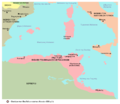
النشاط الإسلامي في البحر المتوسط بين القرنين السابع والتاسع الميلاديين.jpg 1,932 × 1,372; 803 KB
-
اليفرنيون.png 1,280 × 940; 151 KB
-
حملة تونس (1694).png 1,200 × 1,048; 198 KB


