Category:Maps of the history of Cameroon
Jump to navigation
Jump to search
Countries of Africa: Algeria · Angola · Benin · Botswana · Burkina Faso · Burundi · Cameroon · Central African Republic · Chad · Democratic Republic of the Congo · Republic of the Congo · Djibouti · Egypt‡ · Equatorial Guinea · Eritrea · Eswatini · Ethiopia · Gabon · The Gambia · Ghana · Guinea · Guinea-Bissau · Ivory Coast · Kenya · Lesotho · Liberia · Libya · Madagascar · Malawi · Mali · Mauritania · Morocco · Mozambique · Namibia · Niger · Nigeria · Rwanda · Senegal · Sierra Leone · Somalia · South Africa · South Sudan · Sudan · Tanzania · Togo · Tunisia · Uganda · Zambia · Zimbabwe
Limited recognition: Ambazonia · Azawad · Somaliland – Other areas: Canary Islands · Ceuta · Melilla · Réunion · Western Sahara
‡: partly located in Africa
Limited recognition: Ambazonia · Azawad · Somaliland – Other areas: Canary Islands · Ceuta · Melilla · Réunion · Western Sahara
‡: partly located in Africa
Subcategories
This category has the following 8 subcategories, out of 8 total.
Media in category "Maps of the history of Cameroon"
The following 11 files are in this category, out of 11 total.
-
Bamileke and Bamun kingdoms.png 439 × 441; 48 KB
-
Bamun Kingdom.gif 439 × 441; 37 KB
-
Cameron - Evolucion territòriala durant lo procès d'independéncia.png 870 × 1,357; 180 KB
-
Cameron - Partiment francobritanic.png 870 × 1,357; 155 KB
-
Cameroons Province, 1930.webp 720 × 993; 64 KB
-
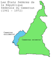
Carte des États de la République fédérale du Cameroun.png 400 × 423; 8 KB
-
Colonizacion de l'Africa Occidentala.png 1,268 × 561; 311 KB
-
Kanem-Bornu 1650.svg 686 × 970; 1.43 MB
-
Map Cameroon Coast 1846 B002.png 1,860 × 2,998; 1.03 MB
-
Map of British Cameroons in 1949.jpg 3,662 × 5,506; 2.91 MB
-
África Ecuatorial Española.svg 2,846 × 1,863; 1.91 MB


