Category:Maps of the history of Angola
Jump to navigation
Jump to search
Countries of Africa: Algeria · Angola · Benin · Botswana · Burkina Faso · Burundi · Cameroon · Central African Republic · Chad · Democratic Republic of the Congo · Republic of the Congo · Djibouti · Egypt‡ · Equatorial Guinea · Eritrea · Eswatini · Ethiopia · Gabon · The Gambia · Ghana · Guinea · Guinea-Bissau · Ivory Coast · Kenya · Lesotho · Liberia · Libya · Madagascar · Malawi · Mali · Mauritania · Morocco · Mozambique · Namibia · Niger · Nigeria · Rwanda · Senegal · Sierra Leone · Somalia · South Africa · South Sudan · Sudan · Tanzania · Togo · Tunisia · Uganda · Zambia · Zimbabwe
Limited recognition: Ambazonia · Azawad · Somaliland – Other areas: Canary Islands · Ceuta · Melilla · Réunion · Western Sahara
‡: partly located in Africa
Limited recognition: Ambazonia · Azawad · Somaliland – Other areas: Canary Islands · Ceuta · Melilla · Réunion · Western Sahara
‡: partly located in Africa
Subcategories
This category has the following 4 subcategories, out of 4 total.
K
M
P
Media in category "Maps of the history of Angola"
The following 23 files are in this category, out of 23 total.
-
Av hvalfangstens historie (1922) (20325844916).jpg 1,816 × 2,056; 462 KB
-
Av hvalfangstens historie (1922) (20358179601).jpg 1,766 × 1,998; 408 KB
-
Av hvalfangstens historie (1922) (20358190551).jpg 1,776 × 2,014; 459 KB
-
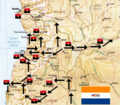
Cubans Angola Map1988.png 1,378 × 1,771; 89 KB
-
FAPLA Military Regions 1986.png 2,000 × 2,262; 67 KB
-
KingdomKongo1711.png 774 × 540; 146 KB
-
KingdomMatamba1711.png 774 × 540; 177 KB
-
KingdomNdongo1711.png 774 × 540; 119 KB
-
Loango-Angolakust.jpg 392 × 532; 30 KB
-
Map of the Kingdom of Ndongo.svg 512 × 512; 35 KB
-
Mbunda Kingdom Map.png 273 × 146; 4 KB
-
MBunduRegions.jpeg 600 × 706; 256 KB
-
Msiri's kingdom in 1880.PNG 767 × 478; 674 KB
-
Op Savannah Map.png 718 × 626; 956 KB
-
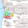
Os cinco grandes reinos ovimbundos - Séc. XVIII-es.svg 600 × 600; 826 KB
-
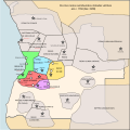
Os cinco grandes reinos ovimbundos - Séc. XVIII.svg 600 × 600; 71 KB
-
The African sketch-book (1873) (14594928347).jpg 1,630 × 2,838; 609 KB
-
The Mbunda Migration Map into Zambia.jpg 5,848 × 4,134; 1.21 MB


