Category:Maps of the history of Ethiopia
Jump to navigation
Jump to search
Countries of Africa: Algeria · Angola · Benin · Botswana · Burkina Faso · Burundi · Cameroon · Central African Republic · Chad · Democratic Republic of the Congo · Republic of the Congo · Djibouti · Egypt‡ · Equatorial Guinea · Eritrea · Eswatini · Ethiopia · Gabon · The Gambia · Ghana · Guinea · Guinea-Bissau · Ivory Coast · Kenya · Lesotho · Liberia · Libya · Madagascar · Malawi · Mali · Mauritania · Morocco · Mozambique · Namibia · Niger · Nigeria · Rwanda · Senegal · Sierra Leone · Somalia · South Africa · South Sudan · Sudan · Tanzania · Togo · Tunisia · Uganda · Zambia · Zimbabwe
Limited recognition: Ambazonia · Azawad · Somaliland – Other areas: Canary Islands · Ceuta · Melilla · Réunion · Western Sahara
‡: partly located in Africa
Limited recognition: Ambazonia · Azawad · Somaliland – Other areas: Canary Islands · Ceuta · Melilla · Réunion · Western Sahara
‡: partly located in Africa
Subcategories
This category has the following 8 subcategories, out of 8 total.
Media in category "Maps of the history of Ethiopia"
The following 83 files are in this category, out of 83 total.
-
10 Afr Est -700 png élargi.png 2,001 × 1,830; 589 KB
-
11-2 Afr Est -600 png élargi.png 2,002 × 1,830; 603 KB
-
12-2 Afr Est -500 png élargi.png 1,998 × 1,830; 635 KB
-
Af.Est 1700.png 1,720 × 1,830; 638 KB
-
1915 ww1 - Idrisid Asir, Gobroon, Kenadiid & Diiriye Guure kingdom.png 590 × 556; 346 KB
-
Abyssynia in 1896.png 688 × 673; 580 KB
-
Adal sultanate during the conquest of habesh.jpg 3,507 × 3,420; 819 KB
-
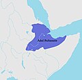
Adal Sultanate.png 379 × 245; 9 KB
-
Adal.PNG 485 × 500; 79 KB
-
AdalEU.png 485 × 500; 83 KB
-
Adua battlefield.jpg 1,270 × 794; 365 KB
-
Africa historical traite.JPG 2,667 × 2,287; 572 KB
-
ArsiProvince.png 602 × 478; 48 KB
-
Bataille de Gundet.png 887 × 529; 156 KB
-
Capture of Gondar, November 1941.jpg 1,035 × 1,647; 446 KB
-
CentralEastAfrica1750-ar.png 574 × 380; 47 KB
-
CentralEastAfrica1750.png 574 × 380; 27 KB
-
Conquests of Amde Seyon.jpg 627 × 858; 149 KB
-
Conquêtes de Menelik II.png 332 × 265; 5 KB
-
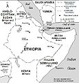
Corne de l'Afrique - années 1930.png 631 × 567; 457 KB
-
Darawiish state.png 550 × 447; 142 KB
-
EritreaCampaign1941.jpg 720 × 720; 59 KB
-
Eritrean Independence War Map.png 2,000 × 1,642; 307 KB
-
Ethiopia (1941-1987) location map.svg 1,843 × 1,862; 626 KB
-
Ethiopia - Administrative regions 1987-1991.png 1,266 × 1,332; 203 KB
-
Ethiopia Map 1963 - 1987.png 730 × 434; 14 KB
-
Ethiopia Map-1850.jpg 1,031 × 956; 343 KB
-
Ethiopian empire abyssinian empire.png 1,110 × 1,327; 229 KB
-
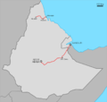
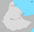
Ethiopian railways 1952-1978.png 1,024 × 975; 118 KB
-
EthiopiaRAND1908.jpg 348 × 472; 60 KB
-
Etiopia - Guèrras dau periòde Mengistu.png 922 × 982; 217 KB
-
Etiopia - Sègle XV.png 897 × 834; 173 KB
-
Etiopia - Sègle XVII.png 1,018 × 847; 201 KB
-
Etiopia - Temps dei Princes vèrs 1850.png 452 × 588; 33 KB
-
Etiopia - Territòri en 1889.png 853 × 779; 191 KB
-
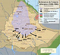
Expansion Abessiniens bis 1929.png 2,321 × 2,864; 540 KB
-
Ferrovie Etiopia 1952-1978.png 1,024 × 975; 117 KB
-
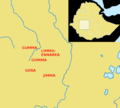
Galla-Sidamo es.svg 1,012 × 908; 233 KB
-
Galla-Sidamo localizzazione it.svg 1,012 × 908; 75 KB
-
GDRTHornR2.png 647 × 460; 149 KB
-
Gibe kingdoms.png 665 × 600; 97 KB
-
Gundet battle map.svg 561 × 506; 12 KB
-
Habesh Eyalet.png 916 × 672; 85 KB
-
Harladomain.jpg 438 × 320; 29 KB
-
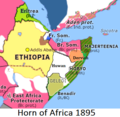
Horn of Africa 1895.png 426 × 415; 119 KB
-
Horn of Africa and Southwest Arabia - Mid-1930s.jpg 503 × 525; 72 KB
-
Ifat.png 485 × 500; 74 KB
-
Invasion De Bono fin 1935.jpg 729 × 634; 32 KB
-
Italian communications in Ethiopia, April 1941.jpg 1,019 × 1,629; 617 KB
-
Karte Somaliland.png 1,489 × 1,046; 423 KB
-
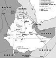
Map Ethiopia WW2.jpg 1,800 × 1,872; 223 KB
-
Map of Colonial Africa in 1913.png 350 × 382; 87 KB
-
Map of Dawa Zone.png 593 × 529; 483 KB
-
Map of Egyptian-Ethiopian War.jpg 968 × 1,130; 466 KB
-
Map of Ethiopia circa 1510.png 1,638 × 1,328; 274 KB
-
Map of Ethiopian Railways 3.png 1,024 × 803; 39 KB
-
Map of the Ethiopian empire under Amda Seyon.jpg 645 × 868; 407 KB
-
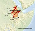
Map Slave Routes Ethiopia.jpg 772 × 667; 410 KB
-
Mapa de Etiopia, 1850-es.svg 651 × 596; 1.61 MB
-
MapaAdel.jpg 410 × 429; 71 KB
-
Medieval Ethiopia (1270 - 1524).png 853 × 621; 23 KB
-
MedievalEthiopia.png 1,028 × 1,026; 451 KB
-
Menelik campaign map 1 3-es.svg 651 × 596; 1.35 MB
-
Menelik campaign map 1 3.jpg 1,026 × 952; 374 KB
-
Menelik campaign map 2 3-es.svg 651 × 596; 1.13 MB
-
Menelik campaign map 2 3.jpg 1,026 × 952; 366 KB
-
Menelik campaign map 3 3-es.svg 651 × 596; 1.56 MB
-
Menelik campaign map 3 3.jpg 1,026 × 952; 411 KB
-
Ogadeno Karas.png 2,528 × 2,048; 889 KB
-
Pre Adoua-HE.png 377 × 409; 116 KB
-
Pre Adoua.jpg 377 × 409; 44 KB
-
Provinces Ethiopie.png 899 × 896; 106 KB
-
Provinces of Ethiopia, before 1935.svg 932 × 728; 483 KB
-
Rete ferroviaria Eritrea 1942-1978.png 1,030 × 842; 86 KB
-
Sentral-Afrika-1750.png 3,093 × 2,046; 793 KB
-
Slave routes of the Ethiopian Empire.jpg 520 × 750; 164 KB
-
Somalis Civil War.png 512 × 652; 122 KB
-
Sudanese Districts affected by demarcation dispute with Ethiopia.svg 600 × 520; 334 KB
-
Sultanate of Aussa.png 2,560 × 2,560; 69 KB
-
Sultanate of Showa.png 17,877 × 20,000; 4.43 MB
-
Tewodros' battles (1853 - 1855).png 847 × 844; 29 KB
-
Vers Adoua.jpg 848 × 675; 142 KB
-
خريطة من كتاب التاريخ الطبيعي للإنسان .jpg 304 × 496; 22 KB


