Category:Maps of departments of French Algeria
Jump to navigation
Jump to search
Subcategories
This category has the following 3 subcategories, out of 3 total.
Media in category "Maps of departments of French Algeria"
The following 12 files are in this category, out of 12 total.
-
319 of 'Cours normal d'histoire de France, etc' (11058832225).jpg 2,771 × 2,206; 1.47 MB
-
CartedelaKabylie.jpg 1,656 × 798; 811 KB
-
Communes mixtes 1934.JPG 2,770 × 1,800; 932 KB
-
Confédérations et tribus de la Grande Kabylie (Tamawya Taqbaylit) Algérie.jpg 2,605 × 2,147; 2.51 MB
-
Constantine 1930.JPG 2,300 × 3,500; 1.34 MB
-
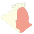
Département des Oasis 1962.PNG 900 × 900; 57 KB
-
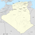
French Algeria 1934-1955 administrative map-fr.svg 1,287 × 1,278; 1.73 MB
-
Laàrach de Beni-Ouragh (Ammi-Moussa. Algérie).jpg 2,731 × 2,048; 1.44 MB
-
Map showing the Départements of Algeria from 1962-1968 and 1968-1974.svg 744 × 1,052; 77 KB
-
NR131AmmiMoussa.jpg 8,070 × 5,831; 21.04 MB
-
Oran department 1934-1955 map-fr.svg 1,287 × 1,278; 1.79 MB
-
Oranie 1930.JPG 2,300 × 2,648; 1.03 MB


