Category:Maps of the history of Namibia
Jump to navigation
Jump to search
Countries of Africa: Algeria · Angola · Benin · Botswana · Burkina Faso · Burundi · Cameroon · Central African Republic · Chad · Democratic Republic of the Congo · Republic of the Congo · Djibouti · Egypt‡ · Equatorial Guinea · Eritrea · Eswatini · Ethiopia · Gabon · The Gambia · Ghana · Guinea · Guinea-Bissau · Ivory Coast · Kenya · Lesotho · Liberia · Libya · Madagascar · Malawi · Mali · Mauritania · Morocco · Mozambique · Namibia · Niger · Nigeria · Rwanda · Senegal · Sierra Leone · Somalia · South Africa · South Sudan · Sudan · Tanzania · Togo · Tunisia · Uganda · Zambia · Zimbabwe
Limited recognition: Ambazonia · Azawad · Somaliland – Other areas: Canary Islands · Ceuta · Melilla · Réunion · Western Sahara
‡: partly located in Africa
Limited recognition: Ambazonia · Azawad · Somaliland – Other areas: Canary Islands · Ceuta · Melilla · Réunion · Western Sahara
‡: partly located in Africa
Subcategories
This category has the following 3 subcategories, out of 3 total.
B
M
Media in category "Maps of the history of Namibia"
The following 25 files are in this category, out of 25 total.
-
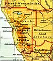
095 deutsch-sudwestafrika (1905) detail bogen-fels.png 450 × 400; 133 KB
-
095 deutsch-sudwestafrika (1905) detail.png 450 × 400; 162 KB
-
095 deutsch-sudwestafrika (1905).png 1,744 × 2,189; 2.34 MB
-
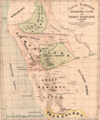
1876 - map from Palgrave Commission papers.png 824 × 987; 1.94 MB
-
MAP OF SOUTH AFRICA BY R.W. LEYLAND.jpg 3,172 × 2,465; 1.79 MB
-
1978년나미비아 전쟁.png 553 × 568; 61 KB
-
Cape Colony and neighbouring states 1870-1890 b.jpg 1,368 × 992; 159 KB
-
Deutsch-Westafrika 1912.png 500 × 550; 89 KB
-
Deutschen Kolonie Afrika - Deutsch-Ostafrika.png 336 × 371; 50 KB
-
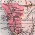
Deutschen Kolonie Afrika - Deutsch-Südwestafrika.png 336 × 371; 53 KB
-
German South West Africa 1914.svg 488 × 488; 5.45 MB
-
Guèrra de la Frontiera Sud-Africana.png 1,060 × 1,003; 306 KB
-
Lange diercke sachsen afrika ehemalige schutzgebiete suedwestafrika.jpg 720 × 826; 394 KB
-
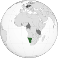
LocationGermanSWAca1890.svg 1,000 × 500; 2.72 MB
-
LocationSWAfrica.png 250 × 115; 5 KB
-
NamibianWar1978.PNG 553 × 568; 83 KB
-
Permanent SADF and SWATF Military Structure in Sector 10 ver 2.png 1,781 × 821; 648 KB
-
Permanent SADF and SWATF Military Structure in Sector 10 ver 3.png 1,782 × 818; 668 KB
-
Permanent SADF and SWATF structure in Sector 10.png 1,398 × 646; 399 KB
-
Red Line SWA 1966.svg 717 × 701; 1.31 MB
-
Simplified map of the front line sectors of South West Africa.jpg 896 × 366; 52 KB
-
South Africa Border War Map - IT.png 926 × 572; 57 KB
-
Deutsch-Sudwestafrika.png 524 × 533; 737 KB
-
SWATF Sector Map.jpg 927 × 382; 54 KB
-
Walvis Bay map.jpeg 372 × 420; 34 KB


