Category:Maps of the history of Ghana
Jump to navigation
Jump to search
Countries of Africa: Algeria · Angola · Benin · Botswana · Burkina Faso · Burundi · Cameroon · Central African Republic · Chad · Democratic Republic of the Congo · Republic of the Congo · Djibouti · Egypt‡ · Equatorial Guinea · Eritrea · Eswatini · Ethiopia · Gabon · The Gambia · Ghana · Guinea · Guinea-Bissau · Ivory Coast · Kenya · Lesotho · Liberia · Libya · Madagascar · Malawi · Mali · Mauritania · Morocco · Mozambique · Namibia · Niger · Nigeria · Rwanda · Senegal · Sierra Leone · Somalia · South Africa · South Sudan · Sudan · Tanzania · Togo · Tunisia · Uganda · Zambia · Zimbabwe
Limited recognition: Ambazonia · Azawad · Somaliland – Other areas: Canary Islands · Ceuta · Melilla · Réunion · Western Sahara
‡: partly located in Africa
Limited recognition: Ambazonia · Azawad · Somaliland – Other areas: Canary Islands · Ceuta · Melilla · Réunion · Western Sahara
‡: partly located in Africa
Subcategories
This category has the following 4 subcategories, out of 4 total.
*
B
D
M
Media in category "Maps of the history of Ghana"
The following 33 files are in this category, out of 33 total.
-
A map of Kintampo culture sites.JPG 446 × 673; 94 KB
-
Abidjan-Niger-Railway.png 1,754 × 2,777; 981 KB
-
Africa de l'Oèst (fin sègle XVIII).png 1,192 × 592; 172 KB
-
Africa de l'Oèst en 1875-es.svg 1,588 × 771; 750 KB
-
Africa de l'Oèst en 1875-hu.svg 1,588 × 771; 263 KB
-
Africa de l'Oèst en 1875.png 1,192 × 596; 195 KB
-
Archaeological sites in Ghana.JPG 594 × 825; 117 KB
-
Basler Mission Arbeitsgebiet Karte Goldküste 001.jpg 1,940 × 2,719; 1.95 MB
-
Brong Asante 001.svg 1,052 × 744; 646 KB
-
Campagnes d'Osei Tutu bis.jpg 654 × 753; 95 KB
-
Campagnes Kwaman.jpg 486 × 563; 60 KB
-
Campagnes Osei tutu + distance.jpg 660 × 750; 99 KB
-
Colonial Africa 1913 Togoland map.svg 1,390 × 1,295; 560 KB
-
Colonizacion de l'Africa Occidentala.png 1,268 × 561; 311 KB
-
Datation fouilles Asantemanso.png 600 × 800; 105 KB
-
Denkyrian Empire 1700ce.svg 2,069 × 2,055; 6.81 MB
-
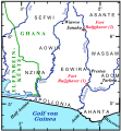
Fort Ruijghaver 010.svg 727 × 786; 384 KB
-
Fédération ashanti 1690.jpg 515 × 590; 66 KB
-
GHANA empire map BLANK.png 1,580 × 988; 36 KB
-
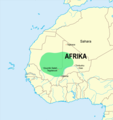
Ghana empire map.png 984 × 864; 51 KB
-
Ghana reich karte-es.svg 706 × 721; 781 KB
-
Ghana reich karte-hy.png 4,221 × 4,084; 1.13 MB
-
Ghana reich karte.png 2,321 × 2,475; 438 KB
-
Gold Coast 1720.png 1,001 × 608; 438 KB
-
Grenze GoldküsteElfenbeinküste 1902.jpg 740 × 2,201; 466 KB
-
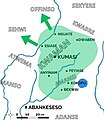
Kingdom of Ashanti (Asanteman).jpg 281 × 228; 13 KB
-
Mapa ghana-pt.svg 512 × 442; 14 KB
-
Nigèria - Colonizacion en 1914.png 716 × 411; 65 KB
-
Nigèria - Colonizacion en 1919.png 891 × 523; 92 KB
-
Reich von ghana.png 1,580 × 988; 41 KB
-
Salagagebiet1897 003.jpg 1,508 × 1,535; 374 KB
-
Togoland 1914.svg 488 × 488; 5.45 MB
-
UBBasel Map 1677 Kartenslg Mappe 252-40 Guinée.tiff 10,995 × 7,692, 2 pages; 241.99 MB


