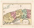
Category:Old maps of Algeria
Jump to navigation
Jump to search
Countries of Africa: Algeria · Angola · Benin · Botswana · Burkina Faso · Burundi · Cameroon · Cape Verde · Central African Republic · Chad · Comoros · Democratic Republic of the Congo · Republic of the Congo · Djibouti · Egypt‡ · Equatorial Guinea · Eritrea · Eswatini · Ethiopia · Gabon · The Gambia · Ghana · Guinea · Guinea-Bissau · Ivory Coast · Kenya · Lesotho · Liberia · Libya · Madagascar · Malawi · Mali · Mauritania · Mauritius · Morocco · Mozambique · Namibia · Niger · Nigeria · Rwanda · São Tomé and Príncipe · Senegal · Seychelles · Sierra Leone · Somalia · South Africa · South Sudan · Sudan · Tanzania · Togo · Tunisia · Uganda · Zambia · Zimbabwe
Limited recognition: Puntland · Somaliland – Other areas: Canary Islands · Ceuta · Madeira · Mayotte · Melilla · Réunion · Western Sahara
‡: partly located in Africa
Limited recognition: Puntland · Somaliland – Other areas: Canary Islands · Ceuta · Madeira · Mayotte · Melilla · Réunion · Western Sahara
‡: partly located in Africa
Use the appropriate category for maps showing all or a large part of Algeria. See subcategories for smaller areas:
| If the map shows | Category to use |
|---|---|
| Algeria on a recently created map | Category:Maps of Algeria or its subcategories |
| Algeria on a map created more than 70 years ago | Category:Old maps of Algeria or its subcategories |
| the history of Algeria on a recently created map | Category:Maps of the history of Algeria or its subcategories |
| the history of Algeria on a map created more than 70 years ago | Category:Old maps of the history of Algeria or its subcategories |
Subcategories
This category has the following 17 subcategories, out of 17 total.
#
C
N
Media in category "Old maps of Algeria"
The following 116 files are in this category, out of 116 total.
-
089 algerien-marokko-und-tunis (1905).png 2,090 × 1,762; 2.22 MB
-
11 of 'L'Algérie ... Ouvrage illustré, etc' (11177200924).jpg 1,936 × 1,192; 677 KB
-
1857 Dufour Map of Algeria - Geographicus - Algerie-dufour-1857.jpg 5,000 × 3,637; 5.7 MB
-
1857 Dufour Map of Constantine, Algeria - Geographicus - Constantine-dufour-1847.jpg 3,770 × 5,000; 6.29 MB
-
A trip through Italy, Sicily, Tunisia, Algeria and southern France (1918) (14595491269).jpg 2,086 × 3,278; 1.99 MB
-
Admiralty Chart No 1567 Approaches to Bone, Published 1892.jpg 8,310 × 12,242; 20.58 MB
-
Admiralty Chart No 1766 C. Ferrat to C Bougaroni (Algeria), Published 1871.jpg 16,224 × 11,094; 44.22 MB
-
Admiralty Chart No 1909 C. Ivi to Algiers, Published 1894.jpg 12,406 × 8,315; 10.78 MB
-
Admiralty Chart No 1910 Algiers to C. Bougaroni, Published 1894.jpg 13,923 × 8,517; 18.93 MB
-
Admiralty Chart No 252 Cape Bugaroni to Fratelli Rocks, Published 1871, New Edition 1917.jpg 17,619 × 11,302; 63.08 MB
-
Admiralty Chart No 812 Ports d'Oran and Mers-el-Kébir, Published 1934.jpg 12,418 × 8,504; 20.84 MB
-
AFR V2 D556 Gurara and Wed Saura.jpg 1,830 × 1,659; 307 KB
-
Alg-et-tun.JPG 2,389 × 1,789; 1.23 MB
-
Alger - DPLA - 6b086bfd014c03f3ed176e19fa048ba1.jpg 1,000 × 713; 144 KB
-
Algeri. RRA 3= 72. Pièce 47.jpg 2,278 × 1,790; 763 KB
-
Annales de géographie (1891) (14595283540).jpg 2,924 × 1,960; 1.32 MB
-
Arab Caliphate.jpg 888 × 674; 220 KB
-
Arab Caliphate.svg 350 × 334; 1.04 MB
-
Archives des missions scientifiques et littéraires (1877) (19752983895).jpg 4,768 × 2,084; 1.89 MB
-
Barbarie 1829.jpg 2,099 × 1,199; 1.2 MB
-
Barbary (1817).png 1,896 × 1,470; 3.77 MB
-
Book of Roger MS. Greaves 42 119b.jpg 1,000 × 714; 676 KB
-
Bouillet - Atlas universel, Carte 59.png 3,425 × 2,674; 26.21 MB
-
Brockhaus and Efron Encyclopedic Dictionary b2 955-6.jpg 2,743 × 1,730; 2.5 MB
-
Bugia 1570.png 120 × 210; 68 KB
-
Bugia Labez ou Calaa.jpg 390 × 452; 56 KB
-
Bulletin de la Société géologique de France (1906) (20411221746).jpg 2,460 × 2,997; 1.33 MB
-
Carte de groupes ethniques en Algérie française.jpg 720 × 529; 59 KB
-
Carte de l'Algérie - divisée par tribus LOC 2007630121.jpg 15,491 × 12,710; 23.98 MB
-
Carte de l'Algérie divisée par (...)Carette Ernest btv1b72002410 2.jpg 1,351 × 1,054; 507 KB
-
Carte de l'Algérie divisée par (...)Carette Ernest btv1b72002410 3.jpg 752 × 498; 163 KB
-
Carte de l'Algérie NemchaCarette Ernest.jpg 471 × 574; 136 KB
-
Carte de la Régence d'Alger en 1650 (Algérie) et du Royaume de Fès.jpg 3,203 × 2,160; 3.45 MB
-
Carte de la Tunisie et de l'Algérie orientale - dressée par Ed. Dumas-Vorzet - btv1b8458760m.jpg 9,188 × 7,618; 11.29 MB
-
Carte des Beni Amer.jpg 1,080 × 910; 353 KB
-
Carte des chemins de fer de l'Algérie et de la Tunisie - btv1b53057592p.jpg 6,232 × 4,368; 4.97 MB
-
Carte des chemins de fer de l'Algérie et de la Tunisie - btv1b8440539r.jpg 8,710 × 5,894; 7 MB
-
Carte des chemins de fer de l'Algérie et de la Tunisie - btv1b84414923.jpg 8,170 × 5,760; 6.85 MB
-
Carte des environs de Béjaïa au XVIe siècle.jpg 100 × 162; 6 KB
-
Carte des Nememcha des Aures en Algerie.jpg 1,300 × 796; 300 KB
-
Carte du gouverrnement d alger 1835.jpg 746 × 580; 339 KB
-
Carte du relief de l'Algérie et de la Tunisie - dressée par E. Guillemin - btv1b8439648k.jpg 8,050 × 5,292; 6.22 MB
-
Carte Hachette Joanne-1887-Bône (Algérie).jpg 2,703 × 4,198; 3.21 MB
-
Carte Hachette Joanne-1887-chemins de fer de la Province d'Oran.jpg 5,428 × 4,784; 9.07 MB
-
Carte Hachette Joanne-1887-chemins de fer de la Province de Constantine.jpg 5,238 × 4,032; 7.94 MB
-
Carte Hachette Joanne-1887-la grande Kabilie.jpg 4,798 × 3,608; 6.57 MB
-
Carte Hachette Joanne-1887-les environs d'Alger.jpg 6,334 × 4,215; 9.46 MB
-
Carte Hachette Joanne-1887-Plan de Constantine.jpg 4,206 × 5,306; 8.68 MB
-
Carte Hachette Joanne-1887-Plan de Sidi-bel-Abbès.jpg 2,687 × 4,215; 1.83 MB
-
Carte Hachette Joanne-1887-plan de Tlemcen.jpg 5,343 × 4,215; 3.62 MB
-
Carte lithologique d'Ait Idris.jpg 3,520 × 1,738; 1.86 MB
-
Carte vinicole de l'Algérie.jpg 861 × 640; 494 KB
-
Cartografie in Nederland, kaart van Algerije met 1 bijkaart, NG-501-56.jpg 5,664 × 4,730; 4.34 MB
-
Colonel amirouche.jpg 1,753 × 1,869; 2.05 MB
-
Compendium florae atlanticae BHL36880242.jpg 4,604 × 3,386; 2.52 MB
-
Compendium florae atlanticae BHL36880246.jpg 4,603 × 3,376; 2.03 MB
-
Constantina, Tunetensis, Tripolitana - (Livio Sanuto) - btv1b8595345z.jpg 8,592 × 6,476; 9.48 MB
-
Constantine 1930.JPG 2,300 × 3,500; 1.34 MB
-
De bay van oran.jpg 5,500 × 4,594; 1.79 MB
-
ETH-BIB-Algier-Tunis, Karte mit -…?--Dia 247-Z-00072.tif 3,600 × 2,866; 29.65 MB
-
France & Colonies-1894-peuples d'Algérie.jpg 2,836 × 2,116; 1.91 MB
-
France & Colonies-1894-pluviométrie de l'Algérie.jpg 2,700 × 2,492; 1.77 MB
-
France & Colonies-1894-relief de l'Algérie-Tunisie.jpg 7,416 × 4,736; 6.81 MB
-
Gavure-algerie-physique.JPG 2,421 × 1,753; 1.41 MB
-
Guergour antiquite.jpg 1,743 × 976; 410 KB
-
Guergour en Numidie.jpg 1,410 × 594; 912 KB
-
Kaart van het huidige Tunesië en oosten van Algerije, RP-P-OB-23.477.jpg 5,338 × 3,358; 3.7 MB
-
Karte der Provinzen Oran und Constantine.jpg 4,724 × 5,654; 8.26 MB
-
Koukou.jpg 340 × 224; 29 KB
-
L'Algérie (Algeria) - Bennet James Henry M - 1875.jpg 2,000 × 1,616; 1.72 MB
-
Meyers b1 s0347a.jpg 2,048 × 1,687; 728 KB
-
Numidia (Imperium Romanum).png 2,495 × 1,775; 53 KB
-
Occupied Algeria on the Globe.jpg 3,216 × 4,288; 3.37 MB
-
Oranie 1930.JPG 2,300 × 2,648; 1.03 MB
-
Partie de la Barbarie, où est le royaume d'Alger.tif 2,699 × 1,976; 11.15 MB
-
Plan du Domaine Altairac à Maison Carrée.JPG 2,560 × 1,920; 2.92 MB
-
Plan du port de la Calle - btv1b53237609d.jpg 4,012 × 6,022; 3.54 MB
-
Rablie ainmerane colonie.jpg 360 × 336; 37 KB
-
Reproducció d'un mapa d'Algèria i Tunísia.jpeg 902 × 768; 89 KB
-
Roman Africa.JPG 3,057 × 2,439; 1.95 MB
-
Royaume de Bugie aux XVIIᵉ siècle.png 394 × 383; 285 KB
-
Régence d'Alger en 1829.png 934 × 609; 897 KB
-
Répertoire alphabétique BHL36872539.jpg 3,826 × 2,750; 2.38 MB
-
Répertoire alphabétique BHL36872540.jpg 3,826 × 2,750; 1.98 MB
-
Répertoire alphabétique BHL36872541.jpg 3,826 × 2,750; 1.68 MB
-
Répertoire alphabétique BHL36872542.jpg 3,826 × 2,750; 1.54 MB
-
Territoire des Harakta déterminé par le Senatus-Consulte.png 1,388 × 915; 1.03 MB
-
UBBasel Map 1677 Kartenslg Mappe 250-2 Empire des Turcs.tiff 11,080 × 7,712, 2 pages; 244.5 MB
-
Voyage dans la régence d'Alger.jpg 4,080 × 3,308; 2.97 MB
-
Карта Алжира 1875 года (Алексей Николаевич Куропатки).jpg 3,496 × 2,528; 1.24 MB
-
حدود قبيلة الخشنة.jpg 219 × 196; 19 KB


