Category:Maps of the Aghlabid Emirate
Jump to navigation
Jump to search
Media in category "Maps of the Aghlabid Emirate"
The following 19 files are in this category, out of 19 total.
-
 Abasside-empire-vers-820-es.svg 2,471 × 1,402; 334 KB
-
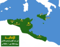
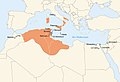
 Aghlabid in 900 ad.png 830 × 482; 12 KB
-
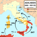
 Aghlabids Dynasty 800 - 909 (AD) - Arabic.svg 667 × 459; 198 KB
-
 Aghlabids Dynasty 800 - 909 (AD) pl.svg 667 × 459; 120 KB
-
 Aghlabids Dynasty 800 - 909 (AD)-es.png 1,001 × 689; 150 KB
-
 Aghlabids Dynasty 800 - 909 (AD)-es.svg 669 × 347; 249 KB
-
 Aghlabids Dynasty 800 - 909 (AD)-pt.svg 667 × 459; 119 KB
-
 Aghlabids Dynasty 800 - 909 (AD).svg 667 × 459; 92 KB
-
 Aghlabids map 900.png 1,391 × 1,080; 373 KB
-
 Aghlabids map.png 1,080 × 1,080; 942 KB
-
 Aglabtarren leinua K. o. 800 - 909.jpg 1,001 × 689; 113 KB
-
 Carte de l'émirat Aghlabides de Kaïrouan.jpg 3,483 × 1,840; 255 KB
-
 Conquête musulmane de la Sicile au IXe siècle.svg 1,052 × 744; 3.82 MB
-
 Fall of the Aghlabid Emirate-es.svg 1,483 × 701; 486 KB
-
 Fall of the Aghlabid Emirate.svg 1,483 × 701; 464 KB
-
 Map Aghlabid.jpg 969 × 664; 246 KB
-
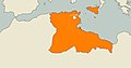
 Rustumid.png 1,202 × 1,051; 81 KB
-
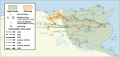
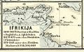 Spruner-Menke Handatlas 1880 Karte 22 Nebenkarte 6.jpg 1,110 × 681; 76 KB
-
 خريطة دولة الأغالبة.png 1,080 × 1,080; 937 KB


_-_Arabic.svg)
_pl.svg)
-es.png)
-es.svg)
-pt.svg)
.svg)


