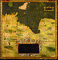
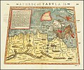
Category:Ptolemy's 2nd African Map
Jump to navigation
Jump to search
Media in category "Ptolemy's 2nd African Map"
The following 45 files are in this category, out of 45 total.
-
*Tabula Aphricae II (North Africa) northwest.jpg 800 × 600; 129 KB
-
*Tabula Aphricae II (North Africa) southeast.jpg 800 × 600; 129 KB
-
*Tabula Aphricae II (North Africa) southwest.jpg 800 × 600; 124 KB
-
*Tabula Aphricae II (North Africa).jpg 960 × 750; 148 KB
-
*Tabula Aphricae II, 1561 ed. (North Africa).jpg 1,365 × 1,029; 324 KB
-
Map after Ptolemy's Geographia (Burney MS 111, f.51v).jpeg 5,318 × 6,846; 41.21 MB
-
Map after Ptolemy's Geographia (Burney MS 111, f.52r).jpeg 5,207 × 6,832; 39.63 MB
-
Claudii Ptolomei Cosmographie XII.jpg 937 × 664; 641 KB
-
Ptolemy Cosmographia 1467 - North Central Africa - Mediterranean Sea.jpg 1,526 × 1,090; 1.2 MB
-
Second map of Africa (Libya), in full gold border (NYPL b12455533-427035).tif 4,872 × 3,831; 53.62 MB
-
Bodleian Libraries, Tunisia, western Libya, Sardinia and Sicily.jpg 1,000 × 675; 112 KB
-
Secunda Africae Tabula.jpg 3,200 × 2,133; 1.11 MB
-
Secunda Africae tabula (7537881894).jpg 2,000 × 1,515; 2.9 MB
-
1513 Ptolemy's 2nd African Map by Martin Waldseemüller.jpg 14,147 × 9,989; 28.72 MB
-
Geographiae Claudii Ptolemaei Alexandrini (Münster, 1552) 17.jpg 10,640 × 6,672; 6.41 MB
-
Africa North 1561, Girolamo Ruscelli (3824699-recto).png 3,617 × 2,717; 15.28 MB
-
Stefano Bonsignori - Tunisia and Libya - Google Art Project.jpg 6,476 × 6,656; 19.39 MB
-
Afr. II tab. - btv1b531968799 (2 of 3).jpg 8,672 × 6,396; 8.51 MB
-
Africa II northcentral Africa.jpg 1,600 × 1,200; 388 KB
-
Aphricae Tabula II - Aphrica, Numidia - (Ptolémée) - btv1b5964099p (1 of 2).jpg 6,032 × 4,688; 3.58 MB
-
Aphricae Tabula II - Aphrica, Numidia - (Ptolémée) - btv1b5964099p (2 of 2).jpg 5,926 × 4,681; 3.96 MB
-
Aphricae Tabula II.jpg 8,732 × 7,263; 12.95 MB
-
Chrausa 01.png 1,482 × 1,125; 4.22 MB
-
Claudii Ptolemaei Tabulae geographicae Orbis Terrarum veteribus cogniti (1704) 08.jpg 9,824 × 7,362; 7.09 MB
-
Mercator's Orbis Antiqui Tabulae Geographicae Secundum Cl. Ptolemaeum (1730) 07.jpg 6,668 × 5,169; 4.84 MB
-
Print, book-illustration, map (BM 1865,0114.1016).jpg 2,500 × 1,839; 1.05 MB
-
Ptolemy, Aphricae Tabula II (FL13726101 2496563).jpg 6,282 × 5,094; 47.63 MB
-
Ptolemy, Aphricae Tabula II (FL13726107 2496602).jpg 5,977 × 4,813; 43.5 MB
-
Tab. II Africae Complectens Africam Proprie dictam.jpg 11,982 × 9,106; 19.49 MB
-
Tabula Secunda Africae.jpg 14,094 × 8,854; 24.71 MB
-
Tabvla Aphricae II - DPLA - 1262b4a2c47779757f2fab7938e96b25.jpg 1,000 × 748; 190 KB
-
Claudii Ptolemaei Tabulae geographicaei 1695 (102834683).jpg 14,435 × 10,356; 26.33 MB


