Category:Maps of the history of Eritrea
Jump to navigation
Jump to search
Countries of Africa: Algeria · Angola · Benin · Botswana · Burkina Faso · Burundi · Cameroon · Central African Republic · Chad · Democratic Republic of the Congo · Republic of the Congo · Djibouti · Egypt‡ · Equatorial Guinea · Eritrea · Eswatini · Ethiopia · Gabon · The Gambia · Ghana · Guinea · Guinea-Bissau · Ivory Coast · Kenya · Lesotho · Liberia · Libya · Madagascar · Malawi · Mali · Mauritania · Morocco · Mozambique · Namibia · Niger · Nigeria · Rwanda · Senegal · Sierra Leone · Somalia · South Africa · South Sudan · Sudan · Tanzania · Togo · Tunisia · Uganda · Zambia · Zimbabwe
Limited recognition: Ambazonia · Azawad · Somaliland – Other areas: Canary Islands · Ceuta · Melilla · Réunion · Western Sahara
‡: partly located in Africa
Limited recognition: Ambazonia · Azawad · Somaliland – Other areas: Canary Islands · Ceuta · Melilla · Réunion · Western Sahara
‡: partly located in Africa
Subcategories
This category has the following 3 subcategories, out of 3 total.
M
O
Media in category "Maps of the history of Eritrea"
The following 16 files are in this category, out of 16 total.
-
BattleofKerenMap1941-en.svg 1,174 × 806; 80 KB
-
BattleofKerenMap1941-it.svg 1,174 × 806; 71 KB
-
Darawiish state.png 550 × 447; 142 KB
-
EritreaCampaign1941 map He.png 674 × 929; 175 KB
-
Eritrean Independence War Map.png 2,000 × 1,642; 307 KB
-
Eritrean–Ethiopian War Map 1998.png 2,000 × 1,642; 285 KB
-
Ethiopia (1941-1987) location map.svg 1,843 × 1,862; 626 KB
-
EthiopiaRAND1908.jpg 348 × 472; 60 KB
-
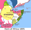
Horn of Africa 1895.png 426 × 415; 119 KB
-
Map Eritrean Campaign 1941-en.svg 674 × 929; 120 KB
-
Map Eritrean Campaign 1941-es.svg 674 × 929; 100 KB
-
Map Eritrean Campaign 1941-he.svg 674 × 929; 314 KB
-
Map of Egyptian-Ethiopian War.jpg 968 × 1,130; 466 KB
-
Map of Eritrea Province.png 739 × 738; 142 KB
-
Rete ferroviaria Eritrea 1942-1978.png 1,030 × 842; 86 KB
-
Rete ferroviaria Eritrea Italiana.png 1,030 × 842; 104 KB


