Category:Maps of French Algeria
Jump to navigation
Jump to search
English: Maps of French Algeria.
Français : Cartes de l'Algérie sous régime français.
Wikimedia category | |||||
| Upload media | |||||
| Instance of | |||||
|---|---|---|---|---|---|
| Category combines topics | |||||
| French Algeria | |||||
French colony in Northern Africa from 1830 to 1962 | |||||
| Pronunciation audio | |||||
| Instance of |
| ||||
| Location |
| ||||
| Capital | |||||
| Official language | |||||
| Currency |
| ||||
| Inception |
| ||||
| Dissolved, abolished or demolished date |
| ||||
| Replaces |
| ||||
 | |||||
Subcategories
This category has the following 2 subcategories, out of 2 total.
A
M
Media in category "Maps of French Algeria"
The following 87 files are in this category, out of 87 total.
-
1888 Plan of Algiers, Algeria Casbah region.jpg 1,779 × 2,388; 1.16 MB
-
1888 Plan of Algiers, Algeria Place du Gouvernement region (actual Martyrs Place).jpg 1,788 × 2,386; 1.17 MB
-
1888 Plan of Algiers, Algeria The 'French' City.jpg 1,788 × 2,386; 1.17 MB
-
1888 Plan of Algiers, Algeria The Waterfront.jpg 1,781 × 2,386; 1.17 MB
-
1888 Plan of Algiers, Algeria--Bab el-Oued region, Mustapha, and Jardin d'Essai.jpg 1,788 × 2,382; 1.18 MB
-
Admiralty Chart No 1766 C. Ferrat to C Bougaroni (Algeria), Published 1871.jpg 16,224 × 11,094; 44.22 MB
-
Aekstate.png 420 × 269; 67 KB
-
AFR V2 D295 La Calle.jpg 1,747 × 1,483; 330 KB
-
AFR V2 D313 Bougie, Algeria.jpg 1,799 × 1,578; 400 KB
-
AFR V2 D363 Tlemcen.jpg 1,775 × 2,501; 1,017 KB
-
Alger - L. Thuillier, del - btv1b8439727r.jpg 3,552 × 5,934; 3.47 MB
-
Alger - L. Thuillier, delt - btv1b8441761k.jpg 3,924 × 5,895; 3.52 MB
-
Alger-1888-Carte.png 9,957 × 6,679; 118.9 MB
-
Algeria-Libya boundary.jpg 3,155 × 4,201; 9.43 MB
-
Algérie 1830-1930.JPG 2,430 × 3,250; 1.17 MB
-
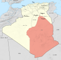
Algérie administrative 1905-1957.PNG 986 × 985; 99 KB
-
Algérie administrative 1934-1956.PNG 988 × 985; 86 KB
-
Algérie en 1956 Localisation.PNG 1,600 × 800; 361 KB
-
Algérie fr.jpg 3,000 × 2,645; 2.6 MB
-
Annaba (bône) 1944.jpg 4,338 × 5,946; 4.73 MB
-
Aïn Sefra territory 1934-1955 map-fr.svg 1,287 × 1,278; 1.84 MB
-
Blank map of French Algeria.png 1,287 × 1,278; 225 KB
-
Carte de Batna, Territoire préservé du choléra en 1867.jpg 1,366 × 1,039; 194 KB
-
Carte du gouverrnement d alger 1835.jpg 746 × 580; 339 KB
-
Carte Hachette Joanne-1887-Bône (Algérie).jpg 2,703 × 4,198; 3.21 MB
-
Carte Hachette Joanne-1887-Oran.jpg 5,285 × 4,215; 5.93 MB
-
Carte Hachette Joanne-1887-Plan de Constantine.jpg 4,206 × 5,306; 8.68 MB
-
Carte Hachette Joanne-1887-Plan de Sidi-bel-Abbès.jpg 2,687 × 4,215; 1.83 MB
-
Carte Hachette Joanne-1887-plan de Tlemcen.jpg 5,343 × 4,215; 3.62 MB
-
Carte Massacre Sétif, Guelma, Kherrata, 1945 ar.png 4,000 × 3,278; 394 KB
-
Carte Massacre Sétif, Guelma, Kherrata, 1945.svg 460 × 377; 5.73 MB
-
Carte oran.jpg 3,000 × 2,391; 803 KB
-
Carte oran2.jpg 1,880 × 1,512; 1.02 MB
-
Compte rendu (20484921848).jpg 2,816 × 2,184; 1.64 MB
-
Cook's practical guide to Algeria and Tunisia (1908) (14586633989).jpg 3,290 × 2,620; 716 KB
-
Cook's practical guide to Algeria and Tunisia (1908) (14586812047).jpg 2,618 × 1,414; 412 KB
-
France & Colonies-1894-baie d'Alger.jpg 4,515 × 4,296; 3.93 MB
-
France & Colonies-1894-Constantine.jpg 2,657 × 3,415; 3.03 MB
-
France & Colonies-1894-Oran.jpg 3,025 × 2,756; 2.27 MB
-
France & Colonies-1894-Oued Righ.jpg 2,788 × 4,488; 2.14 MB
-
France & Colonies-1894-relief de l'Algérie-Tunisie.jpg 7,416 × 4,736; 6.81 MB
-
France & Colonies-1894-Touat & Gourara.jpg 4,609 × 7,722; 7.82 MB
-
French Algeria 1934-1955 administrative map-es.svg 1,287 × 1,278; 1.53 MB
-
French Algeria 1934-1955 administrative map-fr.svg 1,287 × 1,278; 1.73 MB
-
French Algeria evolution 1830-1962 map-es.svg 1,373 × 1,363; 1.71 MB
-
French Algeria evolution 1830-1962 map-fr.svg 1,287 × 1,278; 1.86 MB
-
Front (de l')Algérie Française logo.svg 379 × 428; 13 KB
-
Frontiere algerie tunisie bir romane fort saint.PNG 358 × 652; 13 KB
-
Frontière Maroc-Algérie 1963-ar.svg 632 × 370; 357 KB
-
Frontière Maroc-Algérie 1963.png 2,107 × 1,232; 242 KB
-
Frontière Maroc-Algérie 1963.svg 632 × 370; 134 KB
-
Ghardaïa territory 1934-1955 map-fr.svg 1,287 × 1,278; 1.79 MB
-
Manifestation du 8 mai 1945 à Setif.svg 642 × 436; 252 KB
-
Map Algeria 1929 - Touring Club Italiano CART-TRC-09.jpg 6,461 × 4,919; 20.41 MB
-
Map of Constantine Algeria 1940s.jpg 5,964 × 4,351; 6.86 MB
-
Meyer‘s Zeitungsatlas 044 – Marocco, Algier und Tunis.jpg 7,420 × 6,224; 10.96 MB
-
Morocco 1908.JPG 517 × 368; 63 KB
-
Non musulmans en Algérie-1954-par départements.png 200 × 151; 4 KB
-
North Africa (XIX century).jpg 5,280 × 3,630; 7.3 MB
-
Northeast Africa 1885.jpg 860 × 779; 240 KB
-
Oasis du Gourara, de l'Ouoguerout, etc. - btv1b53028994h.jpg 6,794 × 7,752; 7.71 MB
-
Oasis territory 1934-1955 map-fr.svg 1,287 × 1,278; 1.79 MB
-
Oran 1840.GIF 630 × 729; 119 KB
-
Oran 1927.jpg 3,557 × 2,530; 1.93 MB
-
Oran 1962 centre ville.jpg 584 × 571; 80 KB
-
Oran 1962 plan.jpg 592 × 581; 40 KB
-
Orléansville 1942 US Army Map.jpg 1,790 × 1,805; 743 KB
-
Orléansville algérie map plan tripier 1844.jpg 345 × 294; 22 KB
-
Plan de la colonie francaise de la calle 1788.jpg 8,896 × 6,652; 8.05 MB
-
Territoires du Sud 1934-1955 map-fr.svg 1,287 × 1,278; 1.79 MB
-
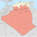
Territoires du sud.PNG 987 × 985; 93 KB
-
Touggourt territory 1934-1955 map-fr.svg 1,287 × 1,278; 1.79 MB
-
Tribus Aïn Témouchent 1846.PNG 1,477 × 1,141; 2.7 MB
-
Tribus sud Oran 1846.PNG 959 × 1,481; 2.32 MB
