Category:Maps of Uganda
Jump to navigation
Jump to search
Countries of Africa: Algeria · Angola · Benin · Botswana · Burkina Faso · Burundi · Cameroon · Cape Verde · Central African Republic · Chad · Comoros · Democratic Republic of the Congo · Republic of the Congo · Djibouti · Egypt‡ · Equatorial Guinea · Eritrea · Eswatini · Ethiopia · Gabon · The Gambia · Ghana · Guinea · Guinea-Bissau · Ivory Coast · Kenya · Lesotho · Liberia · Libya · Madagascar · Malawi · Mali · Mauritania · Mauritius · Morocco · Mozambique · Namibia · Niger · Nigeria · Rwanda · São Tomé and Príncipe · Senegal · Seychelles · Sierra Leone · Somalia · South Africa · South Sudan · Sudan · Tanzania · Togo · Tunisia · Uganda · Zambia · Zimbabwe
Limited recognition: Ambazonia · Azawad · Puntland · Sahrawi Arab Democratic Republic · Somaliland – Other areas: Canary Islands · Ceuta · Madeira · Mayotte · Melilla · Réunion · Saint Helena, Ascension and Tristan da Cunha · Scattered Islands in the Indian Ocean · Western Sahara
‡: partly located in Africa
Wikimedia category | |||||
| Upload media | |||||
| Instance of | |||||
|---|---|---|---|---|---|
| Category combines topics | |||||
 | |||||
Subcategories
This category has the following 31 subcategories, out of 31 total.
B
- Blank maps of Uganda (2 F)
C
D
E
- ECHO Daily Maps of Uganda (42 F)
F
H
- Health maps of Uganda (10 F)
I
L
- Maps of Lake Albert (Uganda) (12 F)
- Location maps of Uganda (3 F)
M
- Maps of Kampala (4 F)
N
- Maps of the White Nile (18 F)
O
P
- Poverty maps of Uganda (4 F)
R
- Maps of rivers of Uganda (12 F)
S
T
- Transport maps of Uganda (3 F)
W
Pages in category "Maps of Uganda"
The following 2 pages are in this category, out of 2 total.
Media in category "Maps of Uganda"
The following 85 files are in this category, out of 85 total.
-
(page 1 crop).jpg 412 × 599; 83 KB
-
20150120 South Sudan Neighbouring Refugees IDPs Landscape A2.pdf 3,508 × 2,479; 333 KB
-
20160120 Somalia Crisis Displacement.pdf 1,754 × 1,239; 599 KB
-
20170608 SouthSudan Crisis.pdf 1,754 × 1,239; 712 KB
-
20180118 DailyMap SouthSudan.pdf 1,754 × 1,239; 792 KB
-
20191014 Uganda Crisis Update.pdf 1,754 × 1,239; 785 KB
-
20191014 Uganda Crisis Update.png 1,123 × 794; 1.03 MB
-
20191219 DailyMap DRC Ebola portait.pdf 1,239 × 1,754; 934 KB
-
20221116 Uganda Refugees & Asylum-Seekers October2022 v2.pdf 1,754 × 1,239; 841 KB
-
20221116 Uganda Refugees & Asylum-Seekers October2022 v2.png 3,508 × 2,481; 6.4 MB
-
20231108 GHoA Complex Humanitarian Crisi v5.pdf 1,754 × 1,239; 5.06 MB
-
20231108 GHoA Complex Humanitarian Crisi v5.png 1,123 × 794; 1.05 MB
-
African use of the shilling.png 600 × 600; 44 KB
-
Ateker-trail-map.png 1,098 × 1,042; 56 KB
-
Ayilo 2 refugee settlement map as of 26 May 2017.pdf 4,964 × 3,506; 1.86 MB
-
Battles of the Uganda–Tanzania War-es.svg 964 × 996; 990 KB
-
Battles of the Uganda–Tanzania War.svg 964 × 996; 494 KB
-
Boeganda.png 710 × 705; 139 KB
-
Boroli Refugee settlement map.png 700 × 495; 138 KB
-
Bunyoro-Kitara map.png 375 × 375; 84 KB
-
Busolwe library.jpg 1,200 × 990; 591 KB
-
BwindiImpenetrable1.svg 1,790 × 1,668; 74 KB
-
CIA map of Uganda - derivative.jpg 503 × 319; 77 KB
-
Density evolution Victoria.svg 766 × 569; 244 KB
-
Eastern Central Africa, 1904.jpg 3,322 × 2,266; 1.92 MB
-
ECHO Horn of Africa Region Basemap Editable A3 Landscape.png 1,344 × 1,008; 551 KB
-
ECHO Uganda Editable A4 Landscape.pdf 1,754 × 1,239; 375 KB
-
ECHO Uganda Editable A4 Landscape.png 1,123 × 794; 337 KB
-
Gayaza and Lake Nakivale.png 1,151 × 828; 156 KB
-
Globe murchison falls.jpg 1,806 × 1,470; 403 KB
-
Horn of Africa Base Map.png 1,331 × 879; 623 KB
-
July 2010 Kampala attacks.png 1,032 × 747; 304 KB
-
Lake Mburo National Park.png 3,600 × 3,600; 6.9 MB
-
Lake Victoria vegetation map-blank.jpg 1,150 × 900; 278 KB
-
Lake Victoria vegetation map-fr.jpg 1,150 × 900; 285 KB
-
Libyan troop movements in Uganda, 1979.svg 923 × 996; 396 KB
-
IDP's in Northern Uganda.png 495 × 541; 61 KB
-
Lwengo District is in the Greater Masaka & Sese Islands.jpg 3,264 × 2,448; 2.72 MB
-
Maaji 2 refugee settlement map.jpg 1,024 × 725; 84 KB
-
Map of central Uganda (CIA map derivative).png 643 × 845; 632 KB
-
Map of Emin Pasha's Province Wellcome L0034859.jpg 3,600 × 3,744; 2.66 MB
-
Map of Kampala area, 1995.jpg 370 × 219; 20 KB
-
Map of the Luwero Triangle.jpg 600 × 308; 50 KB
-
My-Uganda-Kampala.jpg 1,640 × 1,679; 163 KB
-
Noch kene Koort-Uganda.png 577 × 583; 23 KB
-
Omugo refugee settlement map.jpg 1,024 × 723; 115 KB
-
Operations of the Holy Spirit Movement.png 400 × 433; 87 KB
-
Plan of Mt. Keyu, Fatiko District. (WOMAT-AFR-BEA-147).jpg 6,627 × 6,628; 18.18 MB
-
Pékin Express S14 (Ouganda).png 723 × 577; 143 KB
-
Rebel groups in Uganda (1986–1994).png 400 × 430; 20 KB
-
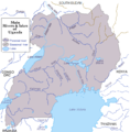
Rivers and lakes of Uganda.png 650 × 660; 88 KB
-
RunningDonus.jpg 720 × 720; 404 KB
-
Ruwenzori Map.jpg 2,700 × 1,737; 349 KB
-
Rwempasha Sector Map.jpg 411 × 390; 40 KB
-
Rwenzori (centre).png 853 × 1,295; 2.33 MB
-
Schools near Health Facilities in Uganda.jpg 975 × 968; 210 KB
-
SVG-Koort Uganda.svg 550 × 600; 33 KB
-
Taala Central Forest Reserve on the map of Uganda.png 1,396 × 1,450; 71 KB
-
Uganda (orthrographic projection).png 730 × 730; 154 KB
-
Uganda - DPLA - 0a4c0e8fd685def309ee62fb30451f4f.jpg 2,554 × 3,276; 5.6 MB
-
Uganda - DPLA - a77d03fb13db6e9d74b76fedee5c33da.jpg 2,556 × 3,274; 6.29 MB
-
Uganda busolwe.png 510 × 518; 43 KB
-
Uganda Hydrogeology3.png 548 × 792; 21 KB
-
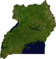
Uganda sat.png 657 × 684; 504 KB
-
Uganda Topography.png 971 × 945; 1.27 MB
-
Uganda Wasserwege.svg 550 × 600; 982 KB
-
Uganda-bunyoro-map.jpg 265 × 299; 14 KB
-
Uganda-districts-and-capital-map-1-e1693208672957.jpg 799 × 878; 138 KB
-
Uganda-locator+scale.PNG 330 × 355; 7 KB
-
Uganda-locator.png 330 × 355; 6 KB
-
Uganda. LOC 2005631138.tif 2,399 × 3,037; 20.84 MB
-
Uganda. LOC 2005631139.jpg 2,405 × 3,110; 826 KB
-
Uganda. LOC 96680034.jpg 2,441 × 3,031; 711 KB
-
Uganda. LOC 96680034.tif 2,441 × 3,031; 21.17 MB
-
Uganda. LOC 96680035.jpg 2,398 × 3,070; 882 KB
-
Uganda. LOC 96680035.tif 2,398 × 3,070; 21.06 MB
-
Ugandan districts affected by Lords Resistance Army.png 596 × 735; 92 KB
-
UgandaOMC.png 920 × 854; 69 KB
-
Victoria Albert Kyoga Lakes in Uganda.svg 1,441 × 1,466; 419 KB
-
Victoria Albert Kyoga Lakes&Rivers in Uganda.svg 650 × 660; 126 KB
-
ZiwaRhinoSanctuary.png 12,000 × 9,000; 2.87 MB


