Category:Maps of Lake Victoria
Jump to navigation
Jump to search
Wikimedia category | |||||
| Upload media | |||||
| Instance of | |||||
|---|---|---|---|---|---|
| Category combines topics | |||||
| Lake Victoria | |||||
lake in east-central Africa | |||||
| Instance of | |||||
| Part of | |||||
| Named after | |||||
| Location | Great Rift Valley | ||||
| Discoverer or inventor | |||||
| Time of discovery or invention |
| ||||
| Width |
| ||||
| Length |
| ||||
| Area |
| ||||
| Elevation above sea level |
| ||||
| Inflows |
| ||||
| Outflows | |||||
| Drainage basin | |||||
| Basin country | |||||
| Different from | |||||
 | |||||
Subcategories
This category has the following 2 subcategories, out of 2 total.
M
O
- Old maps of Lake Victoria (36 F)
Media in category "Maps of Lake Victoria"
The following 25 files are in this category, out of 25 total.
-
Admiralty Chart No 3665 Victoria Nyanza (Southern Portion), Published 1908, Large Corrections 1956.jpg 21,986 × 11,346; 92.73 MB
-
Image-Languages-Lakevictoria-fr.svg 511 × 448; 408 KB
-
Kaart Victoriameer.png 886 × 881; 45 KB
-
Kanjera (site).jpg 1,576 × 1,040; 1.35 MB
-
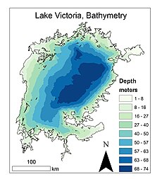
Lake Vic Bathy.jpg 3,000 × 3,300; 839 KB
-
Lake Victoria 1968.jpg 1,426 × 1,453; 841 KB
-
Lake Victoria Basin OSM.svg 4,376 × 3,671; 64.74 MB
-
Lake Victoria German text 1901-1916.png 2,048 × 2,048; 228 KB
-
Lake Victoria vegetation map-blank.jpg 1,150 × 900; 278 KB
-
Lake Victoria vegetation map-fr.jpg 1,150 × 900; 285 KB
-
Lake Victoria.svg 300 × 300; 30 KB
-
Lakeplateau.JPG 512 × 601; 19 KB
-
Lakevictoriafr.png 2,454 × 2,440; 559 KB
-
Languages-Lakevictoria-fr.png 2,130 × 1,868; 407 KB
-
Location GreatLakes-Africa.png 248 × 113; 7 KB
-
Location RegionOfTheGreatLakes-Africa.png 248 × 113; 7 KB
-
MigingoIsland.png 518 × 388; 69 KB
-
Station map ALL STATIONS.png 625 × 513; 656 KB
-
Tanzanian part of Lake Victoria - ZooKeys-256-001-g001.jpeg 1,512 × 1,684; 619 KB
-
Tracing of Field Sh. 7 & 8 (WOOS-18-2).jpg 8,894 × 4,079; 19.56 MB
-
Turkanasjön läge.png 977 × 1,171; 135 KB
-
Victoria outline.gif 59 × 60; 2 KB


