Category:Maps of the Democratic Republic of the Congo
Jump to navigation
Jump to search
Countries of Africa: Algeria · Angola · Benin · Botswana · Burkina Faso · Burundi · Cameroon · Cape Verde · Central African Republic · Chad · Comoros · Democratic Republic of the Congo · Republic of the Congo · Djibouti · Egypt‡ · Equatorial Guinea · Eritrea · Eswatini · Ethiopia · Gabon · The Gambia · Ghana · Guinea · Guinea-Bissau · Ivory Coast · Kenya · Lesotho · Liberia · Libya · Madagascar · Malawi · Mali · Mauritania · Mauritius · Morocco · Mozambique · Namibia · Niger · Nigeria · Rwanda · São Tomé and Príncipe · Senegal · Seychelles · Sierra Leone · Somalia · South Africa · South Sudan · Sudan · Tanzania · Togo · Tunisia · Uganda · Zambia · Zimbabwe
Limited recognition: Ambazonia · Azawad · Puntland · Sahrawi Arab Democratic Republic · Somaliland – Other areas: Canary Islands · Ceuta · Madeira · Mayotte · Melilla · Réunion · Saint Helena, Ascension and Tristan da Cunha · Scattered Islands in the Indian Ocean · Western Sahara
‡: partly located in Africa
Wikimedia category | |||||
| Upload media | |||||
| Instance of | |||||
|---|---|---|---|---|---|
| Category combines topics | |||||
 | |||||
Maps of the Democratic Republic of the Congo.
Subcategories
This category has the following 30 subcategories, out of 30 total.
Pages in category "Maps of the Democratic Republic of the Congo"
The following 2 pages are in this category, out of 2 total.
Media in category "Maps of the Democratic Republic of the Congo"
The following 55 files are in this category, out of 55 total.
-
3D Relief Model of the Kakoi-Koda Focus.png 567 × 339; 364 KB
-
ABIR company posts.svg 2,334 × 1,322; 68 KB
-
Bevölkerungsdichte der DR Kongo.png 500 × 500; 50 KB
-
Cabinda, R. Congo, D.R. Congo, Angola.png 380 × 370; 18 KB
-
Carte Congo ligne haute tension Inga.jpg 519 × 545; 105 KB
-
Chenal de Bosesera map.png 611 × 426; 725 KB
-
Congo (Republic of the Congo) - DPLA - 0fa35bec22decdaec84a539cbb8353bc.jpg 2,548 × 3,276; 5.86 MB
-
Congo Dem Rep Regions Map.png 3,000 × 3,118; 1.61 MB
-
Congo names.png 380 × 370; 18 KB
-
Congo parques nacionales.jpg 1,013 × 1,024; 188 KB
-
Conventional Congo Basin - DPLA - 5dbb94c071822e720e92ec7bb62fad5f.jpg 8,874 × 6,236; 6.43 MB
-
Democratic Republic of Congo Base Map.png 1,108 × 694; 155 KB
-
Democratic Republic of the Congo - DPLA - 074b8d3d7ba1f0cf3e93930a1a3947fd.jpg 2,554 × 3,274; 5.56 MB
-
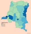
Democratic Republic of the Congo provinces by population density (2016).png 2,700 × 3,000; 736 KB
-
Democratic Republic of the Congo provinces by total population (2016).png 2,700 × 3,000; 771 KB
-
Demokratische Republik Kongo Pressefreiheit 2008.png 745 × 1,053; 107 KB
-
DRC cases south and north kivu , ituri.jpg 1,237 × 1,177; 195 KB
-
DRCongo telephone.png 2,000 × 2,000; 28 KB
-
ECHO DRC Province Orientale Editable A4 Landscape.pdf 1,754 × 1,239; 411 KB
-
ECHO DRC Équateur Editable A4 Landscape.pdf 1,754 × 1,239; 407 KB
-
HDVC Inga-Shaba.png 330 × 355; 39 KB
-
Kaartje van Upemba depression.png 672 × 605; 240 KB
-
Lac Ma Vallée, carte 1.jpg 656 × 676; 44 KB
-
LocMap of WH Okapi WR.png 630 × 600; 134 KB
-
Map of DRC.jpg 745 × 928; 147 KB
-
Map of Territoire d'Isangi.png 2,368 × 2,472; 131 KB
-
Map of Territoire de Buta.png 2,368 × 2,472; 131 KB
-
Mapa da República Democrática do Congo (OCHA).svg 254 × 254; 681 KB
-
Mbunda people location in DRC Congo.jpg 3,941 × 3,776; 763 KB
-
Medienlage in der DR Kongo.jpg 371 × 239; 12 KB
-
Momboyo OSM.png 1,031 × 553; 137 KB
-
Monj'Okuli.jpg 720 × 720; 219 KB
-
MONUC deployments Dec 2009.png 1,166 × 866; 333 KB
-
MONUC deployments Sep 2017.png 1,498 × 1,136; 1.73 MB
-
MONUC deployments Sep 2019.png 1,786 × 1,330; 1.24 MB
-
Monuc-mapa.jpg 601 × 450; 148 KB
-
Monuc.pdf 1,650 × 1,275; 620 KB
-
Nord-Kivu und Ituri (cropped).png 628 × 620; 56 KB
-
Nord-Kivu und Ituri.png 641 × 648; 60 KB
-
Nyiragongo volcano (31583419945).jpg 1,984 × 3,528; 5.03 MB
-
Operation Kitona Diagram.png 518 × 366; 29 KB
-
Population density of Democratic Republic of Congo provinces.png 5,566 × 6,085; 1.19 MB
-
Republic of the Congo- Selected Ethnic Groups - DPLA - ae869a2ef6e0b4f82877e22da129519b.jpg 2,556 × 3,278; 6.96 MB
-
Ruwenzori Map.jpg 2,700 × 1,737; 349 KB
-
Rwenzori (centre).png 853 × 1,295; 2.33 MB
-
Situation in Kinshasa (August 1998).svg 2,789 × 2,219; 40.71 MB
-
Territoire de Ndemba.png 1,357 × 963; 498 KB
-
The Kivus, eastern DRC (6940585108).jpg 4,256 × 2,832; 3.06 MB
-
Tumba-Ngiri-Maindombe in the DRC.jpg 1,150 × 1,095; 257 KB
-
Un-eastern-congo.png 2,057 × 2,582; 1.3 MB
-
UTC hue4map DRC.png 2,000 × 2,022; 407 KB


