Category:Maps of Gabon
Jump to navigation
Jump to search
Countries of Africa: Algeria · Angola · Benin · Botswana · Burkina Faso · Burundi · Cameroon · Cape Verde · Central African Republic · Chad · Comoros · Democratic Republic of the Congo · Republic of the Congo · Djibouti · Egypt‡ · Equatorial Guinea · Eritrea · Eswatini · Ethiopia · Gabon · The Gambia · Ghana · Guinea · Guinea-Bissau · Ivory Coast · Kenya · Lesotho · Liberia · Libya · Madagascar · Malawi · Mali · Mauritania · Mauritius · Morocco · Mozambique · Namibia · Niger · Nigeria · Rwanda · São Tomé and Príncipe · Senegal · Seychelles · Sierra Leone · Somalia · South Africa · South Sudan · Sudan · Tanzania · Togo · Tunisia · Uganda · Zambia · Zimbabwe
Limited recognition: Ambazonia · Azawad · Puntland · Sahrawi Arab Democratic Republic · Somaliland – Other areas: Canary Islands · Ceuta · Madeira · Mayotte · Melilla · Réunion · Saint Helena, Ascension and Tristan da Cunha · Scattered Islands in the Indian Ocean · Western Sahara
‡: partly located in Africa
Wikimedia category | |||||
| Upload media | |||||
| Instance of | |||||
|---|---|---|---|---|---|
| Category combines topics | |||||
 | |||||
Maps of Gabon.
Subcategories
This category has the following 23 subcategories, out of 23 total.
*
+
B
- Maps of borders of Gabon (3 F)
C
D
F
H
- Health maps of Gabon (1 F)
L
- Linguistic maps of Gabon (11 F)
- Location maps of Gabon (4 F)
M
- Maps of Gabon on stamps (2 F)
P
R
S
T
- Transport maps of Gabon (1 F)
Pages in category "Maps of Gabon"
The following 2 pages are in this category, out of 2 total.
Media in category "Maps of Gabon"
The following 31 files are in this category, out of 31 total.
-
20230530 West & Central Africa Complex Crisis(1).pdf 1,754 × 1,239; 728 KB
-
20230530 West & Central Africa Complex Crisis(1).png 3,509 × 2,482; 10.26 MB
-
AT0102 map.png 650 × 836; 24 KB
-
AT0723 map.png 987 × 831; 38 KB
-
AT1401 map.png 824 × 805; 24 KB
-
Carte du pays nzebi Gabon Congo.png 723 × 628; 77 KB
-
Carte pays nzebi.png 723 × 584; 84 KB
-
CongoforestbasinTRIDOM.jpg 661 × 669; 214 KB
-
Corisco Elobey.png 438 × 422; 97 KB
-
Corsico Bay with borders (labelled).svg 743 × 574; 180 KB
-
ECHO Gabon Editable A4 Portrait.pdf 1,239 × 1,754; 327 KB
-
ECHO Gabon Editable A4 Portrait.png 794 × 1,123; 335 KB
-
Evolution du Parc.jpg 3,600 × 2,700; 2.51 MB
-
FLII Gabon.png 959 × 827; 528 KB
-
GA-Point Denis.png 428 × 448; 7 KB
-
Gabon - DPLA - 44c9ce5a84d164e57373e87c845b2f2a.jpg 2,554 × 3,276; 5.01 MB
-
Gabon - DPLA - 6f65c8b97dd5a3fd069f76719154d2a2.jpg 2,554 × 3,282; 4.02 MB
-
Gabon - DPLA - af53e8aa990e5bd92f986d2b1ecbf7e7.jpg 2,554 × 3,280; 5.91 MB
-
Gabon - DPLA - b7d350607a29f3500e9a85505aac4131.jpg 2,556 × 3,286; 7.1 MB
-
Gabon - Economia.png 907 × 873; 230 KB
-
Gabon Base Map.png 756 × 997; 312 KB
-
Gabon Hydrogeology3.png 541 × 884; 24 KB
-
Gabontreeheight landsat 2011 2014.jpg 720 × 538; 207 KB
-
Localisation de Minvoul au Gabon.png 428 × 448; 17 KB
-
Monts de Cristal twin national park.jpg 3,413 × 2,025; 1.99 MB
-
Ogooue-Lolo departments.png 1,056 × 816; 20 KB
-
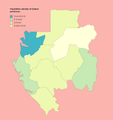
Population density of Gabon provinces.png 3,172 × 3,378; 386 KB
-
Northwestern Congolese lowland forests map.png 872 × 826; 33 KB


