Category:Maps of Eritrea
Jump to navigation
Jump to search
Countries of Africa: Algeria · Angola · Benin · Botswana · Burkina Faso · Burundi · Cameroon · Cape Verde · Central African Republic · Chad · Comoros · Democratic Republic of the Congo · Republic of the Congo · Djibouti · Egypt‡ · Equatorial Guinea · Eritrea · Eswatini · Ethiopia · Gabon · The Gambia · Ghana · Guinea · Guinea-Bissau · Ivory Coast · Kenya · Lesotho · Liberia · Libya · Madagascar · Malawi · Mali · Mauritania · Mauritius · Morocco · Mozambique · Namibia · Niger · Nigeria · Rwanda · São Tomé and Príncipe · Senegal · Seychelles · Sierra Leone · Somalia · South Africa · South Sudan · Sudan · Tanzania · Togo · Tunisia · Uganda · Zambia · Zimbabwe
Limited recognition: Ambazonia · Azawad · Puntland · Sahrawi Arab Democratic Republic · Somaliland – Other areas: Canary Islands · Ceuta · Madeira · Mayotte · Melilla · Réunion · Saint Helena, Ascension and Tristan da Cunha · Scattered Islands in the Indian Ocean · Western Sahara
‡: partly located in Africa
Wikimedia category | |||||
| Upload media | |||||
| Instance of | |||||
|---|---|---|---|---|---|
| Category combines topics | |||||
 | |||||
Maps of Eritrea
Subcategories
This category has the following 25 subcategories, out of 25 total.
*
B
- Blank maps of Eritrea (5 F)
D
- District maps of Eritrea (45 F)
E
F
G
H
L
M
- Maps of Massawa (17 F)
O
P
R
S
T
V
Pages in category "Maps of Eritrea"
The following 2 pages are in this category, out of 2 total.
Media in category "Maps of Eritrea"
The following 47 files are in this category, out of 47 total.
-
Political map Afar triangle.png 373 × 454; 436 KB
-
20160120 Somalia Crisis Displacement.pdf 1,754 × 1,239; 599 KB
-
20231108 GHoA Complex Humanitarian Crisi v5.pdf 1,754 × 1,239; 5.06 MB
-
20231108 GHoA Complex Humanitarian Crisi v5.png 1,123 × 794; 1.05 MB
-
A map of Eritrea regions.png 1,979 × 1,579; 262 KB
-
AfarDrape.jpg 874 × 542; 144 KB
-
Area of Eritrea and the United States.jpg 512 × 600; 93 KB
-
AT1007 map.png 847 × 844; 37 KB
-
AT1304 map.png 826 × 844; 25 KB
-
Dahlak Archipelago 1.svg 1,453 × 1,199; 213 KB
-
Danakil Desert.png 706 × 749; 46 KB
-
ECDM 20160224 CountriesOfOrigin DailyMap.pdf 1,754 × 1,239; 910 KB
-
ECDM 20160826 Yemen Humanitarian Crisis.pdf 1,754 × 1,239; 817 KB
-
ECDM 20181011 Sudan Crisis.pdf 1,754 × 1,239; 912 KB
-
ECDM 20181220 Ethiopia Eritrean refugee.pdf 1,754 × 1,239; 585 KB
-
ECHO Equatorial Guinea Editable A4 Portrait.pdf 1,239 × 1,754; 231 KB
-
ECHO Horn of Africa Region Basemap Editable A3 Landscape.png 1,344 × 1,008; 551 KB
-
Eritrea - DPLA - 68b17c39dc0bf6e437855845ca1df40a.jpg 5,472 × 6,432; 5.72 MB
-
Eritrea - DPLA - 86fe8834e7a72759411e82986773d675.jpg 2,546 × 3,280; 4.19 MB
-
Eritrea and Northern Ethiopia - DPLA - 0836039de1f100d915551b3619c6cdfa.jpg 2,556 × 3,280; 6.86 MB
-
Eritrea Base Map.png 1,102 × 695; 271 KB
-
Eritrea disputed w1 countrymap.svg 1,000 × 1,000; 12 KB
-
ERITREA TOP.jpg 1,148 × 927; 478 KB
-
Eritrea Tribes and Sub Tribes - DPLA - 38a00991f4b3cf050f9a1d2644ca8ca4.jpg 5,892 × 6,665; 6.59 MB
-
EritreaOMC.png 929 × 941; 36 KB
-
Erythree et ses frontieres africaines.gif 774 × 599; 93 KB
-
Ethiopian Civil War.png 922 × 982; 246 KB
-
GolfvonAdenKartevonDanielPresberger.png 800 × 668; 145 KB
-
Governatorato di Eritrea.png 956 × 865; 1.55 MB
-
GSHAP Peak Ground Acceleration and Seismic Zoning map of Eritrea.jpg 4,953 × 3,509; 1.66 MB
-
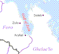
Gulf of Zula.GIF 423 × 389; 19 KB
-
Horn of Africa Base Map.png 1,331 × 879; 623 KB
-
Italian eritrea in 1896.png 688 × 673; 580 KB
-
Kerkebet sub-zone (2012).png 4,967 × 3,508; 1.21 MB
-
Mapa da Eritreia (OCHA).svg 254 × 254; 331 KB
-
Mare Erithrean.jpg 1,280 × 811; 512 KB
-
Medri Bahri.png 17,877 × 20,000; 4.37 MB
-
Mekaikaeritreawiki.png 788 × 586; 90 KB
-
Mereb Melash.png 17,877 × 20,000; 4.22 MB
-
Narrow gauge railways at Massawa, 1887 superimposed onto OpenStreetMap.jpg 1,843 × 808; 308 KB
-
Rashaida people map.png 973 × 964; 249 KB
-
The Danakil Desert.png 1,041 × 1,017; 103 KB
-
AT0705 map.png 1,336 × 844; 54 KB
-
خريطة القوميات الإريترية .jpg 375 × 293; 18 KB
-
AT0715 map.png 667 × 830; 27 KB
-
AT1305 map.png 897 × 844; 28 KB


