Category:Maps of Zimbabwe
Appearance
Countries of Africa: Algeria · Angola · Benin · Botswana · Burkina Faso · Burundi · Cameroon · Cape Verde · Central African Republic · Chad · Comoros · Democratic Republic of the Congo · Republic of the Congo · Djibouti · Egypt‡ · Equatorial Guinea · Eritrea · Eswatini · Ethiopia · Gabon · The Gambia · Ghana · Guinea · Guinea-Bissau · Ivory Coast · Kenya · Lesotho · Liberia · Libya · Madagascar · Malawi · Mali · Mauritania · Mauritius · Morocco · Mozambique · Namibia · Niger · Nigeria · Rwanda · São Tomé and Príncipe · Senegal · Seychelles · Sierra Leone · Somalia · South Africa · South Sudan · Sudan · Tanzania · Togo · Tunisia · Uganda · Zambia · Zimbabwe
Limited recognition: Ambazonia · Azawad · Puntland · Sahrawi Arab Democratic Republic · Somaliland – Other areas: Canary Islands · Ceuta · Madeira · Mayotte · Melilla · Réunion · Saint Helena, Ascension and Tristan da Cunha · Scattered Islands in the Indian Ocean · Western Sahara
‡: partly located in Africa
Wikimedia category | |||||
| Upload media | |||||
| Instance of | |||||
|---|---|---|---|---|---|
| Category combines topics | |||||
 | |||||
Subcategories
This category has the following 27 subcategories, out of 27 total.
!
B
- Blank maps of Zimbabwe (6 F)
C
E
- ECHO Daily Maps of Zimbabwe (12 F)
F
H
- Maps of Harare (7 F)
I
L
M
O
P
R
S
T
Pages in category "Maps of Zimbabwe"
The following 2 pages are in this category, out of 2 total.
Media in category "Maps of Zimbabwe"
The following 56 files are in this category, out of 56 total.
-
103 of 'In the Land of Cecil Rhodes' (11234853436).jpg 1,888 × 1,261; 399 KB
-
2008 Zimbabwe Cholera Outbreak Cases by District.png 754 × 454; 31 KB
-
2008 Zimbabwe Cholera Outbreak Combined.svg 630 × 490; 246 KB
-
2008 Zimbabwe Cholera Outbreak.svg 630 × 490; 247 KB
-
20150119 ECHO Southern Africa Flood Editable A4 Landscape.pdf 1,754 × 1,239; 475 KB
-
201801213 Zimbabwe FoodInsecurity.pdf 1,754 × 1,239; 524 KB
-
201801213 Zimbabwe FoodInsecurity.png 1,123 × 794; 1,006 KB
-
Africa Map Kenya, Tanzania, Zambia, Zimbabwe.jpg 771 × 792; 81 KB
-
AT0709 map.png 927 × 844; 29 KB
-
AT0717 map.png 695 × 802; 23 KB
-
AT0719 map.png 850 × 835; 36 KB
-
AT0725 map.png 893 × 844; 38 KB
-
AT0726 map.png 787 × 822; 30 KB
-
AT1006 map.png 794 × 826; 25 KB
-
Base Map of Southern Africa.png 1,344 × 871; 381 KB
-
Bulawayo1979.png 555 × 655; 26 KB
-
Cecil Movement.jpg 979 × 700; 110 KB
-
Diocesi dello Zimbabwe.png 300 × 276; 41 KB
-
ECDM 20150123 SoutheastAfrica Floods.pdf 1,625 × 1,125; 843 KB
-
ECDM 20150205 World Events v01.pdf 1,625 × 1,125; 445 KB
-
ECDM 20240426 Southern Africa drought.pdf 1,625 × 1,125; 596 KB
-
ECDM 20241211 ECHO funding SAIO(1).pdf 1,754 × 1,239; 441 KB
-
FLII Zimbabwe.png 1,157 × 909; 350 KB
-
Food insecurity in Zimbabwe.svg 630 × 490; 295 KB
-
Location of Zimbabwe.png 280 × 280; 13 KB
-
Map of Africa - Kenya, Tanzania, Zambia, Zimbabwe.jpg 862 × 812; 51 KB
-
Mukumbura.Map.png 376 × 302; 86 KB
-
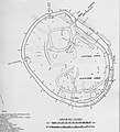
Plan of great enclosure.JPG 651 × 715; 175 KB
-
Population density of Zimbabwe provinces.png 4,148 × 4,179; 529 KB
-
Portuguese Zimbabwe.svg 3,026 × 1,508; 3.16 MB
-
Provinces affected Gukurahundi.png 832 × 755; 107 KB
-
Rhodesia1979.png 842 × 786; 50 KB
-
Salisbury1979.png 465 × 550; 33 KB
-
Spread of Zimbabwean Cholera Outbreak.svg 1,000 × 500; 2.76 MB
-
Veterinary-Fences SouthernAfrica.png 673 × 619; 40 KB
-
Zhombe 12.jpg 752 × 606; 32 KB
-
Zhombe Communal and Constituency.jpg 752 × 606; 61 KB
-
Zhombe Communal land.jpg 807 × 598; 106 KB
-
Zhombe Constituency & Communal.jpg 807 × 597; 119 KB
-
Zhombe Mabura Ward.jpg 1,262 × 1,179; 228 KB
-
Zhombe Map 1.jpg 778 × 541; 114 KB
-
Zimb-MMAP-md.png 1,032 × 726; 81 KB
-
Zimbabwe - DPLA - 0e5f1b9f4d203a72dea8ebdeb2f61120.jpg 3,274 × 2,548; 1,001 KB
-
Zimbabwe - DPLA - 3b9a862f3b57e0fa4f76f8f9d47548c0.jpg 3,276 × 2,552; 1.08 MB
-
Zimbabwe - DPLA - 9a5f18f3010b156e1735f1e471acb2aa.jpg 2,556 × 3,272; 5.52 MB
-
Zimbabwe - Ressorsas naturalas.png 954 × 696; 158 KB
-
Zimbabwe and the Commonwealth of Nations.svg 940 × 415; 1.5 MB
-
Zimbabwe Base Map.png 1,117 × 708; 353 KB
-
Zimbabwe districts.png 1,025 × 624; 21 KB
-
Zimbabwe Hydrogeology3.png 642 × 892; 28 KB
-
Zimbabwe Locator.png 1,298 × 1,116; 52 KB
-
Zimbabwe Municipalities.png 1,601 × 1,025; 89 KB
-
Zimbabwe national parks map.jpg 832 × 755; 171 KB
-
Zimbabwe Population Density, 2000 (5457627922).jpg 2,488 × 3,216; 616 KB
-
Zimbabwe Population Density, 2000 (6171923513).jpg 2,355 × 3,160; 600 KB
-
ZimbabweOMC.png 939 × 778; 36 KB


