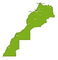
Category:Maps of Morocco
Jump to navigation
Jump to search
Countries of Africa: Algeria · Angola · Benin · Botswana · Burkina Faso · Burundi · Cameroon · Cape Verde · Central African Republic · Chad · Comoros · Democratic Republic of the Congo · Republic of the Congo · Djibouti · Egypt‡ · Equatorial Guinea · Eritrea · Eswatini · Ethiopia · Gabon · The Gambia · Ghana · Guinea · Guinea-Bissau · Ivory Coast · Kenya · Lesotho · Liberia · Libya · Madagascar · Malawi · Mali · Mauritania · Mauritius · Morocco · Mozambique · Namibia · Niger · Nigeria · Rwanda · São Tomé and Príncipe · Senegal · Seychelles · Sierra Leone · Somalia · South Africa · South Sudan · Sudan · Tanzania · Togo · Tunisia · Uganda · Zambia · Zimbabwe
Limited recognition: Ambazonia · Azawad · Puntland · Sahrawi Arab Democratic Republic · Somaliland – Other areas: Canary Islands · Ceuta · Madeira · Mayotte · Melilla · Réunion · Saint Helena, Ascension and Tristan da Cunha · Scattered Islands in the Indian Ocean · Western Sahara
‡: partly located in Africa
Wikimedia category | |||||
| Upload media | |||||
| Instance of | |||||
|---|---|---|---|---|---|
| Category combines topics | |||||
 | |||||
Subcategories
This category has the following 35 subcategories, out of 35 total.
- Blank maps of Morocco (15 F)
*
A
B
C
D
E
F
G
H
I
L
- Location maps of Morocco (4 F)
M
O
P
R
- Maps of rivers of Morocco (22 F)
S
T
W
Pages in category "Maps of Morocco"
The following 2 pages are in this category, out of 2 total.
Media in category "Maps of Morocco"
The following 172 files are in this category, out of 172 total.
-
 &TEMSIA.jpg 966 × 716; 102 KB
-
 000 Maroku harta.PNG 329 × 352; 12 KB
-
 1941Maroq.jpg 3,004 × 1,201; 1.28 MB
-
 1960 02 29 Agadir earthquake.png 331 × 273; 61 KB
-
 2004 Morocco earthquake.png 603 × 522; 23 KB
-
 20220121 DM Overview2021 repatriation v2.pdf 1,754 × 1,239; 757 KB
-
 Acuerdo Tripartito de Madrid.jpg 500 × 500; 28 KB
-
 Administrative divisions of Morocco.jpg 1,536 × 1,642; 1.03 MB
-
 Ait Kamra, Morocco.png 404 × 150; 7 KB
-
 Alaouite dynasty of Morocco-ar.svg 385 × 408; 938 KB
-
 Alaouite dynasty of Morocco-en.svg 385 × 408; 945 KB
-
 AMmaroc.png 280 × 274; 16 KB
-
 AOE,Africa Ocidental Espanhola.png 216 × 206; 9 KB
-
 AOE,Saara Espanhol,mk-II.png 216 × 206; 9 KB
-
 Arab League countries and territories - Morocco.svg 605 × 340; 183 KB
-
 Arab regions of Morocco.png 439 × 317; 9 KB
-
 Arab tribes in morocco.jpg 1,074 × 885; 145 KB
-
 Arab tribu maroc.jpg 1,100 × 540; 97 KB
-
 Arab-Berber regions of Morocco.png 439 × 320; 9 KB
-
 AtlasRange.jpg 816 × 472; 270 KB
-
 Bassin de Saiss.png 754 × 526; 482 KB
-
 Battle of Isli.png 1,080 × 1,080; 559 KB
-
 Berber regions of Morocco.png 439 × 319; 8 KB
-
 Berbers.png 592 × 465; 62 KB
-
 Bodleian Libraries, Fessae, et Marocchi Regna Africae celeberr.jpg 1,000 × 675; 188 KB
-
 Bzou map.jpg 1,520 × 1,145; 236 KB
-
 C maroc.jpg 480 × 541; 68 KB
-
 Card with a map of Morocco given to Green March volunteers.png 3,207 × 4,239; 9.81 MB
-
 Carte Maroc.gif 424 × 411; 23 KB
-
 Carte Meknes-Tafilalet.jpg 600 × 503; 61 KB
-
 Carte--maroc.jpg 1,000 × 1,042; 52 KB
-
 Chaouia Tribus-arr.png 848 × 932; 78 KB
-
 Chefchaouen map with listings.svg 150 × 120; 657 KB
-
 Circonscription Salé-El Jadida.svg 2,004 × 2,067; 35 KB
-
 Circonscription Salé-Médina.svg 2,004 × 2,067; 35 KB
-
 Control of Western Sahara.png 7,200 × 3,318; 1.38 MB
-
 Dakhla maps.png 591 × 599; 28 KB
-
 Douar Tizi - Aghbal - Yat El Ghazi - Yat Khaled - Yat Iznassen - Rif.png 763 × 489; 109 KB
-
 ECDM 20141124 World Events.pdf 1,625 × 1,125; 381 KB
-
 ECHO Morocco Editable A4 Landscape.pdf 1,754 × 1,239; 341 KB
-
 ECHO Morocco Editable A4 Landscape.png 1,123 × 794; 266 KB
-
 Edouard Meyer Record du monde Triptyque Englebert 1.jpg 2,341 × 2,697; 1.85 MB
-
 Eguen Fb Cover.png 1,702 × 630; 410 KB
-
 Electrical Power Grid - Morocco.png 4,334 × 3,528; 926 KB
-
 Essaouira map.png 885 × 659; 209 KB
-
 FIFA World Cup 2026 - Morocco Potential venues.jpg 1,259 × 1,024; 161 KB
-
 FLII Morocco.png 1,184 × 897; 70 KB
-
 Great Morocco map.png 720 × 596; 112 KB
-
 Hyayna Localisation.PNG 375 × 335; 8 KB
-
 Ifni txu-oclc-6949452-nh29-10.jpg 5,000 × 3,798; 4.55 MB
-
 Ifni,Etnico,mk-VI.png 724 × 746; 114 KB
-
 Igiliz.png 580 × 362; 182 KB
-
 Imouzzer kandar-Morocco map Arabic copy.jpg 290 × 348; 45 KB
-
 J12 Agadir - Taghazout - Imouzzer.jpg 1,240 × 2,362; 550 KB
-
 KemKem-fig1-map.jpg 1,512 × 808; 390 KB
-
 Koppen-Geiger Map MAR present.svg 1,573 × 850; 994 KB
-
 LagueraMap.jpg 1,092 × 1,280; 104 KB
-
 Layoune-Semara-Rio doro.PNG 250 × 250; 11 KB
-
 Lhaouari1 (9933747336).jpg 2,394 × 1,798; 225 KB
-
 MAP DE LQLIAA.jpg 1,142 × 713; 157 KB
-
 Map of Beni Amer in Algeria and Morocco.jpg 2,000 × 1,682; 169 KB
-
 Map of kingdom Morocco.webp 800 × 677; 57 KB
-
 Map of Moroccan military regions.svg 879 × 920; 262 KB
-
 Map of Morocco of villages with female potters near Fès and Taounate - Oulad Bou Soltane.png 5,100 × 7,014; 1.95 MB
-
 Map of Morocco of villages with female potters near Fès and Taounate - Slit.png 5,100 × 7,014; 2.17 MB
-

-
 Map ourtzagh.png 1,540 × 1,074; 119 KB
-
 Map zaio maroc.jpg 400 × 328; 35 KB
-
 Mapa AOE, Rio do Ouro.png 1,024 × 905; 115 KB
-
 Mapa de acceso a saidia.jpeg 350 × 165; 9 KB
-
 Mapa de la tribu de Beni Mestara.png 673 × 342; 323 KB
-

-
 Mapas de África Occidental, p. 23.png 331 × 332; 190 KB
-
 Mape payis Imswinne.jpg 1,920 × 1,080; 368 KB
-
 Mape voye Bougmesse Kelaa Mgouna.jpg 2,256 × 1,496; 977 KB
-
 Maps of Unesco heritage sites in Morocco.gif 610 × 410; 106 KB
-
 Maps of Western Sahara according to point of view.png 1,472 × 433; 38 KB
-
 Maptc6.png 1,173 × 725; 1.03 MB
-
 Maroc de facto 2020 map.jpg 377 × 453; 35 KB
-
 Marocco CIA map.gif 329 × 353; 18 KB
-
 Mean wind speed map Morocco.png 768 × 1,010; 838 KB
-
 Melilla Spain (In Morocco).PNG 438 × 476; 425 KB
-
 Merça Maghila.jpg 1,069 × 720; 268 KB
-
 Meseta-01.png 2,775 × 1,972; 275 KB
-
 Military occupation vector (North Africa).png 405 × 529; 38 KB
-
 Morocco & Sahara.png 538 × 518; 11 KB
-
 Morocco - DPLA - 230164743fc1d91308a89294a755f902.jpg 10,140 × 8,822; 8.67 MB
-
 Morocco - DPLA - 649281411e7ec4d444b636972a6690a0.jpg 2,552 × 3,272; 4.56 MB
-
 Morocco - DPLA - 8a82558234820ea5102a1cacf6ae2175.jpg 5,307 × 4,247; 1.9 MB
-
 Morocco - DPLA - 92c95cf292e6adb59b655ed182b43454.jpg 10,200 × 8,823; 8.95 MB
-
 Morocco - DPLA - c7a722eb8596febc2bc66862e4b64eac.jpg 11,782 × 8,619; 6.8 MB
-
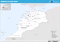
 Morocco Base Map.png 1,108 × 691; 281 KB
-
 Morocco cities and routes.svg 744 × 1,052; 83 KB
-
 Morocco cities.svg 744 × 1,052; 72 KB
-
 Morocco de facto map.jpg 377 × 453; 36 KB
-
 Morocco disputed w1 countrymap.svg 1,000 × 1,000; 16 KB
-
 Morocco location club.png 696 × 568; 77 KB
-
 Morocco location.png 1,280 × 1,041; 56 KB
-
 Morocco map fr.png 3,000 × 3,000; 148 KB
-
 Morocco phosphate basins.png 521 × 599; 120 KB
-
 Morocco physical map (de facto).png 1,172 × 988; 1.56 MB
-
 Morocco Population Density, 2000 (6171913039).jpg 2,322 × 3,160; 594 KB
-
 Morocco real map.png 650 × 761; 56 KB
-
 Morocco Regions.svg 744 × 1,052; 94 KB
-
 Morocco Western-Sahara location map.jpg 1,024 × 1,120; 57 KB
-
 Morocco.gif 257 × 257; 21 KB
-
 MoroccoWesternSahara Hydrogeology3.png 895 × 902; 39 KB
-
 MoroccoWesternSaharaOMC closer.jpg 465 × 573; 55 KB
-
 MoroccoWesternSaharaOMC.png 929 × 1,048; 67 KB
-
 Morocoo1598(2).png 1,942 × 2,158; 116 KB
-
 Mtalsa kharita.png 810 × 702; 253 KB
-
 Organización territorial de las cabilas.JPG 599 × 250; 40 KB
-
 Plan de masse Taghazout Bay.png 1,136 × 797; 553 KB
-
 Population density of Morocco regions.png 4,780 × 5,102; 537 KB
-
 Principales routes du Maroc.jpg 600 × 652; 52 KB
-
 Province de Nador.png 432 × 478; 112 KB
-
 Province de Oujda - Maroc.png 435 × 574; 115 KB
-
 Province of Sidi Bennour Ar.jpg 784 × 591; 86 KB
-
 Provinces maroc herbonautes.jpg 5,651 × 4,503; 6.81 MB
-

-
 Reserva de la biosfera intercontinental del Mediterráneo.svg 997 × 997; 3.1 MB
-
 Riffian people.png 162 × 171; 13 KB
-
 Riffijnen.jpeg 155 × 117; 26 KB
-
 Rio de Oro Location.png 266 × 226; 8 KB
-
 Roman Catholic dioceses of Morocco map.png 737 × 600; 105 KB
-
 ROUTES DE LQLIAA.jpg 1,109 × 636; 260 KB
-
 Sahrawi-Morrocan Dispute Map.png 3,334 × 2,438; 187 KB
-
 Series 1404 sheet 420-B Fes, published 1962.jpg 7,733 × 5,851; 10.86 MB
-
 Series 1404 sheet 420-D Casablanca, published 1967.jpg 7,056 × 5,597; 9.89 MB
-
 Sites archéologiques du Maroc (6372374319).jpg 3,000 × 3,000; 4.79 MB
-
 Siège d'Oran (1693).jpg 630 × 480; 112 KB
-
 Southern marocco.png 1,450 × 671; 428 KB
-
 Sub-Atlantic plains.jpg 439 × 334; 32 KB
-
 Tagzen Carte du Maroc.jpg 612 × 599; 23 KB
-
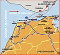 Tanger large map.jpg 830 × 766; 102 KB
-
 Taourdamap.png 800 × 300; 144 KB
-
 TASK-FORCE-BLACKSTONE.png 273 × 350; 146 KB
-
 Tekna-ar (Morocco with WS).png 736 × 600; 50 KB
-
 Tekna-ar.PNG 736 × 600; 49 KB
-
 Tekna.PNG 854 × 696; 26 KB
-
 Territorio IFNI, em 1957, com localidades.png 681 × 757; 81 KB
-
 Territorio IFNI, em 1957, Mesti.png 692 × 757; 87 KB
-
 Territorio IFNI, em 1957, Sbouya.png 692 × 757; 89 KB
-
 Territorio IFNI, em 1957, Zoco el Arbaa.png 700 × 757; 86 KB
-
 The Earth beneath the sea - History (1963) (21124446035).jpg 1,982 × 1,396; 445 KB
-
 The map of moroccan Kingdom.png 1,206 × 1,198; 169 KB
-
 Toph khenichet.png 256 × 256; 15 KB
-
 Toubkal National Park map.png 2,401 × 1,953; 388 KB
-
 Track Aicha.jpg 610 × 422; 89 KB
-
 UTC hue4map MOR.png 2,000 × 2,112; 162 KB
-
 Visa requirements for Moroccan citizens 04082024.svg 2,754 × 1,398; 1.06 MB
-
 Wa-mape veyes do do Marok al Walonreye.jpg 1,496 × 2,256; 458 KB
-
 Western Sahara Positions.png 4,000 × 2,029; 653 KB
-
 África occidental entre 1956-1958, p. 23.png 335 × 353; 203 KB
-
 БСЭ1. Марокко.jpg 1,037 × 907; 497 KB
-
 מפה פאס, מרוקו.png 2,297 × 1,709; 2.16 MB
-
 الإمبراطورية الشريفة.jpg 770 × 816; 248 KB
-
 التقسيم الإداري للمغرب.jpeg 1,446 × 1,817; 582 KB
-
 الثورات على حكم إسماعيل.png 440 × 440; 149 KB
-
 الجماعة الحضرية القليعة في محيطها عبر الخريطة.jpg 1,311 × 994; 944 KB
-
 امتداد الدولة العلوية سنة 1798م.png 957 × 697; 1.2 MB
-
 امتداد المغرب تحت الحكم السعدي أواخر القرن 16.png 479 × 543; 41 KB
-
 انتشار القصور في المغرب.png 530 × 568; 60 KB
-
 بنو كعب في بلاد المغرب.jpg 682 × 648; 170 KB
-
 تموقع قرية أربعاء أيت أحمد على الخريطة.jpg 427 × 532; 22 KB
-
 خريطة إقليم العرائش.gif 600 × 526; 67 KB
-
 خريطة إقليم طاطا.png 1,212 × 634; 374 KB
-
 خريطة المغرب بداية حكم العلويين 1660.png 636 × 636; 20 KB
-
 خريطة المواقع الأثرية و التاريخية بالمغرب.jpg 1,080 × 1,118; 191 KB
-
 خريطة موقع كهف تحت الغار.png 625 × 504; 56 KB
-
 معركة ملوية.jpg 1,200 × 752; 68 KB
-
 نقل أمكريو.jpg 941 × 625; 83 KB


.jpg)


.PNG)


.png)


.png)
.jpg)


.png)


.jpg)
.jpg)


.png)


_(21124446035).jpg)


