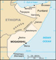
Category:Maps of Puntland
Jump to navigation
Jump to search
Wikimedia category | |||||
| Upload media | |||||
| Instance of | |||||
|---|---|---|---|---|---|
| Category combines topics | |||||
| Puntland | |||||
Federal Member State in northeastern Somalia | |||||
| Instance of |
| ||||
| Part of | |||||
| Location | Somalia | ||||
| Capital | |||||
| Legislative body | |||||
| Official language | |||||
| Currency | |||||
| Head of state |
| ||||
| Head of government |
| ||||
| Inception |
| ||||
| Population |
| ||||
| Area |
| ||||
| Top-level Internet domain | |||||
 | |||||
Media in category "Maps of Puntland"
The following 69 files are in this category, out of 69 total.
-
1974-1983 extent of Puntland province of Nugaal.png 512 × 640; 14 KB
-
Administrative Puntland map.png 1,400 × 1,512; 46 KB
-
Colonial non-signatory territories & Puntland, sea.png 620 × 752; 49 KB
-
Colonial non-signatory territories & Puntland.png 646 × 762; 46 KB
-
Dhul Bicidyahan.jpg 1,080 × 1,403; 400 KB
-
Garowe-Bosaso Highway.jpg 281 × 333; 84 KB
-
GolfvonAdenKartevonDanielPresberger.png 800 × 668; 145 KB
-
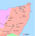
Harti clan distribution in SSC-Khatumo & Puntland.png 824 × 848; 510 KB
-
Harti map areas eligible for Puntland citizenship.png 1,776 × 2,069; 249 KB
-
Harti tribes and non-Harti tribes (blue).jpg 634 × 864; 65 KB
-
Harti tribes and non-Harti tribes (yellow).jpg 634 × 864; 60 KB
-
Location Puntland and Maakhir.png 250 × 325; 15 KB
-
Location puntland.png 250 × 325; 18 KB
-
Location Puntland3.png 247 × 323; 20 KB
-
LocationPuntland.png 250 × 115; 7 KB
-
LocationPuntland2.png 250 × 115; 4 KB
-
LocationPuntland3.png 674 × 600; 94 KB
-
Map of Puntland at its founding in 1998.png 797 × 710; 110 KB
-
Map of Puntland.jpg 497 × 423; 90 KB
-
Map of Somalia with States flags.svg 1,000 × 1,318; 223 KB
-
Northeast somalia geography.gif 891 × 817; 109 KB
-
Northeast somalia geography.png 891 × 817; 95 KB
-
Northsomalia.gif 7,242 × 6,671; 754 KB
-
Nugaal in the 1970s (colored red) was merged with Sool province.png 717 × 911; 52 KB
-
Outline of Puntland.png 1,241 × 1,800; 86 KB
-
Puntie.png 608 × 598; 211 KB
-
Puntite control under Puntlander president Maxamed Xaashi reign.png 805 × 803; 236 KB
-
Puntland location.png 250 × 264; 47 KB
-
Puntland maamul of Somalia.png 684 × 611; 732 KB
-
Puntland Map Clan Aamir.jpg 1,024 × 764; 753 KB
-
Puntland map regions.png 823 × 1,009; 157 KB
-
Puntland map.png 682 × 754; 38 KB
-
Puntland map.svg 1,000 × 1,318; 12 KB
-
Puntland new regions map.jpg 640 × 490; 130 KB
-
Puntland New regions Map.png 640 × 490; 34 KB
-
Puntland oil.png 570 × 599; 42 KB
-
Puntland regions map.png 512 × 363; 14 KB
-
Puntland Regions of map.png 301 × 363; 5 KB
-
Puntland State of Somalia.svg 1,051 × 1,338; 173 KB
-
Puntland-Somaliland Dispute 2016.png 421 × 221; 3 KB
-
Puntland-Somaliland-Dispute-2019.jpg 680 × 451; 60 KB
-
Puntland-Somaliland-Dispute.png 421 × 221; 9 KB
-
Puntland.gif 330 × 355; 11 KB
-
Puntland.png 1,776 × 2,069; 300 KB
-
Puntland2001.png 1,066 × 1,050; 202 KB
-
Puntlandfr.png 330 × 355; 29 KB
-
Puntlandmap.png 250 × 115; 5 KB
-
Regions of Puntland (Numbered).png 301 × 363; 7 KB
-
So-punt-kaart.png 315 × 450; 13 KB
-
Somalia federal member statets.png 1,650 × 2,101; 107 KB
-
Somalia puntland.jpg 405 × 432; 28 KB
-
Somalia tribes1977.jpg 646 × 812; 72 KB
-
Somalia-Puntland 2.PNG 426 × 585; 21 KB
-
Somaliland Puntland.png 458 × 265; 12 KB
-
Somaliland-Khatumo-Puntland Dispute.svg 1,052 × 1,340; 170 KB
-
Somaliland-SSC-Puntland Map.png 1,122 × 794; 92 KB
-
Unionist tribes of northern Somalia (blue).png 644 × 828; 32 KB
-
Unionist tribes of northern Somalia (brown).png 644 × 828; 32 KB
-
Unionist tribes of northern Somalia (green).png 644 × 828; 32 KB
-
Unionist tribes of northern Somalia (olive).png 644 × 828; 32 KB
-
Unionist tribes of northern Somalia (orange).png 644 × 828; 31 KB
-
Unionist tribes of northern Somalia (purple).png 644 × 828; 31 KB
-
Unionist tribes of northern Somalia (red).png 644 × 828; 32 KB
-
Unionist tribes of northern Somalia (viridian).png 644 × 828; 32 KB
-
Unionist tribes of northern Somalia (yellow).png 644 × 828; 31 KB


