Category:Maps of rivers of Uganda
Jump to navigation
Jump to search
Countries of Africa: Algeria · Angola · Benin · Burkina Faso · Burundi · Cameroon · Central African Republic · Chad · Democratic Republic of the Congo · Republic of the Congo · Equatorial Guinea · Eswatini · Ethiopia · Gabon · Ghana · Guinea · Guinea-Bissau · Ivory Coast · Kenya · Lesotho · Liberia · Madagascar · Mali · Morocco · Mozambique · Namibia · Niger · Nigeria · Rwanda · Senegal · Sierra Leone · South Africa · South Sudan · Sudan · Togo · Tunisia · Uganda · Zambia · Zimbabwe
Media in category "Maps of rivers of Uganda"
The following 12 files are in this category, out of 12 total.
-
Akagera map.png 1,179 × 819; 1.73 MB
-
Ishasha river map.svg 842 × 1,003; 53 KB
-
Ishasha river map2.png 480 × 620; 85 KB
-
Kagera catchment OSM.svg 1,949 × 2,445; 54.11 MB
-
Lake Victoria Basin OSM.svg 4,376 × 3,671; 64.74 MB
-
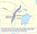
Paleo Lake Obweruka.png 611 × 565; 126 KB
-
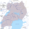
Rivers and lakes of Uganda.png 650 × 660; 88 KB
-
Rivers of North Uganda OSM.png 2,996 × 2,733; 12.57 MB
-
Rivers of South West Uganda.png 2,544 × 2,887; 11.59 MB
-
Uganda Wasserwege.svg 550 × 600; 982 KB
-
Un-uganda.png 2,348 × 2,947; 1.84 MB


