Category:Maps of Somaliland
Jump to navigation
Jump to search
Countries of Africa: Algeria · Angola · Benin · Botswana · Burkina Faso · Burundi · Cameroon · Cape Verde · Central African Republic · Chad · Comoros · Democratic Republic of the Congo · Republic of the Congo · Djibouti · Egypt‡ · Equatorial Guinea · Eritrea · Eswatini · Ethiopia · Gabon · The Gambia · Ghana · Guinea · Guinea-Bissau · Ivory Coast · Kenya · Lesotho · Liberia · Libya · Madagascar · Malawi · Mali · Mauritania · Mauritius · Morocco · Mozambique · Namibia · Niger · Nigeria · Rwanda · São Tomé and Príncipe · Senegal · Seychelles · Sierra Leone · Somalia · South Africa · South Sudan · Sudan · Tanzania · Togo · Tunisia · Uganda · Zambia · Zimbabwe
Limited recognition: Ambazonia · Azawad · Puntland · Sahrawi Arab Democratic Republic · Somaliland – Other areas: Canary Islands · Ceuta · Madeira · Mayotte · Melilla · Réunion · Saint Helena, Ascension and Tristan da Cunha · Scattered Islands in the Indian Ocean · Western Sahara
‡: partly located in Africa
English: Maps of Somaliland.
Wikimedia category | |||||
| Upload media | |||||
| Instance of | |||||
|---|---|---|---|---|---|
| Category combines topics | |||||
| Somaliland | |||||
de facto state in the Horn of Africa | |||||
| Pronunciation audio | |||||
| Instance of | |||||
| Part of | |||||
| Location | East Africa, Africa, Southern Hemisphere | ||||
| Capital | |||||
| Legislative body | |||||
| Executive body | |||||
| Official language | |||||
| Anthem |
| ||||
| Currency | |||||
| Head of state |
| ||||
| Inception |
| ||||
| Highest point |
| ||||
| Population |
| ||||
| Area |
| ||||
| Follows | |||||
| official website | |||||
 | |||||
Subcategories
This category has the following 16 subcategories, out of 16 total.
- Blank maps of Somaliland (3 F)
A
- Maps of Awdal Region (12 F)
E
- Election maps of Somaliland (15 F)
F
H
L
- Location maps of Somaliland (25 F)
M
O
P
S
T
Pages in category "Maps of Somaliland"
The following 2 pages are in this category, out of 2 total.
Media in category "Maps of Somaliland"
The following 88 files are in this category, out of 88 total.
-
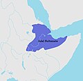
Adal sultanate during the conquest of habesh.jpg 3,507 × 3,420; 819 KB
-
Animin8955.gif 400 × 367; 381 KB
-
Arab, Eidagale and Warsangali in Somaliland.png 825 × 504; 183 KB
-
Awdal2008..png 554 × 939; 133 KB
-
Dhulbahante in Somaliland.png 711 × 400; 128 KB
-
Eidagalle Map.jpg 824 × 504; 310 KB
-
Eidegalla map.jpg 824 × 504; 98 KB
-
Gadabuursi and Habar Jeclo in Somaliland.png 850 × 523; 195 KB
-
Gobolada Somaliland.svg 1,052 × 744; 146 KB
-
GolfvonAdenKartevonDanielPresberger.png 800 × 668; 145 KB
-
Habr Awal in Somaliland.png 837 × 513; 148 KB
-
Habr Yoonis in Somaliland.png 828 × 506; 168 KB
-
Haggenmacher map.png 3,107 × 4,000; 23.3 MB
-
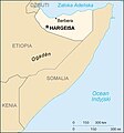
Hargeisa map.jpg 962 × 684; 124 KB
-
Isaaq genocide map.png 2,514 × 3,588; 432 KB
-
Issa in Somaliland.png 780 × 489; 130 KB
-
Karte Somaliland.png 1,489 × 1,046; 423 KB
-
Koppen-Geiger Map Somaliland present.svg 719 × 350; 2.99 MB
-
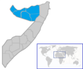
Location somaliland.png 250 × 325; 19 KB
-
Locator map of Somaliland in Africa.svg 863 × 848; 132 KB
-
Maakhirgeo.png 330 × 355; 15 KB
-
Major clan areas in Somaliland and neighboring territories.png 644 × 405; 103 KB
-
Map Caves in Somaliland.jpg 697 × 472; 47 KB
-
Map of showing distribution Arap.jpg 825 × 504; 100 KB
-
Map of somaliland border claims.jpg 590 × 504; 118 KB
-
Map of Somaliland districts.jpg 1,170 × 822; 326 KB
-
Map of Somaliland Protectorate.jpg 1,284 × 904; 145 KB
-
Map of Somaliland.jpg 231 × 336; 34 KB
-
Map of Somaliland.png 849 × 711; 108 KB
-
Map of Somaliland.svg 1,194 × 636; 2.54 MB
-
Map of the Horn of Africa.png 2,001 × 2,590; 532 KB
-
MAP-OF-BLOCK-1.jpg 1,200 × 927; 323 KB
-
Missions in Somaliland.png 1,357 × 628; 19 KB
-
Plan Laas Geel.jpg 180 × 120; 6 KB
-
Plan of Taleh Fort.png 926 × 578; 19 KB
-
Population density of Somaliland regions.png 2,058 × 1,548; 126 KB
-
Primary school net attendance ratio Somaliland.jpg 1,104 × 573; 69 KB
-
Puntland location.png 250 × 264; 47 KB
-
Regions of Soamaliland 1991–2008.jpg 417 × 308; 49 KB
-
Regions of Soamaliland 2014.jpg 1,024 × 581; 238 KB
-
Salahley District.svg 1,052 × 744; 36 KB
-
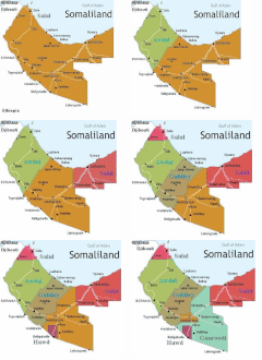
Salal.png 1,600 × 756; 755 KB
-
Secondary school net attendance ratio Somaliland.jpg 1,000 × 577; 68 KB
-
Simplified soil of Somaliland.jpg 259 × 195; 15 KB
-
So-soma-kaart.png 315 × 450; 13 KB
-
Somali clans.jpg 1,019 × 677; 178 KB
-
Somalia (with Somaliland).png 800 × 800; 220 KB
-
Somalia Base Map.png 2,365 × 2,802; 300 KB
-
Somalia Somaliland Locator.png 330 × 355; 14 KB
-
Somalia somaliland.jpg 405 × 432; 28 KB
-
SOMALIE415DS7645424.gif 723 × 681; 23 KB
-
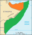
Somaliland CIA map PL.jpg 351 × 377; 41 KB
-
Somaliland Clans map.svg 800 × 504; 81 KB
-
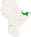
Somaliland in East Africa.svg 771 × 895; 35 KB
-
Somaliland Independence War Map.svg 742 × 251; 685 KB
-
Somaliland location map.png 800 × 504; 54 KB
-
Somaliland map (disputed territory).svg 800 × 504; 189 KB
-
Somaliland map 1.png 512 × 724; 35 KB
-
Somaliland Map 3 represents rock art sites and Himyarite and Sabaean.png 842 × 623; 855 KB
-
Somaliland map de.png 330 × 355; 10 KB
-
Somaliland map of Köppen climate classification.png 800 × 800; 64 KB
-
Somaliland map regions He.jpg 1,048 × 705; 244 KB
-
Somaliland map regions.png 1,006 × 626; 61 KB
-
Somaliland Map.jpg 720 × 410; 62 KB
-
Somaliland map.png 800 × 504; 99 KB
-
Somaliland map.svg 497 × 245; 1.11 MB
-
Somaliland Map.svg 460 × 337; 319 KB
-
Somaliland oil explorations.jpg 408 × 411; 31 KB
-
Somaliland pl.png 762 × 510; 81 KB
-
Somaliland Puntland.png 458 × 265; 12 KB
-
Somaliland relief location map.svg 800 × 504; 8.49 MB
-
Somaliland sat.jpg 1,344 × 768; 182 KB
-
Somaliland Somalia map.png 779 × 640; 32 KB
-
Somaliland-Khaautmo Conflict Map in Sool and Buuhoodle District.svg 565 × 305; 1.72 MB
-
Somaliland-Khatumo-Puntland Dispute.svg 1,052 × 1,340; 170 KB
-
Somaliland-map-en.png 325 × 350; 7 KB
-
Somaliland-map-fr.png 330 × 355; 21 KB
-
Somaliland-Maroodi Jeh Region.svg 1,123 × 770; 3.21 MB
-
Somaliland-Sahil Region.svg 1,123 × 770; 3.21 MB
-
Somaliland-SSC-Puntland Map.png 1,122 × 794; 92 KB
-
Somaliland-Togdheer Region.svg 1,123 × 793; 2.61 MB
-
Somaliland.jpg 1,949 × 1,335; 928 KB
-
Somaliland.png 1,815 × 1,143; 2.6 MB
-
Somaliland–Somalia border.png 2,161 × 2,439; 5.96 MB
-
Somalis Civil War.png 512 × 652; 122 KB
-
Topography of Somaliland.jpg 942 × 674; 86 KB
-
Количество осадков в Сомалиленде..jpg 1,091 × 532; 69 KB
