Category:Maps of Western Sahara
Jump to navigation
Jump to search
Countries of Africa: Algeria · Angola · Benin · Botswana · Burkina Faso · Burundi · Cameroon · Cape Verde · Central African Republic · Chad · Comoros · Democratic Republic of the Congo · Republic of the Congo · Djibouti · Egypt‡ · Equatorial Guinea · Eritrea · Eswatini · Ethiopia · Gabon · The Gambia · Ghana · Guinea · Guinea-Bissau · Ivory Coast · Kenya · Lesotho · Liberia · Libya · Madagascar · Malawi · Mali · Mauritania · Mauritius · Morocco · Mozambique · Namibia · Niger · Nigeria · Rwanda · São Tomé and Príncipe · Senegal · Seychelles · Sierra Leone · Somalia · South Africa · South Sudan · Sudan · Tanzania · Togo · Tunisia · Uganda · Zambia · Zimbabwe
Limited recognition: Ambazonia · Azawad · Puntland · Sahrawi Arab Democratic Republic · Somaliland – Other areas: Canary Islands · Ceuta · Madeira · Mayotte · Melilla · Réunion · Saint Helena, Ascension and Tristan da Cunha · Scattered Islands in the Indian Ocean · Western Sahara
‡: partly located in Africa
Wikimedia category | |||||
| Upload media | |||||
| Instance of | |||||
|---|---|---|---|---|---|
| Category combines topics | |||||
| Western Sahara | |||||
territory in North and West Africa | |||||
| Pronunciation audio | |||||
| Instance of |
| ||||
| Part of | |||||
| Culture | |||||
| Location |
| ||||
| Located in or next to body of water | |||||
| Currency |
| ||||
| Population |
| ||||
| Area |
| ||||
| Elevation above sea level |
| ||||
| Top-level Internet domain | |||||
| Different from | |||||
| Said to be the same as | Southern Provinces | ||||
 | |||||
Subcategories
This category has the following 15 subcategories, out of 15 total.
Pages in category "Maps of Western Sahara"
The following 2 pages are in this category, out of 2 total.
Media in category "Maps of Western Sahara"
The following 137 files are in this category, out of 137 total.
-
000 Saharaja Oksidentale harta.PNG 364 × 390; 4 KB
-
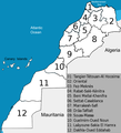
12 régions du Maroc.png 780 × 859; 115 KB
-
2020 coronavirus pandemic in Morocco confirmed.svg 800 × 795; 175 KB
-
3 cartes du-maroc.jpg 1,799 × 736; 95 KB
-
3 maps morocco.PNG 1,799 × 736; 52 KB
-
Acuerdo Tripartito de Madrid.jpg 500 × 500; 28 KB
-
Ahara division-ar.PNG 352 × 382; 108 KB
-
Algeria RASD Locator.PNG 720 × 818; 42 KB
-
Algeria-Mauritania boundary.jpg 4,137 × 3,171; 9.76 MB
-
ALMORÁVIDESJPEG.jpg 546 × 702; 37 KB
-
Asendi kaart Lääne-Sahara.png 386 × 354; 63 KB
-
Chaouia2.png 612 × 599; 8 KB
-
Control of Western Sahara.png 7,200 × 3,318; 1.38 MB
-
Dakhla maps.png 591 × 599; 28 KB
-
Edmund WS.PNG 250 × 115; 10 KB
-
Flag map of Spanish Sahara (1884 - 1976).png 2,000 × 1,636; 425 KB
-
Flags of Morocco and the SADR over Western Sahara map.png 542 × 505; 12 KB
-
Flags of the regions in Western Sahara ar.png 631 × 505; 33 KB
-
Flags of the regions in Western Sahara.png 631 × 505; 21 KB
-
Guelminessemara.png 370 × 372; 25 KB
-
Imouzzer kandar-Morocco map Arabic copy.jpg 290 × 348; 45 KB
-
Karte Westsahara.png 354 × 390; 10 KB
-
Layoune-Semara-Rio doro.PNG 250 × 250; 11 KB
-
Localización de Cuba y Sáhara Occidental.png 1,092 × 644; 29 KB
-
Location Sahrawi Arab Democratic Republic.png 800 × 399; 75 KB
-
Locator EH-MA-MR-DZ.png 300 × 300; 6 KB
-
Map Mauritania Railway.png 692 × 544; 250 KB
-
Map of the 2020 coronavirus pandemic in Morocco.svg 879 × 920; 133 KB
-
Mapa Marruecos y Sáhara Occidental.gif 460 × 517; 30 KB
-
Mapa západní sahary.png 364 × 390; 10 KB
-
Mapas del Sahara Occidental.png 1,469 × 442; 41 KB
-
Maps of Western Sahara according to point of view.png 1,472 × 433; 38 KB
-
Maps of Western Sahara, 5 ways.png 1,834 × 433; 67 KB
-
Maps of Western Sahara.png 1,472 × 433; 98 KB
-
Maroc de facto 2020 map.jpg 377 × 453; 35 KB
-
Maroc sans cadre2.png 407 × 394; 41 KB
-
Maroc-botola.PNG 623 × 612; 42 KB
-
Marokko-regions-nr.png 370 × 372; 30 KB
-
Maroko administativni-deleni.png 371 × 371; 38 KB
-
Maroko+Zapadni-Sahara administativni-deleni.png 371 × 371; 44 KB
-
Martxa Berdea.png 1,200 × 734; 169 KB
-
Meknestafilalet.png 370 × 372; 25 KB
-
Mexico Western Sahara Locator.png 1,260 × 716; 65 KB
-
MINURSO Deployment (April 2014).png 2,278 × 2,779; 973 KB
-
Minurso.png 472 × 603; 96 KB
-
Missions to SADR.png 1,357 × 628; 28 KB
-
Morocco & Sahara.png 538 × 518; 11 KB
-
Morocco & Western Sahara map.jpg 369 × 446; 18 KB
-
Morocco de facto map.jpg 377 × 453; 36 KB
-
Morocco map Ar.JPG 377 × 453; 22 KB
-
Morocco map Arabic.JPG 377 × 453; 16 KB
-
Morocco Western-Sahara location map.jpg 1,024 × 1,120; 57 KB
-
Morocco-with-western-sahara.png 601 × 599; 66 KB
-
Morocco.gif 257 × 257; 21 KB
-
Morocco.med.png 250 × 115; 7 KB
-
Morocco3Protection.png 406 × 388; 30 KB
-
Moroccointheworld.png 550 × 550; 79 KB
-
MoroccoWesternSahara Hydrogeology3.png 895 × 902; 39 KB
-
MoroccoWesternSaharaOMC closer.jpg 465 × 573; 55 KB
-
Oued ed-dahab lagouira.jpg 370 × 372; 25 KB
-
Oued Ed-Dahab Province in Dakhla-Oued Ed-Dahab.svg 1,772 × 1,417; 236 KB
-
Percent of Berber speakers in Morocco by census 2004.png 734 × 684; 39 KB
-
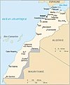
Principales routes du Maroc.jpg 600 × 652; 52 KB
-
ProtectoradoMarruecos-ar.png 406 × 388; 44 KB
-
ProtectoradoMarruecos.png 406 × 388; 44 KB
-
Provinces of Dakhla-Oued Ed-Dahab.svg 1,772 × 1,417; 236 KB
-
Provinces of Guelmim-Oued Noun.svg 1,559 × 1,240; 74 KB
-
Provinces of Laâyoune-Sakia El Hamra.svg 1,772 × 1,240; 156 KB
-
Question dau Sahara Occidentau.png 1,224 × 1,060; 129 KB
-
Regions du Maroc (1).png 374 × 379; 17 KB
-
REGMAROC.jpg 707 × 709; 38 KB
-
Reguibat-Localisation.png 1,275 × 1,354; 212 KB
-
Rio de Oro Location.png 266 × 226; 8 KB
-
Rio do Ouro - Localition.png 254 × 271; 43 KB
-
Région de Guelmim-Wadnoun.png 3,183 × 3,343; 444 KB
-
République-Sahraouie-Démocratique-02.png 795 × 636; 695 KB
-
SADR location.png 350 × 241; 25 KB
-
Saguia el-Hamra Location.png 266 × 226; 8 KB
-
Sahara division-ar.jpg 358 × 385; 24 KB
-
Sahara division.JPG 358 × 385; 14 KB
-
Sahara division.PNG 353 × 379; 109 KB
-
Sahara occidental CIA WFB.png 358 × 386; 8 KB
-
Sahara Occidental.png 250 × 115; 14 KB
-
Sahara political.png 301 × 177; 4 KB
-
SaharaOccidental1976-1979.PNG 487 × 401; 17 KB
-
SaharaOccidentalDivision.jpg 1,153 × 1,111; 271 KB
-
Sahrawi-Morrocan Dispute Map.png 3,334 × 2,438; 187 KB
-
Seguia el Hamra political blank.png 1,728 × 840; 88 KB
-
Sidi Ifni Province in Guelmim-Oued Noun.svg 1,559 × 1,240; 74 KB
-
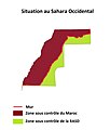
Situation au Sahara Occidental.jpg 1,240 × 1,462; 269 KB
-
Tagzen Carte du Maroc.jpg 612 × 599; 23 KB
-
Tan-Tan Province in Guelmim-Oued Noun.svg 1,559 × 1,240; 74 KB
-
Tarfaya Province in Laâyoune-Sakia El Hamra.svg 1,772 × 1,240; 156 KB
-
Tazaelhoceimataounate.png 370 × 372; 25 KB
-
Tekna Col.PNG 854 × 696; 27 KB
-
Tekna-ar (Morocco with WS).png 736 × 600; 50 KB
-
Tekna-ar.PNG 736 × 600; 49 KB
-
Tekna.PNG 854 × 696; 26 KB
-
Tiris al-Gharbiyya Location-en.png 274 × 366; 17 KB
-
Tiris al-Gharbiyya Location.png 274 × 344; 10 KB
-
Topology Map of Wester Sahara.jpg 324 × 306; 49 KB
-
UN map MINURSO Deployment-feb-2009.jpg 3,894 × 5,010; 1.66 MB
-
W Sahara Map.png 685 × 528; 18 KB
-
Wes-Saharakaart.png 485 × 520; 32 KB
-
Western Sahara - DPLA - 412fbf2941a9be17eea7ba22804e76c9.jpg 2,544 × 3,276; 4.98 MB
-
Western Sahara - DPLA - aa9a1ca913e8c2bc06460b0d73a87146.jpg 2,554 × 3,272; 5.1 MB
-
Western Sahara 2.png 574 × 1,100; 216 KB
-
Western Sahara CIA map PL.png 364 × 390; 8 KB
-
Western Sahara disputed w1 countrymap.svg 1,000 × 1,000; 8 KB
-
Western Sahara Locator.png 1,403 × 1,261; 22 KB
-
Western Sahara map 2012.JPG 727 × 906; 97 KB
-
Western sahara map showing morocco and polisaro.gif 626 × 562; 21 KB
-
Western Sahara Map.png 685 × 528; 12 KB
-
Western Sahara OCHA.png 1,000 × 999; 99 KB
-
Western Sahara relief location map.jpg 1,472 × 1,304; 232 KB
-
Western Sahara sat.png 1,014 × 829; 630 KB
-
Western Sahara Topography.png 1,318 × 1,183; 1.05 MB
-
Western sahara walls moroccan oc.gif 904 × 727; 38 KB
-
Western sahara walls moroccan.png 904 × 727; 26 KB
-
Western Sahara-CIA WFB Map (2004).png 364 × 390; 8 KB
-
Western Sahara-CIA WFB Map.png 329 × 353; 13 KB
-
Western Sahara.png 1,400 × 928; 217 KB
-
Western-sahara-map (fr).png 2,401 × 2,871; 1.05 MB
-
Western-sahara-map.png 2,401 × 2,871; 1.01 MB
-
Westernsaharamap-ar.png 600 × 584; 204 KB
-
Westernsaharamap.png 600 × 584; 256 KB
-
Westernsaharamapunlabeled.png 1,009 × 1,004; 157 KB
-
Wi-map-es.png 364 × 390; 7 KB
-
Wi-map-rus.png 364 × 390; 25 KB
-
Wi-map.png 358 × 386; 8 KB
-
WS Communes.png 1,500 × 1,126; 238 KB
-
WS icon map.png 100 × 82; 1 KB
-
Рельеф Западной Сахары.png 1,550 × 1,044; 1.65 MB
-
توزيع المجموعات القبلية في الصحراء الغربية.jpg 361 × 498; 79 KB
-
خريطة الحدود المغربية داخل الصحراء الغربية.png 200 × 177; 7 KB


