Category:Geological maps of Morocco
Jump to navigation
Jump to search
Countries of Africa: Algeria · Botswana · Cameroon · Cape Verde · Chad · Democratic Republic of the Congo · Djibouti · Egypt‡ · Eritrea · Ethiopia · Guinea · Madagascar · Mali · Mauritania · Mauritius · Morocco · Namibia · Niger · Nigeria · Rwanda · Senegal · Somalia · South Africa · South Sudan · Sudan · Tanzania · Tunisia
Other areas: Canary Islands · Mayotte · Réunion
‡: partly located in Africa
Other areas: Canary Islands · Mayotte · Réunion
‡: partly located in Africa
Subcategories
This category has the following 2 subcategories, out of 2 total.
Media in category "Geological maps of Morocco"
The following 18 files are in this category, out of 18 total.
-
Bloc diagramme Lias Haut Atlas.jpg 678 × 562; 102 KB
-
Bulletin de la Société géologique de France (1905) (19814871394).jpg 3,120 × 2,150; 1.42 MB
-
Carte géologique Algérie.jpg 2,143 × 2,908; 1.82 MB
-
Essaouira Agadir Basin.jpg 2,370 × 1,971; 988 KB
-
Geological map Central Morocco - Herbig 1991.png 3,899 × 2,513; 236 KB
-
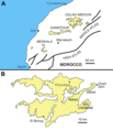
Grand Daoui - Gheerbrant et al 2003.png 3,870 × 2,016; 73 KB
-
Iberian Tectonic EN.svg 382 × 485; 695 KB
-
Jbel Bou Dahar early Mesozoic map.jpg 2,162 × 1,241; 670 KB
-
Jbel Bou Dahar sequences.png 1,348 × 852; 957 KB
-
Meseta-01.png 2,775 × 1,972; 275 KB
-
Ocepechelon bouyai geography stratigraphy.png 4,528 × 3,008; 4.19 MB
-
Oil shale in Morocco.png 844 × 871; 92 KB
-
Oulad Abdoun Basin (borderless).png 2,492 × 2,889; 1.46 MB
-
Oulad Abdoun Basin.png 2,600 × 2,990; 1.58 MB
-
Ouled Abdoun basin Yans et al 2014.png 3,380 × 2,483; 162 KB
-
Ouled-Abdoun - Bardet et al 2013 german.png 2,600 × 2,990; 1.04 MB
-
Palaeogeographic models Phosphate basins Morocco - Herbig 1991.png 5,573 × 4,761; 370 KB
-
Tectonic map Mediterranean EN.svg 1,280 × 715; 623 KB


