Category:Locator maps of Eritrea
Jump to navigation
Jump to search
Subcategories
This category has the following 2 subcategories, out of 2 total.
!
B
- Bilateral maps of Eritrea (40 F)
Media in category "Locator maps of Eritrea"
The following 25 files are in this category, out of 25 total.
-
2011 Eritrean Protests.png 385 × 238; 11 KB
-
Eritrea - Location Map (2013) - ERI - UNOCHA.svg 254 × 254; 262 KB
-
Eritrea Anseba.png 462 × 409; 6 KB
-
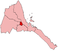
Eritrea Central.png 462 × 409; 6 KB
-
Eritrea Egypt Locator.jpg 394 × 393; 44 KB
-
Eritrea Gash-Barka.png 462 × 409; 6 KB
-
Eritrea NorthernRedSea.png 462 × 409; 6 KB
-
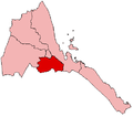
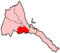
Eritrea Southern.png 462 × 409; 6 KB
-
Eritrea SouthernRedSea.png 462 × 409; 6 KB
-
Eritrea, administrative divisions - sv - monochrome.png 1,844 × 1,514; 320 KB
-
Eritrea-Anseba.png 200 × 176; 3 KB
-
Eritrea-Debub.png 200 × 176; 4 KB
-
Eritrea-Debubawi Keyih Bahri.png 200 × 176; 3 KB
-
Eritrea-Gash Barka.png 200 × 176; 3 KB
-
Eritrea-Maekel.png 200 × 176; 4 KB
-
Eritrea-Semenawi Keyih Bahri.png 200 × 176; 3 KB
-
Location of ambeta.PNG 301 × 149; 14 KB
-
LocationEritrea.png 250 × 115; 7 KB
-
LocationEritrea.svg 1,000 × 500; 2.69 MB
-
Map of Eritrea highlighting Anseba Region.svg 462 × 409; 46 KB
-
Map of Eritrea highlighting Central Region.svg 462 × 409; 46 KB
-
Map of Eritrea highlighting Gash-Barka Region.svg 462 × 409; 46 KB
-
Map of Eritrea highlighting Northern Red Sea Region.svg 462 × 409; 46 KB
-
Map of Eritrea highlighting Southern Red Sea Region.svg 462 × 409; 46 KB
-
Map of Eritrea highlighting Southern Region.svg 462 × 409; 46 KB


