Category:Maps of Calabria
Jump to navigation
Jump to search
- Regions of Italy: Abruzzo · Aosta Valley · Apulia · Basilicata · Calabria · Campania · Emilia-Romagna · Friuli-Venezia Giulia · Lazio · Liguria · Lombardy · Marche · Molise · Piedmont · Sardinia · Sicily · Trentino-South Tyrol · Tuscany · Umbria · Veneto
Wikimedia category | |||||
| Upload media | |||||
| Instance of | |||||
|---|---|---|---|---|---|
| Category combines topics | |||||
| Calabria | |||||
region of Italy | |||||
| Instance of | |||||
| Part of |
| ||||
| Patron saint | |||||
| Location | Italy | ||||
| Capital | |||||
| Legislative body |
| ||||
| Executive body |
| ||||
| Head of government |
| ||||
| Population |
| ||||
| Area |
| ||||
| official website | |||||
 | |||||
Use the appropriate category for maps showing all or a large part of Calabria. See subcategories for smaller areas:
| If the map shows | Category to use |
|---|---|
| Calabria on a recently created map | Category:Maps of Calabria or its subcategories |
| Calabria on a map created more than 70 years ago | Category:Old maps of Calabria or its subcategories |
| the history of Calabria on a recently created map | Category:Maps of the history of Calabria or its subcategories |
| the history of Calabria on a map created more than 70 years ago | Category:Old maps of the history of Calabria or its subcategories |
Subcategories
This category has the following 18 subcategories, out of 18 total.
Media in category "Maps of Calabria"
The following 90 files are in this category, out of 90 total.
-
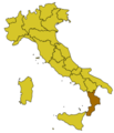
CAL-Mappa.png 300 × 350; 9 KB
-
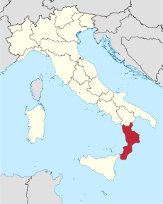
Italy Regions Calabria Map.png 220 × 257; 18 KB
-
ItalyCalabria.png 269 × 314; 9 KB
-
Regione-Calabria-Posizione.png 204 × 238; 6 KB
-
'ndrangheta a Reggio Calabria e dintorni (2017).jpg 916 × 826; 136 KB
-
'ndrangheta in provincia di Catanzaro 2018.jpg 889 × 682; 118 KB
-
'ndrangheta in Provincia di Cosenza (2017).jpg 825 × 774; 112 KB
-
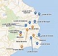
'ndrangheta in Provincia di Crotone (2018).jpg 761 × 730; 96 KB
-
'ndrangheta nel mandamento ionico 2018.jpg 906 × 672; 114 KB
-
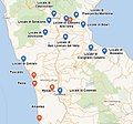
'ndrangheta nella piana di Gioia Tauro.jpg 919 × 736; 137 KB
-
388 of 'L'Italia geografica illustrata, etc' (11210582974).jpg 2,241 × 3,307; 2.49 MB
-
Anachronistic map of Mercurion and Latinion.png 2,500 × 1,377; 633 KB
-
Area metropolitana integrata dello stretto.jpg 480 × 228; 109 KB
-
Aree urbanizzate con continuità territoriale in calabria e nello stretto.jpg 1,812 × 1,090; 263 KB
-
Asl Calabria 2007.png 979 × 1,303; 65 KB
-
ASP Reggio Calabria.png 642 × 559; 41 KB
-
Aziende Sanitarie Calabria.png 954 × 1,489; 108 KB
-
Bruttium outline.jpg 200 × 300; 54 KB
-
Bruttium-be.png 560 × 600; 34 KB
-
Calabria in Italy.svg 1,034 × 1,299; 1.67 MB
-
Calalt.svg 700 × 700; 33 KB
-
Castrovillari pos IT.png 300 × 350; 10 KB
-
Catanzaro in Italy.svg 1,034 × 1,299; 3 MB
-
Catanzaro map.png 708 × 700; 227 KB
-
Catanzaro posizione.png 350 × 424; 11 KB
-
CentralMediterranean-GeotectonicMap.jpg 9,451 × 6,203; 20.29 MB
-
Circoscrizione Calabria (Camera dei Deputati).png 1,632 × 2,112; 122 KB
-
Città più importanti della Calabria.jpg 1,600 × 1,795; 863 KB
-
Comunità Montana Alto Ionio.png 299 × 320; 9 KB
-
Confini della Calabria-var.png 454 × 605; 224 KB
-
Cosenza in Italy.svg 1,034 × 1,299; 1.89 MB
-
Cosenza posizione.png 350 × 424; 13 KB
-
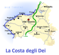
Costa degli dei 2.png 684 × 637; 217 KB
-
Costa degli dei x wikipedia.png 684 × 637; 216 KB
-
Costagels.png 700 × 662; 178 KB
-
Costiera cilentana.svg 2,900 × 2,050; 2.59 MB
-
Crotone in Italy.svg 1,034 × 1,299; 3 MB
-
Crotone mappa.png 750 × 750; 265 KB
-
Crotone posizione.png 350 × 424; 11 KB
-
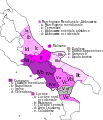
Dialetti italiani meridionali estremi 2.svg 1,150 × 1,227; 221 KB
-
Dialetti italiani meridionali estremi.jpg 510 × 362; 89 KB
-
Dialetti italiani meridionali estremi.svg 612 × 609; 530 KB
-
Distribuzione demografica e sfruttamento del territorio in calabria.jpg 563 × 1,000; 371 KB
-
Flag map of Calabria.svg 1,126 × 2,047; 38 KB
-
Idioma calabrés.png 275 × 228; 5 KB
-
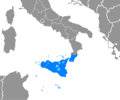
Idioma siciliano.PNG 275 × 229; 5 KB
-
III - LUCANIA - BRUTII.svg 501 × 709; 781 KB
-
Kaart Italie Catanzaro.png 329 × 353; 19 KB
-
Locali di 'ndrangheta in Provincia di Catanzaro.jpg 802 × 596; 83 KB
-
Locali di ndrangheta della Calabria con nomi 2015 v2.png 954 × 1,489; 54 KB
-
Locali di ndrangheta della Calabria con nomi 2015.png 954 × 1,489; 49 KB
-
Locali di ndrangheta della Calabria con nomi 2016.png 954 × 1,489; 48 KB
-
Magna Grecia 280aC.jpg 400 × 613; 233 KB
-
Map Calabria 1930 - Touring Club Italiano CART-TRC-03.jpg 4,612 × 6,254; 3.86 MB
-
Map Cultural heritage and environment V 1992 - Touring Club Italiano CART-TEM-116.jpg 5,000 × 3,452; 11.12 MB
-
Map of Calabria, Italy, and provinces-scn.svg 1,294 × 2,082; 127 KB
-
Map of region of Calabria, Italy, with provinces-el.svg 1,294 × 2,082; 127 KB
-
Map of region of Calabria, Italy, with provinces-fr.svg 1,294 × 2,082; 126 KB
-
Map of region of Calabria, Italy, with provinces-it.svg 1,294 × 2,082; 126 KB
-
Map of region of Calabria, Italy.svg 288 × 522; 91 KB
-
Mappa comune Rende.gif 410 × 408; 28 KB
-
Mappa Comuni della Calabria.PNG 954 × 1,489; 43 KB
-
Mappa comuni della Calabria.PNG 954 × 1,489; 44 KB
-
Mappa dei comuni della Piana di Palmi.jpg 4,000 × 4,496; 1,023 KB
-
Mappa strade principali in Calabria.png 611 × 985; 150 KB
-
Mappa terremoto 1908.jpg 1,415 × 1,149; 400 KB
-
Mgngrc1-scn.svg 440 × 414; 127 KB
-
Neapolitan language.jpg 441 × 514; 132 KB
-
Neapolitan languages-it.svg 441 × 514; 180 KB
-
Neapolitan languages.svg 441 × 514; 60 KB
-
Ordinary statute regions of Italy.svg 735 × 867; 74 KB
-
Ospedali della Calabria.png 926 × 1,154; 82 KB
-
Pianure della Calabria.jpg 4,000 × 4,424; 1.7 MB
-
PlanimetriaBaronale wiki.jpg 609 × 467; 69 KB
-
Reggio calabria mappa urbana metropolitana.jpg 700 × 610; 135 KB
-
Reggio Calabria posizione.png 350 × 424; 11 KB
-
Reggio di Calabria in Italy.svg 1,034 × 1,299; 3 MB
-
Reggiocalabria mappa Posizione Cittanova.png 700 × 662; 196 KB
-
Reggiocalabria mappa.png 700 × 662; 266 KB
-
Regione thumb Calabria.svg 146 × 263; 147 KB
-
Topographic map of Rende.jpg 410 × 408; 76 KB
-
Sila Calabria.jpg 679 × 963; 398 KB
-
Sparviere.jpg 538 × 721; 54 KB
-
Storia di Acri2.jpg 2,665 × 1,856; 2.48 MB
-
Vibo Valentia in Italy.svg 1,034 × 1,299; 3 MB
-
Vibo Valentia posizione.png 350 × 424; 11 KB
-
Vibovalentia mappa.png 700 × 533; 207 KB
-
Vibovalentia posizione.png 350 × 424; 13 KB
-
Бруттий рез.PNG 560 × 600; 14 KB

