Category:Maps of Sardinia
Jump to navigation
Jump to search
- Regions of Italy: Abruzzo · Aosta Valley · Apulia · Basilicata · Calabria · Campania · Emilia-Romagna · Friuli-Venezia Giulia · Lazio · Liguria · Lombardy · Marche · Molise · Piedmont · Sardinia · Sicily · Trentino-South Tyrol · Tuscany · Umbria · Veneto
Wikimedia category | |||||
| Upload media | |||||
| Instance of | |||||
|---|---|---|---|---|---|
| Category combines topics | |||||
| Sardinia | |||||
autonomous region of Italy | |||||
| Instance of |
| ||||
| Part of |
| ||||
| Location |
| ||||
| Located in or next to body of water | |||||
| Capital | |||||
| Legislative body |
| ||||
| Executive body |
| ||||
| Official language | |||||
| Anthem | |||||
| Head of government |
| ||||
| Population |
| ||||
| Area |
| ||||
| Elevation above sea level |
| ||||
| Different from | |||||
| official website | |||||
 | |||||
Use the appropriate category for maps showing all or a large part of Sardinia. See subcategories for smaller areas:
| If the map shows | Category to use |
|---|---|
| Sardinia on a recently created map | Category:Maps of Sardinia or its subcategories |
| Sardinia on a map created more than 70 years ago | Category:Old maps of Sardinia or its subcategories |
| the history of Sardinia on a recently created map | Category:Maps of the history of Sardinia or its subcategories |
| the history of Sardinia on a map created more than 70 years ago | Category:Old maps of the history of Sardinia or its subcategories |
Subcategories
This category has the following 23 subcategories, out of 23 total.
- Satellite pictures of Sardinia (290 F)
+
- Topographic maps of Sardinia (21 F)
A
- Maps of Aggius (2 F)
C
D
E
G
H
I
L
- Linguistic maps of Sardinia (12 F)
M
P
R
S
- Maps of Sardinian subregions (33 F)
Pages in category "Maps of Sardinia"
This category contains only the following page.
Media in category "Maps of Sardinia"
The following 83 files are in this category, out of 83 total.
-
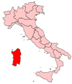
Italy Regions Sardinia Map.png 220 × 257; 18 KB
-
ItalySardinia.png 269 × 314; 9 KB
-
Regione-Sardegna-Posizione.png 200 × 233; 28 KB
-
SAR-Mappa.png 300 × 350; 8 KB
-
Admiralty Chart No 3609 Plans in Sardinia, Published 1972.jpg 11,252 × 16,358; 27.6 MB
-
Admiralty Chart No 3915 Ports in South-West Sardinia, Published 1965.jpg 8,265 × 11,287; 22.57 MB
-
Anglona.png 1,100 × 1,422; 172 KB
-
Autonomous Regions of Italy.jpg 566 × 494; 25 KB
-
Autonomous Regions of Italy.svg 735 × 867; 118 KB
-
Bandiere blu.PNG 1,080 × 1,237; 1.1 MB
-
Barbagia Di Belvì.png 1,100 × 1,422; 172 KB
-
Barbagia Di Nuoro.png 1,100 × 1,422; 172 KB
-
Barbagia Di Ollolai.png 1,100 × 1,422; 172 KB
-
Barbagia Di Seulo.png 1,100 × 1,422; 172 KB
-
Barigadu.png 1,100 × 1,422; 172 KB
-
Baronie.png 1,100 × 1,422; 172 KB
-
Cagliari in Italy (2001–2016).svg 1,034 × 1,299; 3 MB
-
Cagliari in Italy (as of 2016).svg 1,034 × 1,299; 1.87 MB
-
Campdano Di Cagliari.png 1,100 × 1,422; 172 KB
-
Campidano Di Oristano.png 1,100 × 1,422; 172 KB
-
Campidano Di Oristano2.png 1,100 × 1,422; 172 KB
-
Campidano Di Sanluri.png 1,100 × 1,422; 172 KB
-
Carbonia-Iglesias in Italy (2001–2016).svg 1,034 × 1,299; 3 MB
-
Carta di distribuzione dei siti della facies Corona Moltana di Bonnanaro.jpg 2,481 × 3,108; 1.59 MB
-
Carta di distribuzione dei siti di facies Sant’Iroxi.jpg 2,481 × 3,108; 1.1 MB
-
Carta linee e fermate OLBIA GENNAIO 2014.jpg 9,870 × 13,903; 6.4 MB
-
Carta Sardegna nord-est epoca romana.png 789 × 1,116; 343 KB
-
Cartina italia.png 738 × 900; 315 KB
-
Circoscrizione Sardegna (Camera dei Deputati).png 1,632 × 2,112; 122 KB
-
Città della Sardegna.jpg 500 × 700; 157 KB
-
Corse and Sardegna.png 720 × 1,600; 129 KB
-
CostaVerdeMap.PNG 1,030 × 877; 63 KB
-
Dual carriageways in Sardinia.svg 601 × 1,078; 286 KB
-
E.U-Sardinia.png 3,304 × 2,748; 1.23 MB
-
ECDM 20131119 Italy SevereWeather.pdf 1,625 × 1,125; 652 KB
-
Europe location Sardinia.png 1,245 × 1,245; 49 KB
-
Flag of the Istrangios Sardinia.png 1,280 × 853; 28 KB
-
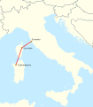
GALSI.svg 924 × 1,308; 1.27 MB
-
HVDC Map SACOI.svg 958 × 1,095; 783 KB
-
It-map-sardinie.jpg 323 × 347; 30 KB
-
Kaart Italie Oristano.png 329 × 353; 19 KB
-
Kaart Italie Porto Foxi.png 329 × 353; 19 KB
-
Kaart Italie Porto Torres.png 329 × 353; 19 KB
-
MANDROLISAI.jpg 2,357 × 3,400; 5.52 MB
-
Map Cultural heritage and environment VI 1992 - Touring Club Italiano CART-TEM-117.jpg 5,000 × 3,447; 11.45 MB
-
Mappa bixinausu (vicinati-quartieri) Masullas.jpg 1,264 × 937; 86 KB
-
Mappa Complesso Archeologico Di Taccu 'e Ticci.webp 899 × 496; 13 KB
-
Mappa del Campaniforme Sardo.jpg 2,481 × 3,108; 1.5 MB
-
Mappa regioni con movimenti indipendentisti.png 480 × 600; 75 KB
-
Mappa sardegna.JPG 545 × 942; 93 KB
-
Medio Campidano in Italy (2001–2016).svg 1,034 × 1,299; 3 MB
-
Nuoro in Italy (2001–2016).svg 1,034 × 1,299; 3 MB
-
Nuoro in Italy (as of 2016).svg 1,034 × 1,299; 1.87 MB
-
Ogliastra in Italy (2001–2016).svg 1,034 × 1,299; 3 MB
-
Olbia cropped from Admiralty Chart No 3609 Plans in Sardinia, Published 1972.jpg 10,488 × 6,984; 11.4 MB
-
Olbia-Tempio in Italy (2001–2016).svg 1,034 × 1,299; 3 MB
-
Organizzazione territoriale del SSR della Sardegna (2017).png 1,024 × 1,971; 280 KB
-
Oristano in Italy (2001–2016).svg 1,034 × 1,299; 3 MB
-
Oristano in Italy (as of 2016).svg 1,034 × 1,299; 1.87 MB
-
Principali fazioni ultras in Sardegna.png 661 × 1,219; 153 KB
-
Regione eclèsiastica de Sardigna.jpg 675 × 1,229; 104 KB
-
Regione thumb Sardegna.svg 156 × 286; 302 KB
-
Rete metropolitana del Nord Sardegna - location map.svg 1,000 × 1,879; 7.4 MB
-
Riu Mannu PT.svg 2,286 × 4,403; 85 KB
-
Sant'Antoni.jpg 552 × 543; 82 KB
-
Sant'Antoni2.jpg 573 × 616; 84 KB
-
Sardegna verdeTD.jpg 652 × 1,181; 233 KB
-
Sardinia Corsica Elba Alternative Blank Map.png 720 × 1,600; 387 KB
-
Sardinia Corsica Elba Blank Map Nameless.png 720 × 1,600; 96 KB
-
Sardinia Corsica Elba Blank Map.png 720 × 1,600; 103 KB
-
Sardinia in Italy.svg 1,034 × 1,299; 1.67 MB
-
Sardinia in its region.svg 396 × 223; 4.21 MB
-
Sardinia, Corsica, Elba Alternative Blank Map Nameless.png 720 × 1,600; 379 KB
-
Sardinian States.jpg 3,914 × 3,062; 9.9 MB
-
Sardinien Karte 206x356.png 206 × 356; 67 KB
-
Sassari in Italy (2001–2016).svg 1,034 × 1,299; 3 MB
-
Sassari in Italy (as of 2016).svg 1,034 × 1,299; 1.87 MB
-
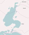
Stagno di Cabras.PNG 315 × 379; 16 KB
-
Tracciato strada statale 131 Carlo Felice.svg 601 × 1,078; 277 KB
-
Tracciato strada statale 131 Diramazione Centrale Nuorese.svg 601 × 1,078; 504 KB
-
Eisenbahn und Verkehrs atlas von Europa 1910 (136549268).jpg 5,152 × 8,444; 30.58 MB


