Category:Maps of Tuscany
Jump to navigation
Jump to search
- Regions of Italy: Abruzzo · Aosta Valley · Apulia · Basilicata · Calabria · Campania · Emilia-Romagna · Friuli-Venezia Giulia · Lazio · Liguria · Lombardy · Marche · Molise · Piedmont · Sardinia · Sicily · Trentino-South Tyrol · Tuscany · Umbria · Veneto
Wikimedia category | |||||
| Upload media | |||||
| Instance of | |||||
|---|---|---|---|---|---|
| Category combines topics | |||||
| Tuscany | |||||
region in central Italy | |||||
| Instance of | |||||
| Location | Italy | ||||
| Capital | |||||
| Legislative body |
| ||||
| Executive body | |||||
| Head of government |
| ||||
| Has part(s) |
| ||||
| Population |
| ||||
| Area |
| ||||
| Elevation above sea level |
| ||||
| official website | |||||
 | |||||
Use the appropriate category for maps showing all or a large part of Tuscany. See subcategories for smaller areas:
| If the map shows | Category to use |
|---|---|
| Tuscany on a recently created map | Category:Maps of Tuscany or its subcategories |
| Tuscany on a map created more than 70 years ago | Category:Old maps of Tuscany or its subcategories |
| the history of Tuscany on a recently created map | Category:Maps of the history of Tuscany or its subcategories |
| the history of Tuscany on a map created more than 70 years ago | Category:Old maps of the history of Tuscany or its subcategories |
Subcategories
This category has the following 21 subcategories, out of 21 total.
A
C
- Climate maps of Tuscany (13 F)
E
G
H
L
- Location maps of Tuscany (5 F)
M
O
P
R
S
T
W
- Wine maps of Tuscany (3 F)
Media in category "Maps of Tuscany"
The following 54 files are in this category, out of 54 total.
-
Circoscrizione Toscana (Camera dei Deputati).png 1,632 × 2,112; 122 KB
-
Italy Regions Tuscany Map.png 220 × 257; 18 KB
-
ItalyTuscany.png 269 × 313; 9 KB
-
Regione-Toscana-Posizione.png 199 × 232; 22 KB
-
TOS-Mappa.png 300 × 349; 10 KB
-
Tuscany in Italy.svg 1,034 × 1,299; 1.67 MB
-
Map of region of Tuscany, Italy.svg 3,624 × 4,010; 185 KB
-
Regione thumb Toscana.svg 241 × 270; 326 KB
-
Tuscany Blank.png 378 × 402; 4 KB
-
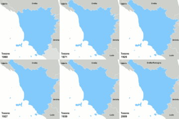
Tuscany boundary changes.gif 480 × 480; 109 KB
-
Grondplan piazza pioII.jpg 619 × 562; 78 KB
-
345 Piazza di Pienza.jpg 400 × 314; 30 KB
-
Stazioni meteo AM-ENAV Toscana.PNG 378 × 402; 10 KB
-
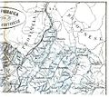
Carta topografica Montagna pistoiese2.jpg 563 × 500; 240 KB
-
Cartina della Toscana alla fine del tredicesimo secolo.jpg 2,688 × 3,528; 1.88 MB
-
Castelfalfi in Italien.jpg 261 × 331; 138 KB
-
Cattura.JPG 641 × 537; 49 KB
-
Estimated location of fictional city-state of Caprona.jpg 989 × 757; 357 KB
-
Galleria dell'Appennino.jpg 702 × 1,349; 530 KB
-
Giardino SottoVico Mappa.jpg 664 × 468; 541 KB
-
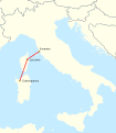
HVDC Map SACOI.svg 958 × 1,095; 783 KB
-
Kaart Italie Livorno.png 329 × 353; 19 KB
-
Livorno dot.png 1,805 × 2,243; 310 KB
-
LocationLimaRiver.png 500 × 369; 392 KB
-
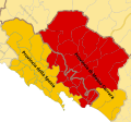
Lunigiana (1).svg 860 × 800; 336 KB
-
Map Cultural heritage and environment III 1992 - Touring Club Italiano CART-TEM-114.jpg 5,000 × 3,433; 12.14 MB
-
Map of Montefeltro.svg 1,680 × 1,520; 97 KB
-
Map of Pisa, Italy 4 - DPLA - add19153e3af8e8e06366cd39172ade2.jpg 4,830 × 7,518; 6.48 MB
-
Map profile of Tuscany.svg 534 × 590; 1.89 MB
-
Marciana Marina (12).JPG 2,592 × 1,944; 1.52 MB
-
Marciana Marina (15).JPG 2,592 × 1,944; 1.46 MB
-
Medici Villas Location-de.svg 1,003 × 715; 112 KB
-
Medici Villas Location-en.svg 1,003 × 715; 109 KB
-
Medici Villas Location-fr.svg 1,003 × 715; 109 KB
-
Medici Villas Location-it.svg 1,003 × 715; 110 KB
-
Medici Villas Location-tag.svg 1,003 × 715; 100 KB
-
Migliarino-SRossore-Massaciuccoli.svg 208 × 240; 165 KB
-
Monte Argentario.PNG 582 × 399; 14 KB
-
Monte Loggio - Regione Toscana - SITA Cartoteca 2.jpg 4,959 × 3,509; 504 KB
-
Monte Loggio - Regione Toscana - SITA Cartoteca 5.jpg 4,959 × 3,509; 851 KB
-
Montecatini.jpg 300 × 349; 73 KB
-
Ordinary statute regions of Italy.svg 735 × 867; 74 KB
-
Parco-Foreste Casentinesi-Posizione.png 269 × 313; 36 KB
-
Plan d'accès tombe archer Montefiridolfi.jpg 235 × 294; 8 KB
-
Regione Toscana - SITA Cartoteca Ufficiale - Badia Tedalda-1.jpg 4,888 × 2,864; 1.5 MB
-
Regione Toscana - SITA Cartoteca Ufficiale - Badia Tedalda-2.jpg 4,944 × 2,944; 1.5 MB
-
Regione Toscana - SITA Cartoteca Ufficiale - Badia Tedalda-3.jpg 3,056 × 1,852; 756 KB
-
Regione Toscana - SITA Cartoteca Ufficiale - Badia Tedalda-4.jpg 4,920 × 2,800; 759 KB
-
RSCN0449.jpg 2,711 × 2,745; 1.99 MB
-
RSCN0786.jpg 4,180 × 2,584; 2.39 MB
-
Subregioni della Toscana.svg 2,807 × 3,006; 3.52 MB
-
볼테라.png 250 × 267; 32 KB


