Category:Maps of Emilia-Romagna
Jump to navigation
Jump to search
- Regions of Italy: Abruzzo · Aosta Valley · Apulia · Basilicata · Calabria · Campania · Emilia-Romagna · Friuli-Venezia Giulia · Lazio · Liguria · Lombardy · Marche · Molise · Piedmont · Sardinia · Sicily · Trentino-South Tyrol · Tuscany · Umbria · Veneto
Wikimedia category | |||||
| Upload media | |||||
| Instance of | |||||
|---|---|---|---|---|---|
| Category combines topics | |||||
| Emilia-Romagna | |||||
region in Italy | |||||
| Instance of | |||||
| Named after | |||||
| Patron saint | |||||
| Location | Italy | ||||
| Located in or next to body of water | |||||
| Capital | |||||
| Legislative body |
| ||||
| Executive body |
| ||||
| Head of government |
| ||||
| Population |
| ||||
| Area |
| ||||
| Elevation above sea level |
| ||||
| official website | |||||
 | |||||
Use the appropriate category for maps showing all or a large part of Emilia-Romagna. See subcategories for smaller areas:
| If the map shows | Category to use |
|---|---|
| Emilia-Romagna on a recently created map | Category:Maps of Emilia-Romagna or its subcategories |
| Emilia-Romagna on a map created more than 70 years ago | Category:Old maps of Emilia-Romagna or its subcategories |
| the history of Emilia-Romagna on a recently created map | Category:Maps of the history of Emilia-Romagna or its subcategories |
| the history of Emilia-Romagna on a map created more than 70 years ago | Category:Old maps of the history of Emilia-Romagna or its subcategories |
Subcategories
This category has the following 18 subcategories, out of 18 total.
Media in category "Maps of Emilia-Romagna"
The following 65 files are in this category, out of 65 total.
-
EMR-Mappa.png 300 × 350; 9 KB
-
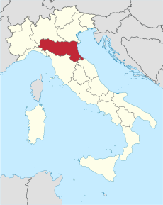
Italy Regions Emilia-Romagna Map.png 220 × 257; 18 KB
-
ItalyEmilia-Romagna.png 269 × 314; 9 KB
-
Mappa regione emilia romagna.jpg 6,927 × 3,736; 6.38 MB
-
Regione-Emilia-Romagna-Posizione.png 200 × 233; 22 KB
-
'ndrangheta In Emilia Romagna 2017.jpg 1,256 × 649; 158 KB
-
Asdea.jpg 1,034 × 779; 185 KB
-
Bologna posizione.png 350 × 424; 11 KB
-
Bologna-pos.png 229 × 290; 17 KB
-
Bosconure OpenStreetMap.png 390 × 428; 60 KB
-
Circoscrizione Emilia-Romagna (Camera dei Deputati).png 1,632 × 2,112; 122 KB
-
Civici Emilia Romagna.jpg 1,419 × 860; 238 KB
-
Dialetto Piacentino.svg 744 × 1,052; 237 KB
-
Dialetto piacentino.svg 744 × 1,052; 242 KB
-
Emilia - territori.jpg 785 × 515; 87 KB
-
Emilia Romagna - cartina territori.jpg 800 × 785; 105 KB
-
Emilia Romagna - Valle e lidi di Comacchio.jpg 802 × 482; 66 KB
-
Emilia-Romagna in Italy.svg 1,034 × 1,299; 1.67 MB
-
Emiliano-Romagnolo area.jpg 800 × 488; 40 KB
-
Forli-Cesena in Italy.svg 1,034 × 1,299; 3 MB
-
Forlicesena posizione.png 350 × 424; 14 KB
-
Forlì posizione.png 350 × 424; 11 KB
-
Italy Emilia-Romagna location map.jpg 2,000 × 1,054; 156 KB
-
Italy.Emilia Romagna.Bologna.Position.png 182 × 152; 4 KB
-
Italy.Emilia Romagna.Forlì-Cesena.Position.png 182 × 152; 4 KB
-
Italy.Emilia Romagna.Parma.Position.png 182 × 152; 4 KB
-
Italy.Emilia Romagna.Provinces.png 182 × 152; 4 KB
-
Italy.Emilia Romagna.Ravenna.Position.png 182 × 152; 4 KB
-
Italy.Emilia Romagna.Reggio Emilia.Position.png 182 × 152; 4 KB
-
Italy.Emilia Romagna.Rimini.Position.png 182 × 152; 4 KB
-
Kaart Italie Bologna.png 329 × 353; 19 KB
-
Lamborghini Map.png 381 × 367; 136 KB
-
Map Cultural heritage and environment III 1992 - Touring Club Italiano CART-TEM-114.jpg 5,000 × 3,433; 12.14 MB
-
Map of Emilia (square).svg 562 × 562; 484 KB
-
Map of Emilia and Romagna - boundaries (2021).jpg 873 × 464; 50 KB
-
Map of Emilia and Romagna with provinces and bounderies 2.jpg 800 × 423; 53 KB
-
Map of Emilia and Romagna with provinces and bounderies 3.jpg 800 × 423; 53 KB
-
Map of Emilia and Romagna with provinces and bounderies.jpg 800 × 423; 53 KB
-
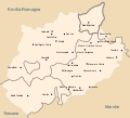
Map of Montefeltro.svg 1,680 × 1,520; 97 KB
-
Map of region of Emilia-Romagna, Italy, with provinces-es.svg 4,800 × 2,530; 186 KB
-
Map of region of Emilia-Romagna, Italy, with provinces-fr.svg 4,800 × 2,530; 186 KB
-
Map of region of Emilia-Romagna, Italy, with provinces-it.svg 4,800 × 2,530; 186 KB
-
Map of region of Emilia-Romagna, Italy.svg 4,800 × 2,530; 146 KB
-
Map of Valmarecchia.svg 2,899 × 2,658; 63 KB
-
Mappa linguistica Romagna.jpg 1,060 × 898; 331 KB
-
Modena in Italy.svg 1,034 × 1,299; 3 MB
-
Ordinary statute regions of Italy.svg 735 × 867; 74 KB
-
Parma in Italy.svg 1,034 × 1,299; 3 MB
-
Parma posizione.png 350 × 424; 14 KB
-
Pianura padana emiliana - territori.jpg 802 × 626; 77 KB
-
Ravenna in Italy.svg 1,034 × 1,299; 3 MB
-
Ravenna posizione.png 350 × 424; 11 KB
-
Reggio Emilia in Italy.svg 1,034 × 1,299; 3 MB
-
Reggio Emilia posizione.png 350 × 424; 11 KB
-
Region Parmigiano-Reggiano.png 2,000 × 1,277; 533 KB
-
Regione thumb Emilia-Romagna.svg 325 × 178; 43 KB
-
Rimini in Italy.svg 1,034 × 1,299; 3 MB
-
Rimini posizione.png 350 × 424; 14 KB
-
Risć Sìśmic in Emìglia Rumàgna.png 441 × 238; 37 KB
-
Romagna - cartina territori.jpg 800 × 438; 96 KB
-
Romagna geopolitica.png 608 × 516; 240 KB
-
Romagna.png 859 × 791; 29 KB
-
Sistema linguistico emiliano romagnolo.jpg 4,317 × 2,633; 393 KB
-
Sponda emiliana del Po.jpg 802 × 541; 84 KB


