Category:Maps of Basilicata
Jump to navigation
Jump to search
- Regions of Italy: Abruzzo · Aosta Valley · Apulia · Basilicata · Calabria · Campania · Emilia-Romagna · Friuli-Venezia Giulia · Lazio · Liguria · Lombardy · Marche · Molise · Piedmont · Sardinia · Sicily · Trentino-South Tyrol · Tuscany · Umbria · Veneto
Wikimedia category | |||||
| Upload media | |||||
| Instance of | |||||
|---|---|---|---|---|---|
| Category combines topics | |||||
| Basilicata | |||||
region of Italy | |||||
| Instance of | |||||
| Patron saint | |||||
| Location | Italy | ||||
| Located in or next to body of water | |||||
| Capital | |||||
| Legislative body |
| ||||
| Executive body |
| ||||
| Head of government |
| ||||
| Population |
| ||||
| Area |
| ||||
| Elevation above sea level |
| ||||
| official website | |||||
 | |||||
Use the appropriate category for maps showing all or a large part of Basilicata. See subcategories for smaller areas:
| If the map shows | Category to use |
|---|---|
| Basilicata on a recently created map | Category:Maps of Basilicata or its subcategories |
| Basilicata on a map created more than 70 years ago | Category:Old maps of Basilicata or its subcategories |
| the history of Basilicata on a recently created map | Category:Maps of the history of Basilicata or its subcategories |
| the history of Basilicata on a map created more than 70 years ago | Category:Old maps of the history of Basilicata or its subcategories |
Subcategories
This category has the following 12 subcategories, out of 12 total.
E
L
M
O
R
S
T
Media in category "Maps of Basilicata"
The following 48 files are in this category, out of 48 total.
-
BAS-Mappa.png 300 × 350; 10 KB
-
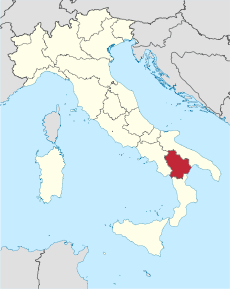
Italy Regions Basilicata Map.png 220 × 257; 18 KB
-
ItalyBasilicata.png 269 × 314; 9 KB
-
Regione-Basilicata-Posizione.png 200 × 233; 26 KB
-
332 of 'L'Italia geografica illustrata, etc' (11211291485).jpg 3,104 × 2,241; 1.75 MB
-
376 of 'L'Italia geografica illustrata, etc' (11210717384).jpg 2,241 × 3,215; 2.2 MB
-
Aglianico Vulture map.tif 308 × 258; 311 KB
-
Anachronistic map of Mercurion and Latinion.png 2,500 × 1,377; 633 KB
-
Autorità di bacino interregionale del fiume Sele.png 456 × 353; 20 KB
-
Autorità interregionale bacino basilicata.png 122 × 140; 3 KB
-
Basilicata from satellite NASA.png 990 × 609; 1.2 MB
-
Basilicata in Italy.svg 1,034 × 1,299; 1.67 MB
-
Circoscrizione Basilicata (Camera dei Deputati).png 1,632 × 2,112; 122 KB
-
Confini della Basilicata-var.png 934 × 776; 997 KB
-
Confini della Basilicata.png 934 × 776; 1.3 MB
-
Costiera cilentana.svg 2,900 × 2,050; 2.59 MB
-
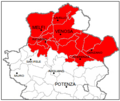
Kaart Italie Potenza.png 329 × 353; 19 KB
-
Karte Basilikata 2025.png 2,500 × 2,547; 937 KB
-
Lagonegro pos IT.gif 300 × 350; 8 KB
-
Magna Grecia 280aC.jpg 400 × 613; 233 KB
-
Map Basilicata 1930 - Touring Club Italiano CART-TRC-02.jpg 7,485 × 5,562; 18.92 MB
-
Map Cultural heritage and environment V 1992 - Touring Club Italiano CART-TEM-116.jpg 5,000 × 3,452; 11.12 MB
-
Map of Lucania.png 1,667 × 1,019; 695 KB
-
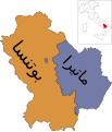
Map of region of Basilicata, Italy, with provinces-ar.svg 1,952 × 2,278; 84 KB
-
Map of region of Basilicata, Italy, with provinces-el.svg 1,952 × 2,278; 84 KB
-
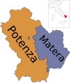
Map of region of Basilicata, Italy, with provinces-it.svg 1,952 × 2,278; 84 KB
-
Map of region of Basilicata, Italy.svg 489 × 522; 54 KB
-
Map vulture in basilicata.png 339 × 251; 45 KB
-
Mappa centro storico monte.jpg 3,507 × 2,480; 1.19 MB
-
Matera in Italy.svg 1,034 × 1,299; 3 MB
-
Matera mappa.png 667 × 751; 229 KB
-
Matera posizione.png 350 × 424; 13 KB
-
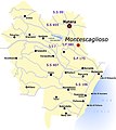
Montescaglioso-map.jpg 532 × 599; 165 KB
-
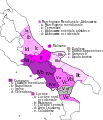
Neapolitan language.jpg 441 × 514; 132 KB
-
Neapolitan languages-it.svg 441 × 514; 180 KB
-
Neapolitan languages.svg 441 × 514; 60 KB
-
Ofanto.jpg 451 × 306; 132 KB
-
Ordinary statute regions of Italy.svg 735 × 867; 74 KB
-
Positioncitybernalda.png 500 × 510; 155 KB
-
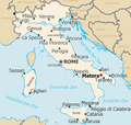
Positioncitymatera.png 400 × 379; 161 KB
-
Potenza in Italy.svg 1,034 × 1,299; 3 MB
-
Potenza mappa.png 560 × 800; 205 KB
-
Potenza posizione.png 350 × 424; 13 KB
-
Regione thumb Basilicata.svg 139 × 146; 130 KB
-
Sassimap-HE.png 1,082 × 891; 276 KB
-
Sassimap.png 1,082 × 891; 404 KB
-
Sparviere.jpg 538 × 721; 54 KB
-
Vulture area map.tif 308 × 258; 311 KB


