Category:Maps of Piedmont
Jump to navigation
Jump to search
- Regions of Italy: Abruzzo · Aosta Valley · Apulia · Basilicata · Calabria · Campania · Emilia-Romagna · Friuli-Venezia Giulia · Lazio · Liguria · Lombardy · Marche · Molise · Piedmont · Sardinia · Sicily · Trentino-South Tyrol · Tuscany · Umbria · Veneto
Wikimedia category | |||||
| Upload media | |||||
| Instance of | |||||
|---|---|---|---|---|---|
| Category combines topics | |||||
| Piedmont | |||||
region in North-West Italy | |||||
| Instance of | |||||
| Location | Italy | ||||
| Capital | |||||
| Legislative body | |||||
| Executive body |
| ||||
| Head of government |
| ||||
| Inception |
| ||||
| Population |
| ||||
| Area |
| ||||
| Elevation above sea level |
| ||||
| official website | |||||
 | |||||
Use the appropriate category for maps showing all or a large part of Piedmont. See subcategories for smaller areas:
| If the map shows | Category to use |
|---|---|
| Piedmont on a recently created map | Category:Maps of Piedmont or its subcategories |
| Piedmont on a map created more than 70 years ago | Category:Old maps of Piedmont or its subcategories |
| the history of Piedmont on a recently created map | Category:Maps of the history of Piedmont or its subcategories |
| the history of Piedmont on a map created more than 70 years ago | Category:Old maps of the history of Piedmont or its subcategories |
Subcategories
This category has the following 21 subcategories, out of 21 total.
C
- Maps of Canale Cavour (3 F)
E
G
H
I
- Maps of Isole Borromee (4 F)
L
M
O
R
S
T
- Travel maps of Piedmont (11 F)
V
- Maps of Valsesia (13 F)
Media in category "Maps of Piedmont"
The following 93 files are in this category, out of 93 total.
-
Italy Regions Piedmont Map.png 220 × 257; 18 KB
-
ItalyPiemont.png 269 × 313; 9 KB
-
PMN-Mappa.png 300 × 349; 10 KB
-
'ndrangheta In Provincia di Cuneo 2017.jpg 573 × 422; 56 KB
-
'ndrangheta in provincia di Torino 2017.jpg 1,098 × 739; 139 KB
-
'ndrangheta In Provincia di Vercelli 2017.jpg 842 × 613; 93 KB
-
64 - Northern Piedmont ecoregion.png 259 × 231; 58 KB
-
Alessandria in Italy.svg 1,034 × 1,299; 3 MB
-
Anfit rivoli avigliana location.png 864 × 632; 1.21 MB
-
Arpitania-arpitan-harpitanya-franco-provençal.jpg 389 × 325; 20 KB
-
Asti in Italy.svg 1,034 × 1,299; 3 MB
-
Asti posizione.png 1,077 × 1,401; 206 KB
-
Biella in Italy.svg 1,034 × 1,299; 3 MB
-
Biella posizione.png 350 × 424; 14 KB
-
Biella rivers location.png 1,000 × 1,493; 3.34 MB
-
Campanha de Napoleão no Piemonte (1796).jpg 1,123 × 794; 164 KB
-
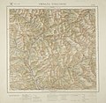
Carmagnola-G.jpg 3,374 × 3,360; 11.89 MB
-
Cesana Torinese.jpg 3,403 × 3,318; 10.88 MB
-
Chorographic map of the province of Novara.jpg 3,456 × 4,515; 12.27 MB
-
Circoscrizione Piemonte 1 (Camera dei Deputati).png 1,632 × 2,112; 122 KB
-
Circoscrizione Piemonte 2 (Camera dei Deputati).png 1,632 × 2,112; 122 KB
-
Cuneo in Italy.svg 1,034 × 1,299; 1.9 MB
-
Eccellenza piemontese 2010-11.png 450 × 576; 61 KB
-
Flag map of Piedmont.svg 767 × 947; 155 KB
-
Italy, Piedmont, linguistical map.png 1,600 × 2,000; 240 KB
-
KonturLanghe.jpg 232 × 271; 28 KB
-
Lago della Vecchia.png 860 × 498; 33 KB
-
Map Cultural heritage and environment I 1992 - Touring Club Italiano CART-TEM-112.jpg 5,000 × 3,464; 11.78 MB
-
Map of Langhe inside Piedmont.svg 1,000 × 1,303; 12.5 MB
-
Map of region of Piedmont, Italy, with provinces-ar.svg 3,493 × 4,314; 217 KB
-
Map of region of Piedmont, Italy, with provinces-en.svg 3,493 × 4,314; 216 KB
-
Map of region of Piedmont, Italy, with provinces-es.svg 3,493 × 4,314; 216 KB
-
Map of region of Piedmont, Italy, with provinces-fr.svg 3,493 × 4,314; 216 KB
-
Map of region of Piedmont, Italy, with provinces-it.svg 3,493 × 4,314; 216 KB
-
Map of region of Piedmont, Italy, with provinces-pms.svg 3,493 × 4,314; 216 KB
-
Map of region of Piedmont, Italy.svg 3,493 × 4,314; 171 KB
-
Map of subdivisions of Langhe in Piedmont.svg 657 × 591; 10.15 MB
-
Map of the XX Olympic Winter Games (blank).png 2,000 × 1,600; 134 KB
-
Map of the XX Olympic Winter Games (english).png 2,000 × 1,600; 176 KB
-
Map of the XX Olympic Winter Games (french).png 2,000 × 1,600; 176 KB
-
Map of the XX Olympic Winter Games (italian).png 2,000 × 1,600; 176 KB
-
Mappa Comunità Montana Valli Po, Bronda, Infernotto e Varaita.jpg 1,024 × 702; 75 KB
-
Mappa-colori-Comunità-Montana-Valli-Po,-Bronda,-Infernotto-e-Varaita.jpg 1,024 × 694; 88 KB
-
Monferrato 2.jpg 5,184 × 3,456; 15.79 MB
-
Monferrato 3.jpg 4,269 × 3,277; 13.44 MB
-
Monferrato map.svg 2,183 × 2,697; 2.59 MB
-
Monte Argentera schema.png 1,338 × 1,691; 126 KB
-
MontReusa01.png 810 × 600; 399 KB
-
Nordpiemont.jpg 454 × 340; 32 KB
-
Novara in Italy.svg 1,034 × 1,299; 3 MB
-
Ordinary statute regions of Italy.svg 735 × 867; 74 KB
-
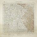
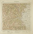
Oulx̞-G.jpg 3,286 × 3,338; 10.87 MB
-
Parco-Gran Paradiso-Posizione.png 269 × 313; 36 KB
-
Parco-Val Grande-Posizione.png 269 × 313; 36 KB
-
Piedmont 1.jpg 4,098 × 3,224; 10.91 MB
-
Piedmont in Italy.svg 1,034 × 1,299; 1.67 MB
-
Piedmont provinces.png 593 × 757; 15 KB
-
Piemonte 'ndrangheta.gif 972 × 1,201; 67 KB
-
Piemonte it-voy map.png 2,998 × 3,735; 1.27 MB
-
Piemonte it.png 450 × 599; 46 KB
-
Piemonte Province.gif 382 × 500; 21 KB
-
Piemonte theatruum.jpg 600 × 523; 211 KB
-
Piemonte.png 450 × 599; 42 KB
-
Pinerolo.jpg 3,275 × 3,346; 11.51 MB
-
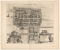
Plattegrond van Ciriè Ciriacum vulgo Ciriè (titel op object), RP-P-1908-272.jpg 5,698 × 4,796; 4.62 MB
-
Popolazioni preromane del Piemonte.jpg 700 × 960; 212 KB
-
Regione thumb Piemonte.svg 232 × 306; 38 KB
-
Sardinian States.jpg 3,914 × 3,062; 9.9 MB
-
Schema idrografia biellese.jpg 836 × 906; 528 KB
-
Seigneurie de Vercelli, Marquisat d'Ivrea, Comté d'Ast, Le Canavez et Monferrato.jpg 3,026 × 3,830; 10.91 MB
-
Signpost with hiking map in Saint Vito of Lunella.jpg 1,800 × 4,000; 2.22 MB
-
SOIUSA04-Alpi Cozie.png 2,795 × 2,553; 549 KB
-
Susa-G.jpg 3,411 × 3,358; 12.28 MB
-
Swisstopo Dufourkarte BLATT XXIII DOMO D'OSSOLA ARONA LT TK 023 1862.tiff 11,676 × 8,600; 95.79 MB
-
The four valleys of Lucerna, Angrogna, S. Martino and the Perosa.jpg 4,608 × 3,378; 15.61 MB
-
Torino in Italy.svg 1,034 × 1,299; 3 MB
-
Torino location map blank.PNG 689 × 772; 28 KB
-
Torino location map winter olympics.PNG 687 × 768; 34 KB
-
Torino posizione.png 350 × 424; 14 KB
-
Torino prima cintura.png 3,507 × 2,480; 590 KB
-
Torino prima seconda cintura.png 2,480 × 3,507; 885 KB
-
Vallardi - Pinerolo Susa.jpg 6,349 × 4,177; 14.29 MB
-
Valli occitane.png 947 × 1,401; 1.01 MB
-
Verbania posizione.png 350 × 424; 11 KB
-
Vercelli in Italy.svg 1,034 × 1,299; 3 MB
-
Vercelli posizione.png 350 × 424; 14 KB
-
Vercelli.jpg 3,351 × 3,347; 11.94 MB
-
피에몬테주의 도.svg 3,493 × 4,314; 220 KB


