Category:Maps of Strait of Messina
Jump to navigation
Jump to search
- English: Maps of the Strait of Messina — in the Mediterranean Sea, located between Sicily and mainland Italy.
Wikimedia category | |||||
| Upload media | |||||
| Instance of | |||||
|---|---|---|---|---|---|
| Category combines topics | |||||
| Strait of Messina | |||||
strait between Sicily and Calabria | |||||
| Instance of | |||||
| Part of | |||||
| Location |
| ||||
| Basin country | |||||
| Different from | |||||
 | |||||
Media in category "Maps of Strait of Messina"
The following 34 files are in this category, out of 34 total.
-
Locatie Straat van Messina.PNG 404 × 263; 9 KB
-
Estrecho Mesina.gif 320 × 400; 4 KB
-
Admiralty Chart No 177 Italy The Faro or Strait of Messina, Published 1889.jpg 9,752 × 8,160; 10.61 MB
-
Admiralty Chart No 177 Plans in Stretto di Messina, Published 1964.jpg 16,290 × 11,076; 21.82 MB
-
Admiralty Chart No 1800 Malta to Cape Malea, Published 1894.jpg 13,902 × 8,363; 16.83 MB
-
Admiralty Chart No 188 Catania to Cefalu Published 1872.jpg 10,426 × 7,208; 8.26 MB
-
Admiralty Chart No 1976 Italy west coast Cape Bonifati to Strait of Messina, Published 1894.jpg 8,348 × 10,462; 9.43 MB
-
Admiralty Chart No 198 Policastro to Cape Sta. Maria di Leuca, Published 1882.jpg 11,121 × 16,218; 35.78 MB
-
Admiralty Chart No 3935 Stretto di Messina and Aproaches, Published 1945.jpg 16,297 × 11,116; 43.94 MB
-
Area metropolitana integrata dello stretto.jpg 480 × 228; 109 KB
-
Aree urbanizzate con continuità territoriale in calabria e nello stretto.jpg 1,812 × 1,090; 263 KB
-
Batimetry Messina.jpg 641 × 599; 34 KB
-
ETH-BIB-Meerenge von Messina, Karte, nach Alb. Defant-Dia 247-Z-00381.tif 2,929 × 3,418; 28.74 MB
-
FMIB 36810 Remous de Charybde.jpeg 676 × 603; 128 KB
-
Guide to Italy and Sicily (1911) (14743059626).jpg 2,324 × 2,980; 749 KB
-
Mappa grande reggio.jpg 760 × 959; 236 KB
-
Mediterranean Sea, plans on the coasts of Italy and Sicilia (2674795729).jpg 1,445 × 2,000; 1.73 MB
-
Mesinski tjesnac.svg 794 × 910; 180 KB
-
Messina Straits Defant currents model sections.JPG 2,012 × 1,971; 320 KB
-
Messina Straits Jean Houel 1785.jpg 960 × 720; 128 KB
-
Messina Straits upwelling area.JPG 769 × 778; 62 KB
-
Meyers b11 s0515.jpg 800 × 1,275; 435 KB
-
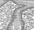
Karte Str von Messina MKL1888.png 541 × 485; 94 KB
-
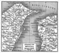
Karte der Strasse von Messina.jpg 524 × 472; 97 KB
-
Meyers b11 s0515 b1.png 559 × 505; 168 KB
-
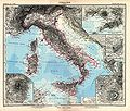
Stielers Handatlas 1891 22.jpg 5,050 × 4,300; 6.56 MB
-
Strait of Messina, Pergamon World Atlas 1967.jpg 1,239 × 1,567; 405 KB
-
Strait of Messina.jpg 438 × 448; 32 KB
-
Vatikanische Museen 59.jpg 6,720 × 4,480; 36.87 MB


