Category:Maps of Sicily
Jump to navigation
Jump to search
- Regions of Italy: Abruzzo · Aosta Valley · Apulia · Basilicata · Calabria · Campania · Emilia-Romagna · Friuli-Venezia Giulia · Lazio · Liguria · Lombardy · Marche · Molise · Piedmont · Sardinia · Sicily · Trentino-South Tyrol · Tuscany · Umbria · Veneto
Wikimedia category | |||||
| Upload media | |||||
| Instance of | |||||
|---|---|---|---|---|---|
| Category combines topics | |||||
| Sicily | |||||
Italian region | |||||
| Instance of |
| ||||
| Location |
| ||||
| Capital | |||||
| Legislative body | |||||
| Executive body |
| ||||
| Head of government |
| ||||
| Inception |
| ||||
| Highest point | |||||
| Population |
| ||||
| Area |
| ||||
| Elevation above sea level |
| ||||
| Different from | |||||
| official website | |||||
 | |||||
Use the appropriate category for maps showing all or a large part of Sicily. See subcategories for smaller areas:
| If the map shows | Category to use |
|---|---|
| Sicily on a recently created map | Category:Maps of Sicily or its subcategories |
| Sicily on a map created more than 70 years ago | Category:Old maps of Sicily or its subcategories |
| the history of Sicily on a recently created map | Category:Maps of the history of Sicily or its subcategories |
| the history of Sicily on a map created more than 70 years ago | Category:Old maps of the history of Sicily or its subcategories |
Subcategories
This category has the following 34 subcategories, out of 34 total.
*
A
C
- Maps of Catholic dioceses in Sicily (1 P, 66 F)
- Maps of Cava d'Ispica (10 F)
E
F
G
H
I
L
- Linguistic maps of Sicily (14 F)
- Localisation maps of Sicily (28 F)
- Location maps of Sicily (13 F)
M
- Maps of Sicilian Mafia (9 F)
- Maps of Linosa Island (7 F)
- Maps of mountains in Sicily (10 F)
O
P
R
S
- Maps of Strait of Messina (34 F)
T
- Maps of Taormina (5 F)
- Topographic maps of Sicily (33 F)
- Travel maps of Sicily (7 F)
W
- Wine maps of Sicily (6 F)
Pages in category "Maps of Sicily"
The following 2 pages are in this category, out of 2 total.
Media in category "Maps of Sicily"
The following 134 files are in this category, out of 134 total.
-
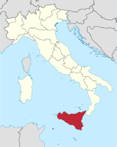
Italy Regions Sicily Map.png 220 × 257; 18 KB
-
ItalySicily.png 269 × 314; 9 KB
-
Regione Siciliana map-blank.svg 2,812 × 3,260; 566 KB
-
Regione-Sicilia-Posizione.png 204 × 238; 6 KB
-
Sicily map-blank.svg 2,373 × 1,582; 473 KB
-
1. Sicilia, centri citati nel testo.jpg 9,591 × 7,502; 2.6 MB
-
194percorso.jpg 352 × 447; 34 KB
-
Administrative Map of Sicily (1948).png 1,528 × 1,729; 244 KB
-
Admiralty Chart No 2122 Bizerte to Capo San Marco, Published 1963.jpg 16,334 × 11,152; 47.18 MB
-
Aeolian Arc.jpg 925 × 676; 140 KB
-
Aeroporto Milo S1.jpg 543 × 495; 17 KB
-
Agrigento posizione.svg 1,200 × 1,500; 828 KB
-
AgrigentoMap.png 234 × 229; 14 KB
-
Angevin Invasion of Sicily Campaign Map (PNG).png 960 × 540; 176 KB
-
Angevin Invasion of Sicily Campaign Map.pdf 1,500 × 843; 776 KB
-
Area metropolitana integrata dello stretto.jpg 480 × 228; 109 KB
-
Aree urbanizzate con continuità territoriale in calabria e nello stretto.jpg 1,812 × 1,090; 263 KB
-
Autonomous Regions of Italy.jpg 566 × 494; 25 KB
-
Autonomous Regions of Italy.svg 735 × 867; 118 KB
-
Autostrade in Sicilia modified.svg 483 × 326; 75 KB
-
Autostrade in Sicilia.svg 550 × 600; 88 KB
-
Bacino imbrifero Niceto.png 1,020 × 1,320; 1.58 MB
-
Belice map.png 1,152 × 1,364; 333 KB
-
Belice map.svg 631 × 742; 443 KB
-
BivonaPlace.jpg 234 × 229; 10 KB
-
BlueOutlineSicily.png 1,200 × 800; 5 KB
-
Caltagironelocation.png 239 × 234; 10 KB
-
Caltanissetta in Italy.svg 1,034 × 1,299; 3 MB
-
Caltanissetta posizione.png 350 × 424; 11 KB
-
Canal du Cap Bon (moyen).png 768 × 922; 197 KB
-
Canal du Cap Bon (petit).png 600 × 720; 140 KB
-
Canis lupus cristaldii distribution (1900).png 360 × 279; 13 KB
-
Canis lupus cristaldii distribution.png 466 × 521; 7 KB
-
Carte Sicile.png 776 × 557; 33 KB
-
Cartina cisterna regina.jpg 679 × 551; 134 KB
-
Cartina italia.png 738 × 900; 315 KB
-
Catania dot.png 1,805 × 2,243; 178 KB
-
Catania in Italy.svg 1,034 × 1,299; 3 MB
-
CataniaMap.png 239 × 234; 10 KB
-
Circoscrizione Sicilia 1 (Camera dei Deputati).png 1,632 × 2,112; 121 KB
-
Circoscrizione Sicilia 2 (Camera dei Deputati).png 1,632 × 2,112; 122 KB
-
Cittàmetrocataniacongela.jpg 2,345 × 1,673; 375 KB
-
Clima Sicilia sud-orientale.png 1,193 × 987; 167 KB
-
Corleonelocation.png 239 × 234; 10 KB
-
Delimitatio Templum Caelesti di Sicilia.jpg 2,835 × 2,008; 367 KB
-
Divisions de Sicília en 2016.png 645 × 702; 51 KB
-
Eccellenzasicilia201415.png 1,344 × 972; 112 KB
-
Elettrodotto Italia-Malta.jpg 516 × 490; 92 KB
-
Enna in Italy.svg 1,034 × 1,299; 3 MB
-
Enna posizione.png 350 × 424; 11 KB
-
Ennalocation.png 239 × 234; 10 KB
-
Erice Bezienswaardigheden.PNG 1,212 × 751; 217 KB
-
Erice Sites.PNG 1,212 × 751; 216 KB
-
Etna map.PNG 636 × 427; 17 KB
-
Europe location Sicilia.png 1,245 × 1,245; 49 KB
-
Europe map sicily.png 1,231 × 929; 65 KB
-
Geografia provincia di Siracusa.jpg 820 × 1,400; 335 KB
-
Greco-siculi.svg 550 × 398; 32 KB
-
Greenway delle zolfare.svg 1,701 × 1,276; 2.42 MB
-
Kaart Italie Augusta.png 329 × 353; 19 KB
-
La Sicilia. RRA 3= 72. Pièce 40.jpg 2,290 × 1,762; 881 KB
-
La via dei Frati in Sicilia.svg 1,701 × 1,276; 2.48 MB
-
Le vie francigene in Sicilia.svg 1,701 × 1,276; 2.94 MB
-
Localisation map of the Val di Mazara.png 1,528 × 1,329; 197 KB
-
Localisation map of the Val di Noto.png 1,528 × 1,329; 166 KB
-
Localisation map of the Valdemone.png 1,528 × 1,329; 202 KB
-
Localisation map of the Vallo di Castrogiovanni.png 1,528 × 1,329; 203 KB
-
Localisation map of the Vallo di Girgenti e di Castrogiovanni.png 1,528 × 1,329; 176 KB
-
Localisation map of the Vallo di Girgenti.png 1,528 × 1,329; 200 KB
-
Localisation map of the Vallo di Milazzo.png 1,528 × 1,329; 206 KB
-
Lokatie Licata.png 750 × 551; 201 KB
-
Lokatie van Canicatti.png 750 × 551; 202 KB
-
Lokatie van het eiland Pantelleria.png 1,052 × 733; 539 KB
-
Lokatie van Trapani op Sicilië.png 1,000 × 768; 98 KB
-
Map Cultural heritage and environment VI 1992 - Touring Club Italiano CART-TEM-117.jpg 5,000 × 3,447; 11.45 MB
-
Map of airports in Sicily.jpg 549 × 599; 32 KB
-
Map of region of Sicily, Italy.svg 8,803 × 6,748; 103 KB
-
Map of Sicily.jpg 1,080 × 597; 75 KB
-
Map of Tuscan settlements in Sicily.jpg 518 × 445; 41 KB
-
Mappa regioni con movimenti indipendentisti.png 480 × 600; 75 KB
-
MapPalOM.png 1,920 × 941; 236 KB
-
Mappatrigrid.JPG 823 × 645; 79 KB
-
MapSicilyOM.png 1,920 × 941; 211 KB
-
Mapssicily.png 1,920 × 941; 6.91 MB
-
Marsala, Italy blank map.png 1,000 × 767; 139 KB
-
Mazara del Vallo, Italy map.png 1,000 × 769; 226 KB
-
Mediterranean Sea location map with blue Sicily.svg 1,754 × 862; 1.2 MB
-
Messina in Italy.svg 1,034 × 1,299; 3 MB
-
Messina position.jpg 250 × 225; 12 KB
-
Messinalocation.png 239 × 234; 10 KB
-
Niceto Mappa.jpg 750 × 551; 44 KB
-
Palermo dot.png 1,805 × 2,243; 178 KB
-
Palermo in Italy.svg 1,034 × 1,299; 3 MB
-
Palermo map.PNG 636 × 427; 18 KB
-
Palermo posizione.png 350 × 424; 11 KB
-
Palermo province map 3430.jpg 281 × 173; 17 KB
-
Palermo, Sicily-2.png 482 × 599; 159 KB
-
Palermo, Sicily.png 482 × 599; 139 KB
-
Parchi regionali siciliani.png 700 × 500; 41 KB
-
Positioncitymarsala.png 360 × 400; 161 KB
-
Provincia Catania.JPG 386 × 323; 79 KB
-
Ragusa 1860S.jpg 1,203 × 603; 52 KB
-
Ragusa in Italy.svg 1,034 × 1,299; 3 MB
-
Ragusa posizione.png 350 × 424; 11 KB
-
Ragusalocation.PNG 239 × 234; 10 KB
-
Regione thumb Sicilia.svg 329 × 249; 274 KB
-
Sicilia 2.png 2,000 × 1,926; 469 KB
-
Sicilia occidentale.jpg 1,000 × 769; 231 KB
-
Sicilia Parco Mediterraneo.svg 838 × 633; 5.12 MB
-
Sicilia-Valle del Belice.pdf 4,964 × 3,506; 7.44 MB
-
Sicily in Italy.svg 1,034 × 1,299; 1.01 MB
-
Sicily in its region.svg 396 × 223; 4.21 MB
-
Sicily map RU.gif 1,416 × 850; 231 KB
-
Sicily Map.png 3,473 × 2,456; 3.57 MB
-
Sicily Wikivoyage.svg 550 × 398; 134 KB
-
Siculo-albanesi.svg 550 × 398; 44 KB
-
Siracusa in Italy.svg 1,034 × 1,299; 3 MB
-
SiracusaMap.png 239 × 234; 10 KB
-
Strada Statale 185 Italia mappa.jpg 411 × 230; 47 KB
-
Strait of Sicily map it.PNG 1,502 × 1,802; 383 KB
-
Strait of Sicily map-ar.png 2,000 × 2,400; 710 KB
-
Strait of Sicily map-sr.png 500 × 607; 68 KB
-
Strait of Sicily map.png 1,500 × 1,800; 147 KB
-
Syracuse location.png 234 × 229; 14 KB
-
Taormina map.PNG 239 × 234; 10 KB
-
Torri costiere della Sicilia.svg 550 × 600; 153 KB
-
Trapani in Italy.svg 1,034 × 1,299; 1.9 MB
-
Trapani posizione.png 350 × 424; 11 KB
-
Valle Niceto mappa.jpg 982 × 1,205; 762 KB
-
Wikisicily-gold.png 135 × 155; 28 KB
-
Meyers Konversations-Lexikon Bd. 16 1897 (136986237).jpg 5,499 × 4,398; 28.1 MB
-
מצר סיציליה.svg 3,810 × 4,571; 1.16 MB
