Category:Maps of Friuli-Venezia Giulia
Jump to navigation
Jump to search
- Regions of Italy: Abruzzo · Aosta Valley · Apulia · Basilicata · Calabria · Campania · Emilia-Romagna · Friuli-Venezia Giulia · Lazio · Liguria · Lombardy · Marche · Molise · Piedmont · Sardinia · Sicily · Trentino-South Tyrol · Tuscany · Umbria · Veneto
Wikimedia category | |||||
| Upload media | |||||
| Instance of | |||||
|---|---|---|---|---|---|
| Category combines topics | |||||
| Friuli Venezia Giulia | |||||
autonomous region of Italy | |||||
| Instance of |
| ||||
| Part of |
| ||||
| Patron saint | |||||
| Location | Italy | ||||
| Located in or next to body of water | |||||
| Capital | |||||
| Legislative body |
| ||||
| Executive body |
| ||||
| Official language | |||||
| Head of government |
| ||||
| Inception |
| ||||
| Highest point | |||||
| Population |
| ||||
| Area |
| ||||
| Elevation above sea level |
| ||||
| official website | |||||
 | |||||
Use the appropriate category for maps showing all or a large part of Friuli Venezia Giulia. See subcategories for smaller areas:
| If the map shows | Category to use |
|---|---|
| Friuli Venezia Giulia on a recently created map | Category:Maps of Friuli-Venezia Giulia or its subcategories |
| Friuli Venezia Giulia on a map created more than 70 years ago | Category:Old maps of Friuli-Venezia Giulia or its subcategories |
| the history of Friuli Venezia Giulia on a recently created map | Category:Maps of the history of Friuli-Venezia Giulia or its subcategories |
| the history of Friuli Venezia Giulia on a map created more than 70 years ago | Category:Old maps of the history of Friuli-Venezia Giulia or its subcategories |
Subcategories
This category has the following 17 subcategories, out of 17 total.
Pages in category "Maps of Friuli-Venezia Giulia"
This category contains only the following page.
Media in category "Maps of Friuli-Venezia Giulia"
The following 86 files are in this category, out of 86 total.
-
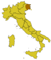
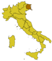
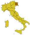
Friuli--Mappa.png 204 × 238; 7 KB
-
FVG-Mappa.png 300 × 350; 9 KB
-
Italy Regions Friuli-Venezia Giulia Map.png 220 × 257; 18 KB
-
ItalyFriuli-VeneziaGiulia.png 204 × 238; 6 KB
-
Regione-Friuli-Venezia-Giulia-Posizione.png 204 × 238; 6 KB
-
Aas3 gemonese.jpg 1,648 × 1,120; 210 KB
-
Aas3 sdan.jpg 1,044 × 816; 157 KB
-
Aft.JPG 667 × 576; 56 KB
-
Autonomous Regions of Italy.jpg 566 × 494; 25 KB
-
Autonomous Regions of Italy.svg 735 × 867; 118 KB
-
Bassa friulana map.png 105 × 90; 3 KB
-
Bay-of-Piran maritime-boundary-dispute-ar.png 2,000 × 1,863; 334 KB
-
Bay-of-Piran maritime-boundary-dispute-hr.svg 789 × 735; 30 KB
-
Bay-of-Piran maritime-boundary-dispute-hu.svg 789 × 735; 36 KB
-
Bay-of-Piran maritime-boundary-dispute-mk.SVG 789 × 735; 107 KB
-
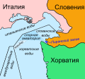
Bay-of-Piran maritime-boundary-dispute-ru.svg 789 × 735; 136 KB
-
Bay-of-Piran maritime-boundary-dispute-sr.svg 789 × 735; 36 KB
-
Bay-of-Piran maritime-boundary-dispute.jpg 709 × 600; 160 KB
-
Bay-of-Piran maritime-boundary-dispute.svg 789 × 735; 35 KB
-
BigName.jpg 3,639 × 2,573; 381 KB
-
Bisiacaria map.png 55 × 55; 1 KB
-
BorderDispute BayOfPiran blank.png 800 × 742; 601 KB
-
Carnia map.png 120 × 110; 3 KB
-
Carnia.jpg 2,873 × 1,721; 573 KB
-
Carta Vajont Soverzene.jpg 720 × 480; 73 KB
-
CervComune.jpg 343 × 344; 30 KB
-
CervParti.jpg 235 × 333; 32 KB
-
Circoscrizione Friuli-Venezia Giulia (Camera dei Deputati).png 1,632 × 2,112; 122 KB
-
Codroipo.jpg 1,561 × 1,233; 240 KB
-
Descrizione esatta delle 2 componenti della Regione.png 1,134 × 1,123; 203 KB
-
DOC Colli Orientali del Friuli.png 356 × 410; 96 KB
-
Friulano & Co..JPG 847 × 623; 70 KB
-
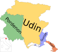
Friuli provinces.png 514 × 473; 7 KB
-
Friuli Venezia Giulia - Languages.png 875 × 779; 130 KB
-
Friuli wine regions.JPG 776 × 600; 59 KB
-
Friuli-Venezia Giulia in Italy.svg 1,034 × 1,299; 1.67 MB
-
Friulian Language distribution.png 2,000 × 1,829; 431 KB
-
Friûl map.png 1,018 × 929; 141 KB
-
Gorizia in Italy.svg 1,034 × 1,299; 1.9 MB
-
Gorizia posizione.png 350 × 424; 13 KB
-
Grenzstreit-Bucht-von-Piran.jpg 800 × 742; 181 KB
-
Idioma friulano.PNG 1,001 × 767; 138 KB
-
Idioma véneto.PNG 1,001 × 767; 204 KB
-
LINEA VALLO E OLTRE.jpeg 611 × 794; 100 KB
-
Linguistic map of Northeast Italy.png 770 × 314; 94 KB
-
Linguistic minorities in FVG.png 1,110 × 722; 326 KB
-
Litorale 1.png 2,264 × 2,221; 203 KB
-
Litorale 3.png 744 × 972; 74 KB
-
Map Cultural heritage and environment II 1992 - Touring Club Italiano CART-TEM-113.jpg 5,000 × 3,419; 12.42 MB
-
Map of region of Friuli-Venezia Giulia, Italy, with provinces-de.svg 4,316 × 3,831; 102 KB
-
Map of region of Friuli-Venezia Giulia, Italy, with provinces-el.svg 4,316 × 3,831; 102 KB
-
Map of region of Friuli-Venezia Giulia, Italy, with provinces-fur.svg 4,316 × 3,831; 102 KB
-
Map of region of Friuli-Venezia Giulia, Italy, with provinces-it.svg 4,316 × 3,831; 102 KB
-
Map of region of Friuli-Venezia Giulia, Italy, with provinces-ru.svg 4,316 × 3,831; 102 KB
-
Map of region of Friuli-Venezia Giulia, Italy.svg 4,316 × 3,831; 66 KB
-
Map of Sivian with toponyms.svg 816 × 736; 68 KB
-
Mappa della Pieve.jpg 1,500 × 1,090; 254 KB
-
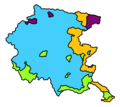
Mappa Friuli-Partiti per comune 2018.png 1,000 × 898; 361 KB
-
NSA 55 - 402.png 1,098 × 828; 57 KB
-
Pordenone in Italy.svg 1,034 × 1,299; 1.9 MB
-
Pordenone posizione.png 350 × 424; 11 KB
-
Provincia di Udine e Venezia Giulia 1963.jpg 338 × 299; 16 KB
-
Provinciapro.JPG 229 × 287; 19 KB
-
Regione thumb Friuli-Venezia Giulia.svg 142 × 142; 422 KB
-
Regjons Istorichis FUR.jpg 2,044 × 1,417; 365 KB
-
Sentiero Panoramica, Riserva Naturale della foce dell'Isonzo, Italia.jpg 1,500 × 1,184; 1.38 MB
-
Slavia veneta.png 865 × 1,023; 151 KB
-
TerremotoFriuli 19760506 MappaScosse.gif 430 × 350; 34 KB
-
Trieste dot.png 1,805 × 2,243; 177 KB
-
Trieste in Italy.svg 1,034 × 1,299; 1.9 MB
-
Trieste mapa.jpg 300 × 350; 14 KB
-
Trieste posizione.png 350 × 424; 13 KB
-
Triveneto-fr.svg 720 × 643; 102 KB
-
Triveneto.svg 720 × 643; 86 KB
-
Udine in Italy.svg 1,034 × 1,299; 1.89 MB
-
Udine posizione.png 350 × 424; 11 KB
-
Unioni territoriali intercomunali del Friuli-Venezia Giulia.png 1,300 × 1,300; 102 KB
-
Uti friuli.png 7,015 × 4,960; 1.48 MB
-
Venezia Euganea (1935-1947).png 350 × 424; 10 KB
-
Venezia Euganea (1947-1954).png 350 × 424; 10 KB
-
Venezia Euganea (1954-1963).png 350 × 424; 10 KB
-
VENEZIA GIULIA 1924 - 1943.JPG 341 × 599; 26 KB
-
Venezie.PNG 1,169 × 826; 1.45 MB
-
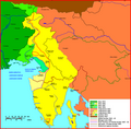
Vgiulia.PNG 826 × 1,169; 1.62 MB
-
VIA - comp Systemskizze.jpg 1,618 × 2,064; 445 KB

