Category:Maps of Umbria
Jump to navigation
Jump to search
- Regions of Italy: Abruzzo · Aosta Valley · Apulia · Basilicata · Calabria · Campania · Emilia-Romagna · Friuli-Venezia Giulia · Lazio · Liguria · Lombardy · Marche · Molise · Piedmont · Sardinia · Sicily · Trentino-South Tyrol · Tuscany · Umbria · Veneto
Wikimedia category | |||||
| Upload media | |||||
| Instance of | |||||
|---|---|---|---|---|---|
| Category combines topics | |||||
| Umbria | |||||
region of Italy | |||||
| Instance of | |||||
| Part of |
| ||||
| Named after |
| ||||
| Patron saint | |||||
| Location | Italy | ||||
| Capital | |||||
| Legislative body |
| ||||
| Executive body |
| ||||
| Head of government |
| ||||
| Inception |
| ||||
| Population |
| ||||
| Area |
| ||||
| Elevation above sea level |
| ||||
| official website | |||||
 | |||||
Use the appropriate category for maps showing all or a large part of Umbria. See subcategories for smaller areas:
| If the map shows | Category to use |
|---|---|
| Umbria on a recently created map | Category:Maps of Umbria or its subcategories |
| Umbria on a map created more than 70 years ago | Category:Old maps of Umbria or its subcategories |
| the history of Umbria on a recently created map | Category:Maps of the history of Umbria or its subcategories |
| the history of Umbria on a map created more than 70 years ago | Category:Old maps of the history of Umbria or its subcategories |
Subcategories
This category has the following 12 subcategories, out of 12 total.
Media in category "Maps of Umbria"
The following 43 files are in this category, out of 43 total.
-
Italy Regions Umbria Map.png 220 × 257; 18 KB
-
ItalyUmbria.png 269 × 314; 9 KB
-
Regione-Umbria-Posizione.png 204 × 238; 6 KB
-
UMB-Mappa.png 300 × 349; 9 KB
-
50 of 'L'Italia geografica illustrata, etc' (11208764944).jpg 2,204 × 3,315; 1.67 MB
-
Assisi approx position in Italy.png 540 × 628; 30 KB
-
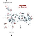
Carsulae-siteplan fr.jpg 510 × 540; 94 KB
-
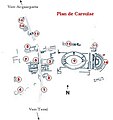
Carsulae-siteplan.jpg 355 × 376; 57 KB
-
Central Italian dialects.png 1,099 × 1,004; 102 KB
-
Circoscrizione Umbria (Camera dei Deputati).png 1,632 × 2,112; 122 KB
-
Deruta-Pos.png 340 × 371; 11 KB
-
Dialetti italiani centrali.jpg 327 × 335; 38 KB
-
Dialetti toscani.jpg 320 × 310; 69 KB
-
Flag map of Umbria.svg 3,705 × 4,496; 75 KB
-
Idioma toscano y dialectos mutuamente inteligibles.png 213 × 200; 4 KB
-
Italy July 2023 14 18 53 835000.jpeg 3,024 × 4,032; 2.62 MB
-
Italy Umbria location map.png 434 × 539; 5 KB
-
Karte Umbrien 2025.png 2,500 × 2,681; 1.07 MB
-
Map Cultural heritage and environment III 1992 - Touring Club Italiano CART-TEM-114.jpg 5,000 × 3,433; 12.14 MB
-
Map of region of Umbria, Italy, with provinces-fr.svg 3,705 × 4,496; 89 KB
-
Map of region of Umbria, Italy, with provinces-it.svg 3,705 × 4,496; 89 KB
-
Map of region of Umbria, Italy.svg 3,705 × 4,496; 53 KB
-
Maschere Umbre.png 400 × 511; 310 KB
-
Ordinary statute regions of Italy.svg 735 × 867; 74 KB
-
Orvieto Weinbaugebiet.JPG 349 × 262; 61 KB
-
Panicale map.JPG 2,592 × 1,944; 1.6 MB
-
Parchi dell'Umbria.jpg 216 × 182; 32 KB
-
Perugia in Italy.svg 1,034 × 1,299; 3 MB
-
Perugia mappa.png 725 × 716; 391 KB
-
Perugia posizione.png 350 × 424; 11 KB
-
Pianta-StabilimentoFrazzi-CdP.JPG 2,768 × 1,764; 4.55 MB
-
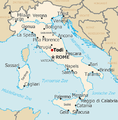
Positionoftodi.png 500 × 507; 239 KB
-
Regione thumb Umbria.svg 126 × 158; 211 KB
-
Sabina map.png 160 × 160; 9 KB
-
San Gemini Map - Medieval gates.jpg 2,197 × 2,409; 967 KB
-
Terni in Italy.svg 1,034 × 1,299; 3 MB
-
Terni posizione.png 350 × 424; 11 KB
-
Umbria in Italy.svg 1,034 × 1,299; 1.67 MB
-
Umbria provinces.png 470 × 562; 5 KB
-
Umbria Wikivoyage Travel map.png 1,678 × 2,004; 713 KB
-
Umbria Wikivoyage Travel map.svg 663 × 792; 962 KB
-
Umbria WV.svg 1,000 × 1,230; 1.38 MB
-
Umbrian Provinces Blank.png 530 × 651; 10 KB


