Category:Maps of Abruzzo
Jump to navigation
Jump to search
- Regions of Italy: Abruzzo · Aosta Valley · Apulia · Basilicata · Calabria · Campania · Emilia-Romagna · Friuli-Venezia Giulia · Lazio · Liguria · Lombardy · Marche · Molise · Piedmont · Sardinia · Sicily · Trentino-South Tyrol · Tuscany · Umbria · Veneto
Wikimedia category | |||||
| Upload media | |||||
| Instance of | |||||
|---|---|---|---|---|---|
| Category combines topics | |||||
| Abruzzo | |||||
region in Italy | |||||
| Instance of | |||||
| Patron saint | |||||
| Location | Italy | ||||
| Located in or next to body of water | |||||
| Capital | |||||
| Legislative body |
| ||||
| Executive body |
| ||||
| Head of government |
| ||||
| Highest point | |||||
| Population |
| ||||
| Area |
| ||||
| Elevation above sea level |
| ||||
| official website | |||||
 | |||||
Use the appropriate category for maps showing all or a large part of Abruzzo. See subcategories for smaller areas:
| If the map shows | Category to use |
|---|---|
| Abruzzo on a recently created map | Category:Maps of Abruzzo or its subcategories |
| Abruzzo on a map created more than 70 years ago | Category:Old maps of Abruzzo or its subcategories |
| the history of Abruzzo on a recently created map | Category:Maps of the history of Abruzzo or its subcategories |
| the history of Abruzzo on a map created more than 70 years ago | Category:Old maps of the history of Abruzzo or its subcategories |
Subcategories
This category has the following 14 subcategories, out of 14 total.
Media in category "Maps of Abruzzo"
The following 52 files are in this category, out of 52 total.
-
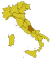
ABR-Mappa.png 300 × 350; 9 KB
-
Italy Regions Abruzzo Map.png 220 × 257; 18 KB
-
ItalyAbruzzo.png 269 × 314; 9 KB
-
173 of 'L'Italia geografica illustrata, etc' (11211677094).jpg 2,241 × 3,121; 1.79 MB
-
20090406 013242 umbria quake intensity.jpg 800 × 927; 330 KB
-
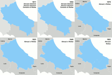
Abruzzi e Molise boundary changes.gif 480 × 480; 113 KB
-
Abruzzi e Molise in Italy.svg 1,034 × 1,299; 1.39 MB
-
Abruzzo in Italy.svg 1,034 × 1,299; 1.67 MB
-
Ateleta mappa.JPG 1,014 × 916; 452 KB
-
Autostrada A25.png 1,163 × 829; 374 KB
-
Chieti in Italy.svg 1,034 × 1,299; 1.88 MB
-
Chieti posizione.png 350 × 424; 11 KB
-
Circondario Penne ins.PNG 765 × 591; 18 KB
-
Circondario Penne sudd.PNG 765 × 591; 32 KB
-
Circoscrizione Abruzzo (Camera dei Deputati).png 1,632 × 2,112; 122 KB
-
Confini Abruzzi e Molise.png 979 × 797; 1.36 MB
-
Confini Abruzzo-var.png 874 × 781; 952 KB
-
Confini Abruzzo.png 874 × 781; 1.23 MB
-
Densità Abruzzo dicembre 2019.png 1,082 × 1,076; 416 KB
-
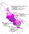
Dialetti abruzzesi settentrionali 2.PNG 960 × 704; 1,024 KB
-
Dialetti abruzzesi settentrionali.png 898 × 704; 1.1 MB
-
Dialetti italiani centrali.jpg 327 × 335; 38 KB
-
Eccellenza 2013-14.png 500 × 470; 37 KB
-
Eccellenza Abruzzese 2012-13.png 500 × 470; 37 KB
-
Map Abruzzo and Molise 1928 - Touring Club Italiano CART-TRC-01.jpg 7,497 × 5,642; 20.2 MB
-
Map Cultural heritage and environment IV 1992 - Touring Club Italiano CART-TEM-115.jpg 5,000 × 3,429; 11.24 MB
-
Map of Baronia di Carapelle.png 2,410 × 2,249; 541 KB
-
Neapolitan language.jpg 441 × 514; 132 KB
-
Neapolitan languages-it.svg 441 × 514; 180 KB
-
Neapolitan languages.svg 441 × 514; 60 KB
-
Oliva Ascolana del Piceno.png 462 × 560; 77 KB
-
Ordinary statute regions of Italy.svg 735 × 867; 74 KB
-
Parco-Gran Sasso-Posizione.png 269 × 313; 36 KB
-
Pescara in Italy.svg 1,034 × 1,299; 1.88 MB
-
Pescara posizione.png 350 × 424; 11 KB
-
Promozione 2012-13.png 500 × 470; 50 KB
-
Promozione abruzzese 2011-12.png 500 × 470; 55 KB
-
Regione thumb Abruzzo.svg 160 × 150; 127 KB
-
Sabina map.png 160 × 160; 9 KB
-
Squadre Eccellenza Abruzzese 2011-12.jpg 500 × 470; 50 KB
-
Teramo in Italy.svg 1,034 × 1,299; 1.88 MB
-
Teramo posizione.png 350 × 424; 11 KB
-
TraforoGranSassoMappa.png 600 × 580; 81 KB
-
Tratturo-Celano-Foggia.jpg 340 × 255; 24 KB
-
Tratturo-Centurelle-Montesecco.jpg 340 × 255; 24 KB
-
Tratturo-LAquila-Foggia.jpg 340 × 255; 24 KB
-
Tratturo-Pescasseroli-Candela.jpg 340 × 255; 24 KB
-
Variazioni confine Abruzzo nord.PNG 1,020 × 591; 33 KB
-
Variazioni confine Abruzzo sud.PNG 1,020 × 591; 44 KB
-
Vias del comercio de los Picenos.svg 340 × 410; 49 KB
-
Vie del commercio dei Piceni.svg 350 × 420; 55 KB
-
Zone-Alto-Sangro-Posizione.jpg 500 × 586; 32 KB

