Category:Old maps of Calabria
Jump to navigation
Jump to search
- Regions of Italy: Abruzzo · Aosta Valley · Apulia · Basilicata · Calabria · Campania · Emilia-Romagna · Friuli-Venezia Giulia · Lazio · Liguria · Lombardy · Marche · Molise · Piedmont · Sardinia · Sicily · Trentino-South Tyrol · Tuscany · Umbria · Veneto
Use the appropriate category for maps showing all or a large part of Calabria. See subcategories for smaller areas:
| If the map shows | Category to use |
|---|---|
| Calabria on a recently created map | Category:Maps of Calabria or its subcategories |
| Calabria on a map created more than 70 years ago | Category:Old maps of Calabria or its subcategories |
| the history of Calabria on a recently created map | Category:Maps of the history of Calabria or its subcategories |
| the history of Calabria on a map created more than 70 years ago | Category:Old maps of the history of Calabria or its subcategories |
Subcategories
This category has the following 5 subcategories, out of 5 total.
Media in category "Old maps of Calabria"
The following 56 files are in this category, out of 56 total.
-
ItalySouth1849.jpg 1,829 × 1,619; 779 KB
-
Meyers b11 s0515.jpg 800 × 1,275; 435 KB
-
Stielers Handatlas 1891 26.jpg 4,200 × 5,150; 5.05 MB
-
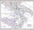
Butler Italiæ Pars Meridionalis.jpg 3,397 × 2,003; 2.3 MB
-
Butler Italiæ Pars Meridionalis (Part Calabria).jpg 1,120 × 1,120; 1.26 MB
-
7 - Süditalien, Straße von Otranto; Scheda-Karte europ Türkei.jpg 5,951 × 4,502; 27.35 MB
-
A. Zatta - Il Regno di Napoli diviso nelle sue Provincie - 1782.PNG 1,251 × 1,621; 4.47 MB
-
Carta Geografica Della Sicilia Prima o sia Regno Di Napoli 02.jpg 6,171 × 9,287; 13.37 MB
-
Cartina Monteleone 1710.jpg 2,042 × 1,712; 1.3 MB
-
Castello di Amantea.jpg 2,248 × 1,370; 890 KB
-
Certosa Serra San Bruno - Mappa del feudo (1765).jpg 3,125 × 2,277; 5.45 MB
-
Eliseo.jpg 638 × 800; 201 KB
-
Fabrizia Prunari Cropanei TerritorioNel700.png 1,141 × 800; 107 KB
-
Golfo di S. Eufemia.jpg 3,167 × 2,364; 6.1 MB
-
Italia - di Matteo Greuter... - btv1b525056959 (16 of 24).jpg 10,294 × 7,734; 10.45 MB
-
Italia - di Matteo Greuter... - btv1b525056959 (23 of 24).jpg 10,281 × 7,725; 11.54 MB
-
Italia colonie.jpg 298 × 433; 173 KB
-
Italy (South) 1050.jpg 548 × 575; 100 KB
-
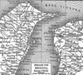
Karte der Strasse von Messina.jpg 524 × 472; 97 KB
-
Karte Str von Messina MKL1888.png 541 × 485; 94 KB
-
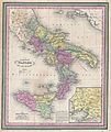
Koenigreich beider Sizilien.jpg 428 × 374; 43 KB
-
Maps of Apulia and of Calabria by Abraham Ortelius.jpeg 1,606 × 1,194; 531 KB
-
Messignadi Calabria Ultra.jpg 960 × 1,217; 212 KB
-
Messignadi Magini.jpg 641 × 610; 85 KB
-
NAPOLITANIA.PNG 504 × 644; 313 KB
-
Calabria (NYPL b13967336-5206899).tiff 7,758 × 10,326, 2 pages; 229.46 MB
-
Mappa grande reggio.jpg 760 × 959; 236 KB
-
SanBernardino '10.jpg 1,961 × 1,362; 1.22 MB
-
Shepherd - Bruttium (Calabria) - 1911 - Petelia.png 415 × 599; 446 KB
-
Shepherd - Bruttium (Calabria) - 1911.png 457 × 660; 546 KB
-
Shepherd-c-030-031.jpg 1,989 × 1,528; 629 KB
-
Thema di calabria anno mille.jpg 500 × 508; 147 KB
-
Torri costiere lametino curinga calabria.jpg 1,831 × 1,025; 410 KB
-
Vallardi - Calabria citeriore.jpg 6,374 × 4,237; 12.45 MB
-
Vallardi - Calabria ulteriore prima.jpg 6,348 × 4,274; 12.75 MB
-
Vallardi - Calabria ulteriore seconda.jpg 6,344 × 4,224; 11.68 MB
-
Vatikanische Museen 59.jpg 6,720 × 4,480; 36.87 MB


