Category:SVG maps of Pennsylvania
Jump to navigation
Jump to search
States of the United States: Alabama · Alaska · Arizona · Arkansas · California · Colorado · Connecticut · Delaware · Florida · Georgia · Hawaii · Idaho · Illinois · Indiana · Iowa · Kansas · Kentucky · Louisiana · Maine · Maryland · Massachusetts · Michigan · Minnesota · Mississippi · Missouri · Montana · Nebraska · Nevada · New Hampshire · New Jersey · New Mexico · New York · North Carolina · North Dakota · Ohio · Oklahoma · Oregon · Pennsylvania · Rhode Island · South Carolina · South Dakota · Tennessee · Texas · Utah · Vermont · Virginia · Washington · West Virginia · Wisconsin · Wyoming – Washington, D.C.
American Samoa · Guam · Northern Mariana Islands · Puerto Rico – Navassa Island · Palmyra Atoll
American Samoa · Guam · Northern Mariana Islands · Puerto Rico – Navassa Island · Palmyra Atoll
A collection of maps of Pennsylvania or portions thereof in SVG format.
Subcategories
This category has the following 3 subcategories, out of 3 total.
Media in category "SVG maps of Pennsylvania"
The following 71 files are in this category, out of 71 total.
-
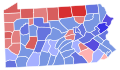
 1854 Pennsylvania gubernatorial election results map by county.svg 800 × 461; 716 KB
-
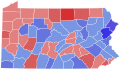
 1857 Pennsylvania gubernatorial election results map by county.svg 800 × 462; 721 KB
-
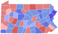
 1863 Pennsylvania gubernatorial election results map by county.svg 794 × 472; 289 KB
-
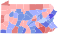
 1866 Pennsylvania gubernatorial election results map by county.svg 810 × 471; 50 KB
-
 1869 Pennsylvania gubernatorial election results map by county.svg 810 × 471; 50 KB
-
 1872 Pennsylvania gubernatorial election results map by county.svg 810 × 471; 50 KB
-
 1875 Pennsylvania gubernatorial election results map by county.svg 810 × 471; 50 KB
-
 1878 Pennsylvania gubernatorial election results map by county.svg 810 × 471; 50 KB
-
 1882 Pennsylvania gubernatorial election results map by county.svg 810 × 471; 50 KB
-
 1886 Pennsylvania gubernatorial election results map by county.svg 810 × 471; 50 KB
-
 1890 Pennsylvania gubernatorial election results map by county.svg 810 × 471; 50 KB
-
 1894 Pennsylvania gubernatorial election results map by county.svg 810 × 471; 50 KB
-
 1902 Pennsylvania gubernatorial election results map by county.svg 810 × 471; 50 KB
-
 1926 Pennsylvania gubernatorial election results map by county.svg 810 × 471; 50 KB
-
 1930 Pennsylvania gubernatorial election results map by county.svg 810 × 471; 50 KB
-
 1934 Pennsylvania gubernatorial election results map by county.svg 810 × 471; 50 KB
-
 1938 Pennsylvania gubernatorial election results map by county.svg 810 × 471; 50 KB
-
 1942 Pennsylvania gubernatorial election results map by county.svg 810 × 471; 50 KB
-
 Area Map of Lackawanna County, Moosic Borough.svg 3,550 × 5,500; 102 KB
-
 Area Map of Lackawanna County, Scranton.svg 3,550 × 5,500; 104 KB
-
 Battle of Gettysburg, July 1, 1863, Nightfall - ru.svg 1,519 × 1,155; 949 KB
-
 Battle of Gettysburg, July 1, Heth's attack - ru.svg 813 × 873; 599 KB
-
 COVID-19 Cases in Pennsylvania by counties.svg 512 × 298; 124 KB
-
 COVID-19 outbreak Pennsylvania per capita cases map.svg 512 × 259; 127 KB
-
 Delaware-wedge mk.svg 400 × 400; 58 KB
-
 Eastern District of Pennsylvania (map).svg 501 × 288; 190 KB
-
 Flag-map of Pennsylvania.svg 1,129 × 641; 824 KB
-
 LGBT flag map of Pennsylvania.svg 4,950 × 2,840; 22 KB
-
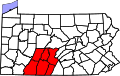 Map of PA Southern Alleghenies.svg 763 × 480; 508 KB
-
 Map of USA Commonwealths.svg 286 × 186; 169 KB
-
 Marcellus Bedrock.svg 540 × 540; 1.21 MB
-
 Middle District of Pennsylvania (map).svg 501 × 288; 190 KB
-
 Nanfan-es.svg 512 × 396; 1.86 MB
-
 Nanfan.svg 512 × 396; 1.48 MB
-
 Nya Sverige.svg 720 × 1,260; 461 KB
-
 PA State House districts blank (2003-2015).svg 5,000 × 2,873; 2.92 MB
-
 PA-739 map.svg 1,475 × 860; 211 KB
-
 Pennsylvania county map, cb 500k.svg 810 × 471; 44 KB
-
 Pennsylvania Dutch USC2000 PHS.svg 959 × 593; 173 KB
-
 Pennsylvania Farm Concentration by County.svg 209 × 122; 41 KB
-
 Pennsylvania Köppen.svg 1,305 × 1,170; 714 KB
-
 Pennsylvania Locator Map with US.svg 800 × 573; 1.22 MB
-
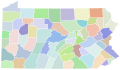
 Pennsylvania Municipalities.svg 4,954 × 2,850; 9.14 MB
-
 Pennsylvania Presidential Election Results by County, 1936.svg 209 × 122; 40 KB
-
 Pennsylvania Presidential Election Results by County, 1944.svg 209 × 122; 39 KB
-
 Pennsylvania Presidential Election Results by County, 1948.svg 209 × 122; 39 KB
-
 Pennsylvania Presidential Election Results by County, 1952.svg 209 × 122; 39 KB
-
 Pennsylvania Presidential Election Results by County, 1956.svg 209 × 122; 39 KB
-
 Pennsylvania Presidential Election Results by County, 1960.svg 209 × 122; 39 KB
-
 Pennsylvania Presidential Election Results by County, 1968.svg 209 × 122; 39 KB
-
 Pennsylvania Presidential Election Results by County, 1972.svg 209 × 122; 39 KB
-
 Pennsylvania Presidential Election Results by County, 1976.svg 209 × 122; 39 KB
-
 Pennsylvania Presidential Election Results by County, 1980.svg 209 × 122; 39 KB
-
 Pennsylvania Presidential Election Results by County, 1984.svg 209 × 122; 39 KB
-
 Pennsylvania Presidential Election Results by County, 1988.svg 209 × 122; 39 KB
-
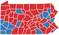
 Pennsylvania Presidential Election Results by County, 2012.svg 209 × 122; 39 KB
-
 Pennsylvania presidential election results by county, 2012.svg 223 × 130; 42 KB
-
 Pennsylvania racial and ethnic map.svg 223 × 130; 19 KB
-

-
 Pennsylvania swine flu map.svg 4,950 × 2,846; 107 KB
-
 Perkiomen Trail Map.svg 900 × 900; 461 KB
-
 Presbytery of Redstone map.svg 159 × 137; 208 KB
-
 Raid on Chambersburg - ru.svg 1,473 × 1,549; 833 KB
-
 Route NYC NiagaraFalls.svg 1,052 × 744; 224 KB
-
 Synod of the Trinity map - border.svg 159 × 137; 208 KB
-
 Synod of the Trinity map.svg 130 × 130; 69 KB
-
 The fight for Little Round Top - ru.svg 690 × 892; 33 KB
-
 USA Pennsylvania location map.svg 1,201 × 805; 146 KB
-
 USA Pennsylvania relief location map.svg 1,201 × 805; 3.13 MB
-
 Washington Presbytery map.svg 159 × 137; 208 KB
-
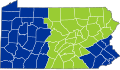
 Western District of Pennsylvania (map).svg 501 × 288; 190 KB


.svg)


.svg)


.svg)
.svg)