Category:SVG maps of New York (state)
Jump to navigation
Jump to search
States of the United States: Alabama · Alaska · Arizona · Arkansas · California · Colorado · Connecticut · Delaware · Florida · Georgia · Hawaii · Idaho · Illinois · Indiana · Iowa · Kansas · Kentucky · Louisiana · Maine · Maryland · Massachusetts · Michigan · Minnesota · Mississippi · Missouri · Montana · Nebraska · Nevada · New Hampshire · New Jersey · New Mexico · New York · North Carolina · North Dakota · Ohio · Oklahoma · Oregon · Pennsylvania · Rhode Island · South Carolina · South Dakota · Tennessee · Texas · Utah · Vermont · Virginia · Washington · West Virginia · Wisconsin · Wyoming – Washington, D.C.
American Samoa · Guam · Northern Mariana Islands · Puerto Rico – Navassa Island · Palmyra Atoll
American Samoa · Guam · Northern Mariana Islands · Puerto Rico – Navassa Island · Palmyra Atoll
Subcategories
This category has the following 5 subcategories, out of 5 total.
Media in category "SVG maps of New York (state)"
The following 94 files are in this category, out of 94 total.
-
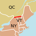
45th parallel US Canada.svg 250 × 250; 32 KB
-
Adirondack Park map with Blue Line.svg 936 × 768; 95 KB
-
Area code 212.svg 819 × 1,013; 58 KB
-
Area code 315.svg 819 × 1,013; 70 KB
-
Area code 347.svg 819 × 1,013; 70 KB
-
Area code 516.svg 819 × 1,013; 70 KB
-
Area code 518.svg 819 × 1,013; 70 KB
-
Area code 585.svg 819 × 1,013; 70 KB
-
Area code 607.svg 819 × 1,013; 70 KB
-
Area code 631.svg 819 × 1,013; 70 KB
-
Area code 716.svg 819 × 1,013; 70 KB
-
Area code 845.svg 819 × 1,013; 70 KB
-
Area code 914.svg 819 × 1,013; 70 KB
-
Area code 917.svg 819 × 1,013; 70 KB
-
Avogadro number cube visualisation.svg 512 × 768; 124 KB
-
Beacon.svg 677 × 541; 343 KB
-
Buffaloniagara.svg 633 × 476; 418 KB
-
Burned over district.svg 1,572 × 1,277; 613 KB
-
COVID-19 Cases in New York (state) by counties (Confirmed).svg 512 × 384; 392 KB
-
Early Localization Native Americans NY - Red-Green Coloring.svg 936 × 766; 291 KB
-
Early Localization Native Americans NY-es.svg 936 × 768; 299 KB
-
Early Localization Native Americans NY.svg 936 × 768; 291 KB
-
Erie County New York incorporated and unincorporated areas Buffalo highlighted.svg 1,300 × 740; 2.74 MB
-
Essex County NY map.svg 1,450 × 860; 1.81 MB
-
Fire Island-NY-USA-Location Map-01.svg 670 × 299; 215 KB
-
Flag map of New York (1909–2020).svg 1,172 × 880; 230 KB
-
Flag-map of New York.svg 1,172 × 880; 191 KB
-
Largest ancestry of each New York county (en).svg 633 × 476; 439 KB
-
LGBT flag map of New York.svg 632 × 475; 49 KB
-
Long Island location map.svg 512 × 416; 237 KB
-
Map - Clarence NY.svg 1,235 × 1,653; 2.64 MB
-
Map - Letchworth State Park - overview.svg 2,400 × 2,100; 1.55 MB
-
Map - New York - Liberty League locations.svg 1,572 × 1,277; 602 KB
-
Map - New York - NCAA Division I colleges.svg 1,572 × 1,277; 507 KB
-
Map - Orleans County NY.svg 3,418 × 3,008; 3.66 MB
-
Map - Palmyra NY 02.svg 1,171 × 1,086; 4.17 MB
-
Map of New York County Outlines.svg 633 × 476; 506 KB
-
Map of New York Economic Regions.svg 633 × 476; 552 KB
-
Map of New York highlighting Capital District.svg 6,599 × 5,030; 125 KB
-
Map of New York highlighting Hudson Valley 2.svg 512 × 390; 273 KB
-
Map of New York highlighting Hudson Valley.svg 512 × 390; 285 KB
-
Map of New York highlighting Nassau County.svg 1,100 × 838; 66 KB
-
Map of New York highlighting Tech Valley.svg 633 × 476; 472 KB
-
Map of New York Metropolitan Areas.svg 633 × 476; 584 KB
-
Map of USA NY.svg 286 × 186; 167 KB
-
Marcellus Bedrock.svg 540 × 540; 1.21 MB
-
Monroe County (New York) - Towns, Villages, and City.svg 1,500 × 1,406; 73 KB
-
Nanfan-es.svg 512 × 396; 1.86 MB
-
Nanfan.svg 512 × 396; 1.48 MB
-
NENY (8).svg 2,560 × 1,920; 8 KB
-
New York - Southern Tier region map.svg 3,336 × 1,139; 1.31 MB
-
New York Adirondack.svg 936 × 768; 95 KB
-
New York Ancestry.svg 512 × 663; 2.79 MB
-
New York City Council Election 2013 - Party Strength By District.svg 750 × 732; 268 KB
-
New york counties by race.svg 635 × 476; 401 KB
-
New York Counties Map (without water).svg 1,200 × 800; 212 KB
-
New York Counties Map.svg 1,200 × 800; 203 KB
-
New York Counties—Nassau.svg 655 × 500; 427 KB
-
New York county map, cb 500k.svg 810 × 621; 62 KB
-
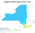
New York Köppen.svg 1,440 × 1,350; 939 KB
-
New York Landscape Regions.svg 735 × 536; 487 KB
-
New York off-track betting corporations.svg 633 × 476; 454 KB
-
New York racial and ethnic map.svg 480 × 379; 19 KB
-
New York State Department Economic Development Regions.svg 633 × 476; 454 KB
-
New York state geographic map-en.svg 2,811 × 2,000; 18.34 MB
-
New York State Municipalities.svg 512 × 391; 4.71 MB
-
NewYork.svg 512 × 663; 2.77 MB
-
Normanskill Watershed, New York (en).svg 1,275 × 901; 1.53 MB
-
Normanskill Watershed, New York.svg 1,275 × 901; 1.39 MB
-
NY Comptroller Election, 2006.svg 810 × 621; 67 KB
-
Nyhouse22retirements.svg 640 × 480; 77 KB
-
NYS Tug Hill Region and Core.svg 1,052 × 744; 375 KB
-
NYSA22Incumbents.svg 1,111 × 1,000; 988 KB
-
NYSDEC regions map.svg 633 × 476; 518 KB
-
NYSDOT regions map.svg 633 × 476; 463 KB
-
NYSS20Percents.svg 800 × 1,153; 223 KB
-
NYSSIncumbents22.svg 1,100 × 1,339; 594 KB
-
Oakwood Map.svg 1,361 × 2,742; 128 KB
-
Orleans County (New York) - Towns and Villages.svg 1,500 × 1,100; 28 KB
-
Proposed map of Long Island and New York City as independent state.svg 6,599 × 5,030; 112 KB
-
Route NYC NiagaraFalls.svg 1,052 × 744; 224 KB
-
Staten Island Ferry OSM Map.svg 1,556 × 1,556; 10.37 MB
-
Upstatenewyorkinblue.svg 633 × 475; 445 KB
-
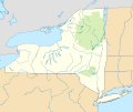
USA New York location map.svg 1,569 × 1,276; 427 KB
-
USA New York location map2.svg 1,569 × 1,276; 428 KB
-
USA New York rel location map.svg 1,569 × 1,276; 2.55 MB
-
USA New York relief location map.svg 1,569 × 1,276; 3.53 MB
-
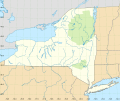
USA New York rivers locator map with grid.svg 900 × 600; 664 KB
-
USA New York rivers locator map.svg 900 × 600; 437 KB
-
USA New York rivers NAD27 locator map with grid.svg 900 × 750; 561 KB
-
USA New York rivers NAD27 locator map.svg 900 × 750; 453 KB
-
USA New York Tri State NYC area.svg 512 × 324; 531 KB
-
WenroSVG.svg 936 × 768; 772 KB


