Category:SVG maps of Ohio
Jump to navigation
Jump to search
States of the United States: Alabama · Alaska · Arizona · Arkansas · California · Colorado · Connecticut · Delaware · Florida · Georgia · Hawaii · Idaho · Illinois · Indiana · Iowa · Kansas · Kentucky · Louisiana · Maine · Maryland · Massachusetts · Michigan · Minnesota · Mississippi · Missouri · Montana · Nebraska · Nevada · New Hampshire · New Jersey · New Mexico · New York · North Carolina · North Dakota · Ohio · Oklahoma · Oregon · Pennsylvania · Rhode Island · South Carolina · South Dakota · Tennessee · Texas · Utah · Vermont · Virginia · Washington · West Virginia · Wisconsin · Wyoming – Washington, D.C.
American Samoa · Guam · Northern Mariana Islands · Puerto Rico – Navassa Island · Palmyra Atoll
American Samoa · Guam · Northern Mariana Islands · Puerto Rico – Navassa Island · Palmyra Atoll
Subcategories
This category has the following 2 subcategories, out of 2 total.
Media in category "SVG maps of Ohio"
The following 76 files are in this category, out of 76 total.
-
 133OHHouse.svg 1,243 × 1,021; 3.06 MB
-
 133OHSenate.svg 819 × 886; 1.84 MB
-
 134OHHouse.svg 1,243 × 1,021; 3.06 MB
-
 134OHSenate.svg 798 × 865; 1.84 MB
-
 2009 Ohio General Election Issue 1.svg 3,675 × 3,995; 230 KB
-
 2009 Ohio General Election Issue 2.svg 3,675 × 3,995; 230 KB
-
 2009 Ohio General Election Issue 3.svg 3,675 × 3,995; 277 KB
-
 2010 United States Senate election in Ohio results map by county.svg 810 × 810; 39 KB
-
 Amish in Ohio locator map.svg 512 × 545; 516 KB
-
 ARC-Ohio-designations-2012.svg 3,551 × 4,300; 46 KB
-
 Area codes OH.svg 586 × 610; 44 KB
-
 Black Swamp.svg 538 × 401; 315 KB
-
 Cleveland Interstate Highways map.svg 440 × 258; 224 KB
-
 Flag Map of Ohio.svg 391 × 425; 64 KB
-
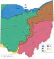 Geographic regions Ohio with numbers.svg 948 × 1,028; 870 KB
-
 Geographic regions ohio.svg 650 × 870; 237 KB
-
 I-270 (OH) map.svg 1,475 × 860; 415 KB
-
 I-271 (OH) map.svg 1,475 × 860; 414 KB
-
 I-277 (OH) map.svg 1,475 × 860; 413 KB
-
 I-280 (OH) map.svg 1,475 × 860; 412 KB
-
 I-475 (OH) map.svg 1,475 × 860; 412 KB
-
 I-480 (OH) map.svg 1,475 × 860; 416 KB
-
 I-490 (OH) map.svg 1,475 × 860; 417 KB
-
 I-670 (OH) map.svg 1,475 × 860; 413 KB
-
 I-675 (OH) map.svg 1,475 × 860; 413 KB
-
 I-680 (OH) map.svg 1,475 × 860; 413 KB
-
 I-70 (OH) map.svg 1,475 × 860; 323 KB
-
 I-74 (OH) map.svg 1,475 × 860; 324 KB
-
 I-75 (OH) map.svg 1,475 × 860; 412 KB
-
 I-76 (OH) map.svg 1,475 × 860; 413 KB
-
 I-77 (OH) map.svg 1,475 × 860; 412 KB
-
 I-80 (OH) map.svg 1,475 × 860; 413 KB
-
 I-90 (OH) map.svg 1,475 × 860; 413 KB
-
 LGBT flag map of Ohio.svg 3,675 × 3,995; 29 KB
-
 Map of Ohio highlighting Cuyahoga County.svg 1,050 × 1,141; 37 KB
-
 Map of USA OH.svg 286 × 186; 167 KB
-
 Marcellus Bedrock.svg 540 × 540; 1.21 MB
-
 Mid Ohio Counties.svg 3,675 × 3,995; 154 KB
-
 Municipalities in Hamilton County, Ohio.svg 934 × 702; 2.07 MB
-
 Nanfan-es.svg 512 × 396; 1.86 MB
-
 Nanfan.svg 512 × 396; 1.48 MB
-
 NE Ohio Counties.svg 3,675 × 3,995; 154 KB
-
 NW Ohio Counties.svg 3,675 × 3,995; 154 KB
-
 Ohio Associate Justice 2020 Brunner French.svg 810 × 810; 39 KB
-
 Ohio Canals Map.svg 942 × 1,009; 109 KB
-
 Ohio change in population by county 2010 to 2020.svg 3,675 × 3,995; 154 KB
-
 Ohio Counties Labeled proposal.svg 3,675 × 3,995; 153 KB
-
 Ohio Counties Labeled White ja.svg 3,675 × 3,995; 150 KB
-
 Ohio Counties Labeled White.svg 3,675 × 3,995; 154 KB
-
 Ohio county map, cb 500k.svg 810 × 810; 32 KB
-
 Ohio Gubernatorial Election Results by County, 2010.svg 230 × 260; 41 KB
-
 Ohio Highway Patrol Map.svg 3,690 × 4,010; 257 KB
-
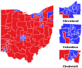
 Ohio House 2020 Election.svg 1,243 × 1,021; 3.06 MB
-
 Ohio Köppen.svg 945 × 1,350; 628 KB
-
 Ohio Lands.svg 323 × 364; 242 KB
-
 Ohio map of Köppen climate classification.svg 1,900 × 1,900; 105 KB
-
 Ohio Presidential Election Results by County, 2008.svg 230 × 260; 40 KB
-
 Ohio racial and ethnic map.svg 230 × 260; 38 KB
-
 Ohio Senate 2018 Election.svg 819 × 886; 1.84 MB
-
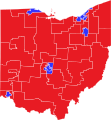
 Ohio Senate 2020 Election.svg 819 × 886; 1.84 MB
-
 Ohio State Route 161 map.svg 2,899 × 1,719; 1.84 MB
-
 Ohio State Route 228 map.svg 2,899 × 1,719; 180 KB
-
 Ohio State Route 249 map.svg 2,899 × 1,719; 481 KB
-
 Ohio State Route 253 map.svg 3,425 × 2,031; 276 KB
-
 Ohio State Route 300 map.svg 2,899 × 1,719; 149 KB
-
 Ohio State Route 710 map.svg 2,899 × 1,719; 276 KB
-
 Ohio stub.svg 147 × 164; 21 KB
-
 Ohio-gsusa.svg 3,675 × 3,995; 73 KB
-
 Ohio’s counties and their county route shields.svg 3,675 × 3,995; 715 KB
-
 OHMap-doton-Centerburg.svg 3,675 × 3,995; 66 KB
-
 OHMap-doton-Columbus.svg 3,675 × 3,995; 62 KB
-
 SE Ohio Counties.svg 3,675 × 3,995; 154 KB
-
 SW Ohio Counties.svg 3,675 × 3,995; 154 KB
-
 ToledoStrip.svg 239 × 88; 44 KB
-
 USA Ohio location map.svg 1,010 × 1,200; 455 KB
-
 USA Ohio relief location map.svg 1,010 × 1,200; 2.71 MB


_map.svg)
_map.svg)
_map.svg)
_map.svg)
_map.svg)
_map.svg)
_map.svg)
_map.svg)
_map.svg)
_map.svg)
_map.svg)
_map.svg)
_map.svg)
_map.svg)
_map.svg)
_map.svg)
_map.svg)


