Category:Maps of Pennsylvania
Jump to navigation
Jump to search
States of the United States: Alabama · Alaska · Arizona · Arkansas · California · Colorado · Connecticut · Delaware · Florida · Georgia · Hawaii · Idaho · Illinois · Indiana · Iowa · Kansas · Kentucky · Louisiana · Maine · Maryland · Massachusetts · Michigan · Minnesota · Mississippi · Missouri · Montana · Nebraska · Nevada · New Hampshire · New Jersey · New Mexico · New York · North Carolina · North Dakota · Ohio · Oklahoma · Oregon · Pennsylvania · Rhode Island · South Carolina · South Dakota · Tennessee · Texas · Utah · Vermont · Virginia · Washington · West Virginia · Wisconsin · Wyoming – Washington, D.C.
insular area of the United States: American Samoa · Guam · Northern Mariana Islands · Puerto Rico · United States Virgin Islands – United States Minor Outlying Islands: Baker Island · Howland Island · Jarvis Island · Johnston Atoll · Kingman Reef · Midway Atoll · Navassa Island · Palmyra Atoll · Wake Island
insular area of the United States: American Samoa · Guam · Northern Mariana Islands · Puerto Rico · United States Virgin Islands – United States Minor Outlying Islands: Baker Island · Howland Island · Jarvis Island · Johnston Atoll · Kingman Reef · Midway Atoll · Navassa Island · Palmyra Atoll · Wake Island
Wikimedia category | |||||
| Upload media | |||||
| Instance of | |||||
|---|---|---|---|---|---|
| Category combines topics | |||||
| Pennsylvania | |||||
state of the United States of America | |||||
| Pronunciation audio | |||||
| Instance of |
| ||||
| Part of | |||||
| Named after | |||||
| Location |
| ||||
| Located in or next to body of water |
| ||||
| Capital | |||||
| Legislative body | |||||
| Executive body | |||||
| Highest judicial authority | |||||
| Anthem |
| ||||
| Head of government |
| ||||
| Inception |
| ||||
| Highest point | |||||
| Population |
| ||||
| Area |
| ||||
| Elevation above sea level |
| ||||
| Follows |
| ||||
| Replaces |
| ||||
| Maximum temperature record |
| ||||
| Minimum temperature record |
| ||||
| official website | |||||
 | |||||

This a category for Maps of the State of Pennsylvania, a commonwealth in the United States of America.
Subcategories
This category has the following 37 subcategories, out of 37 total.
Media in category "Maps of Pennsylvania"
The following 156 files are in this category, out of 156 total.
-
1795 Schuykill Navigation company Map for PA canals.jpg 2,047 × 1,494; 2.03 MB
-
1884 Jersey Reynolds & Nottingham Collieries Plymouth PA.jpg 2,674 × 2,674; 3.88 MB
-
1990 NPS AIHP graphic.jpg 1,408 × 746; 517 KB
-
315 of 'La Vie Américaine. Ouvrage illustré, etc' (11218587076).jpg 1,815 × 1,480; 566 KB
-
6um2yxtbowpdkIn9gcZ3IPjgcZ8XrABvehn1Tfd0gFE.png 1,024 × 672; 475 KB
-
A Map of the State of Pennsylvania - NARA - 102278756 (page 1).jpg 9,834 × 7,174; 5.94 MB
-
A Map of the State of Pennsylvania - NARA - 102278756 (page 2).jpg 9,957 × 7,110; 7.43 MB
-
A Map of the State of Pennsylvania - NARA - 102278756 (page 3).jpg 9,916 × 6,956; 7.91 MB
-
A Map of the State of Pennsylvania - NARA - 102278756 (page 4).jpg 10,059 × 6,858; 8.92 MB
-
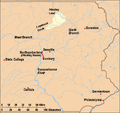
Alleghenies and Susquehanna Valley.jpg 480 × 471; 23 KB
-
Annual report of the Commissioner of Agriculture .. (1894-1911) (18429944815).jpg 2,656 × 1,979; 846 KB
-
Bethel Township Map.jpg 3,598 × 2,732; 1.09 MB
-
Bryn Mawr PA.png 422 × 359; 6 KB
-
Bulletin (Pennsylvania Department of Forestry), no. 20-24 (1901) (19878171344).jpg 4,192 × 2,488; 2.05 MB
-
Carlisle Barracks CDP (2020).jpg 1,344 × 787; 280 KB
-
Ceratiocaridæ from the upper Devonian measures in Warren County (1884) (20588554175).jpg 2,880 × 1,738; 1.31 MB
-
Combined biennial report for the period ending 1942-1946 (20657116792).jpg 4,368 × 2,510; 1.45 MB
-
Course and Watershed of Coon Run (East Branch Oil Creek tributary).jpg 1,056 × 816; 139 KB
-
Course and Watershed of Dunham Run (Pine Creek tributary).jpg 1,056 × 816; 186 KB
-
Cranberries; - the national cranberry magazine (1966) (20680126206).jpg 2,480 × 1,424; 431 KB
-
Crozer Chester Medical Center Campus Map.jpg 4,032 × 3,024; 1.19 MB
-
Cumberlandplateaumap.png 600 × 600; 539 KB
-
DC-DE-MD-PA-VA-WV Level IV ecoregions.pdf 5,100 × 6,300; 2.34 MB
-
Delaware Canal State Park2.PNG 290 × 170; 26 KB
-
Delaware01.png 1,182 × 1,387; 473 KB
-
Dellville, Shermans Creek tributaries, from USGS.jpg 614 × 432; 40 KB
-
Diocese Of Allegheny.svg 964 × 560; 394 KB
-
Eastern Pennsylvania - NARA - 26335557.jpg 6,176 × 8,448; 10.22 MB
-
Electric railway journal (1909) (14758075471).jpg 2,878 × 2,220; 1,013 KB
-
Erie Region.jpg 480 × 471; 23 KB
-
Family Life Network stations.png 1,848 × 1,236; 274 KB
-
Gastonvilleclean.jpg 700 × 595; 72 KB
-
Geo Map of Income by Location in Pennsylvania.png 1,122 × 882; 494 KB
-
German Pennsylvania.png 800 × 460; 46 KB
-
GreaterPennsylvaniaDutchCountry.png 800 × 460; 46 KB
-
Greatvalley-map.jpg 624 × 637; 385 KB
-
HighlandsConnecticutNewJerseyNewYorkPennsylvaniaMap.jpg 2,550 × 3,300; 529 KB
-
Homestead map from the darlington collection.png 863 × 593; 838 KB
-
Johnston properties USGS Topo 1964.jpg 991 × 853; 1.07 MB
-
Johnston properties USGS Topo 2001.jpg 1,086 × 865; 1.74 MB
-
Johnstown-Somerset, PA CSA 2014.jpg 976 × 545; 46 KB
-
JumonvilleGlennMap.png 328 × 423; 27 KB
-
Location Caln Township.png 1,446 × 829; 102 KB
-
Location map of Conewago Canal.png 1,807 × 986; 847 KB
-
Map of Bucks County, Pennsylvania - from surveys LOC 2012590185.jpg 11,537 × 16,689; 24.58 MB
-
Map of Bucks County, Pennsylvania - from surveys LOC 2012590185.tif 11,537 × 16,689; 550.86 MB
-
Map of Deitscherei.png 1,600 × 920; 272 KB
-
Map of Main Line of Public Work in Pennsylvania.png 1,807 × 986; 850 KB
-
Map of New Jersey and Pennsylvania WDL9594.png 1,376 × 1,024; 2.19 MB
-
Map of PA Allegheny National Forest.gif 800 × 460; 22 KB
-
Map of PA Coal Region.gif 800 × 460; 22 KB
-
Map of PA Cumberland Valley.gif 800 × 460; 21 KB
-
Map of PA Delaware Valley.gif 800 × 460; 22 KB
-
Map of PA Dutch Region.gif 808 × 468; 32 KB
-
Map of PA Endless Mountains.gif 800 × 460; 22 KB
-
Map of PA Highlands.gif 800 × 460; 22 KB
-
Map of PA Laurel Highlands.gif 800 × 460; 22 KB
-
Map of PA Lehigh Valley.gif 800 × 460; 21 KB
-
Map of PA Molly Maguires counties.svg 799 × 460; 44 KB
-
Map of PA Northeast.gif 808 × 468; 28 KB
-
Map of PA Northwest Region.gif 800 × 460; 22 KB
-
Map of PA Pittsburgh Metro Area.gif 800 × 460; 22 KB
-
Map of PA Poconos.gif 808 × 468; 30 KB
-
Map of PA Susquehanna Valley.gif 800 × 460; 23 KB
-
Map of PA Wyoming Valley.gif 800 × 460; 22 KB
-
Map of Pennsylvania province 1768.jpg 1,597 × 1,268; 786 KB
-
Map of Pennsylvania.jpg 3,501 × 2,937; 4.02 MB
-
Milford and NYC and Cambridge.GIF 216 × 103; 5 KB
-
Moshannon.png 1,650 × 1,275; 54 KB
-
Nanfan.jpg 994 × 768; 543 KB
-
New PA-9 Congressional District.jpg 621 × 541; 99 KB
-
NovaSveciae.jpg 1,114 × 1,810; 995 KB
-
NWPenn.png 1,920 × 1,104; 221 KB
-
Ohio1755.jpg 933 × 700; 131 KB
-
OldMapUnionTwp.LuzerneCounty.jpg 1,820 × 1,540; 348 KB
-
Original Lycoming County Pennsylvania Map.png 964 × 550; 41 KB
-
PA - State Police Troops.png 866 × 504; 309 KB
-
PA CENTRALIA NEW.PNG 3,300 × 2,550; 420 KB
-
Pa ct md va claims.gif 572 × 368; 19 KB
-
Pa ct md va claims2.gif 494 × 330; 16 KB
-
PA solar plants.png 675 × 405; 591 KB
-
PA Wilds location in Pennsylvania.jpg 2,000 × 1,262; 286 KB
-
PA Wilds Map.jpg 480 × 471; 24 KB
-
PA-Delaware-wedge.png 659 × 1,002; 470 KB
-
Pennsyltucky.png 722 × 454; 74 KB
-
Pennsylvania 90.jpg 1,194 × 825; 296 KB
-
Pennsylvania canals.png 759 × 414; 133 KB
-
Pennsylvania counties cities and boroughs with domestic partnerships.png 1,992 × 1,196; 226 KB
-
Pennsylvania Dutch Country Map.gif 800 × 460; 21 KB
-
Pennsylvania Dutch Country.jpg 480 × 471; 23 KB
-
Pennsylvania Electric Vehicle Map.png 1,901 × 882; 993 KB
-
Pennsylvania House District 98.png 1,192 × 625; 34 KB
-
Pennsylvania Köppen.png 6,000 × 5,519; 285 KB
-
Pennsylvania land purchases.png 1,300 × 773; 959 KB
-
Pennsylvania Map Counties Allegheny College Meadville.png 800 × 465; 110 KB
-
Pennsylvania newspaper map, August 2018.png 1,068 × 622; 620 KB
-
Pennsylvania population map 1.png 710 × 540; 41 KB
-
Pennsylvania Population Map Cropped.png 575 × 342; 100 KB
-
Pennsylvania population map.png 700 × 400; 179 KB
-
Pennsylvania state map outlines.png 865 × 532; 16 KB
-
Pennsylvania wind resource map 50m 800.jpg 1,100 × 850; 657 KB
-
Pennsylvania Wind Resource Map 80m wind map.PNG 685 × 517; 248 KB
-
Pennsylvania-2012 presidential election-by county.PNG 601 × 350; 11 KB
-
Physiographic provinces of Pennsylvania (26309605323).jpg 2,184 × 1,686; 2.38 MB
-
Pittsburgh Region.jpg 480 × 471; 24 KB
-
PittsburghMinedOut1973.png 805 × 1,533; 148 KB
-
Plunketts Creek Locator Map.PNG 256 × 147; 18 KB
-
Population density of Pennsylvania counties (2020).png 4,860 × 3,176; 1.41 MB
-
Priestley House Map for inset.png 529 × 500; 33 KB
-
Priestley House Map with inset 1.png 529 × 500; 78 KB
-
Priestley House Map with inset.png 529 × 500; 77 KB
-
Priestley House Map.png 529 × 500; 20 KB
-
PSAC Locations and Divisions.png 800 × 460; 83 KB
-
Rainsburg 1861 Map LOC.jpg 749 × 929; 999 KB
-
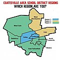
Regionscoatesville.jpg 415 × 416; 33 KB
-
Rothrock.png 1,650 × 1,275; 150 KB
-
Scranton Neighborhoods.png 505 × 658; 72 KB
-
Sproul State Park.png 1,564 × 1,199; 127 KB
-
Susquehannock.png 1,248 × 955; 64 KB
-
The American midland naturalist (1909) (17969106480).jpg 3,136 × 2,079; 415 KB
-
The American midland naturalist (1909) (18156797685).jpg 3,136 × 2,022; 731 KB
-
The wedge delaware.JPG 636 × 463; 29 KB
-
The Wedge.png 640 × 463; 128 KB
-
ThesisJimThorpeWiki.png 1,986 × 1,656; 2.52 MB
-
Tiadaghton.png 1,513 × 1,159; 159 KB
-
Turkey Foot area map by G Washington.png 845 × 588; 613 KB
-
Tuscarora.png 1,248 × 955; 75 KB
-
Twelve-mile-circle.gif 539 × 475; 7 KB
-
U.S. Census Bureau map of Temple, Pennsylvania.gif 422 × 359; 24 KB
-
UA Flight 93-path-and-witness-locations.jpg 2,550 × 3,300; 1.03 MB
-
Union Canal Pennsylvania.png 759 × 414; 176 KB
-
Walking purchase de.png 1,300 × 773; 1.51 MB
-
Watershed of Beatty Run (Sugar Creek tributary).jpg 1,056 × 816; 285 KB
-
Watershedmap.png 1,200 × 698; 169 KB

