Category:SVG maps of Oregon
Jump to navigation
Jump to search
States of the United States: Alabama · Alaska · Arizona · Arkansas · California · Colorado · Connecticut · Delaware · Florida · Georgia · Hawaii · Idaho · Illinois · Indiana · Iowa · Kansas · Kentucky · Louisiana · Maine · Maryland · Massachusetts · Michigan · Minnesota · Mississippi · Missouri · Montana · Nebraska · Nevada · New Hampshire · New Jersey · New Mexico · New York · North Carolina · North Dakota · Ohio · Oklahoma · Oregon · Pennsylvania · Rhode Island · South Carolina · South Dakota · Tennessee · Texas · Utah · Vermont · Virginia · Washington · West Virginia · Wisconsin · Wyoming – Washington, D.C.
American Samoa · Guam · Northern Mariana Islands · Puerto Rico – Navassa Island · Palmyra Atoll
American Samoa · Guam · Northern Mariana Islands · Puerto Rico – Navassa Island · Palmyra Atoll
Subcategories
This category has the following 2 subcategories, out of 2 total.
Media in category "SVG maps of Oregon"
The following 53 files are in this category, out of 53 total.
-
1954 Oregon gubernatorial election results map by county.svg 810 × 608; 34 KB
-
1956 Oregon gubernatorial special election results map by county.svg 810 × 608; 34 KB
-
1958 Oregon gubernatorial election results map by county.svg 810 × 608; 34 KB
-
1962 Oregon gubernatorial election results map by county.svg 810 × 608; 34 KB
-
1966 Oregon gubernatorial election results map by county.svg 810 × 608; 34 KB
-
1970 Oregon gubernatorial election results map by county.svg 810 × 608; 34 KB
-
1974 Oregon gubernatorial election results map by county.svg 810 × 608; 34 KB
-
1982 Oregon gubernatorial election results map by county.svg 744 × 565; 250 KB
-
1986 Oregon gubernatorial election results map by county.svg 744 × 565; 250 KB
-
1990 Oregon gubernatorial election results map by county.svg 810 × 608; 33 KB
-
1994 Oregon gubernatorial election results map by county.svg 810 × 608; 33 KB
-
2002 Oregon gubernatorial election results map by county.svg 810 × 608; 34 KB
-
Columbia gorge topographic map-fr.svg 682 × 359; 2.84 MB
-
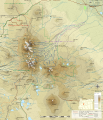
Diamond Peak topographic map-fr.svg 3,543 × 2,863; 2.45 MB
-
Flag-map of Oregon.svg 718 × 535; 361 KB
-
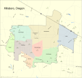
Hillsboro Map.svg 1,500 × 1,411; 1.12 MB
-
LGBT flag map of Oregon.svg 6,451 × 4,810; 54 KB
-
Mount Jefferson (Oregon) topographic map-fr.svg 1,772 × 1,369; 2.26 MB
-
Northwest Oregon.svg 1,280 × 965; 142 KB
-
Oregon 2006 Measure 43.svg 454 × 338; 472 KB
-
Oregon 2006 Measure 44.svg 454 × 339; 491 KB
-
Oregon Central Military Road.svg 1,994 × 1,518; 146 KB
-
Oregon Central Railroads.svg 1,120 × 640; 875 KB
-
Oregon counties by date of establishment.svg 810 × 608; 34 KB
-
Oregon county map, cb 500k.svg 810 × 608; 30 KB
-
Oregon Gubernatorial Election Results by County, 2010.svg 248 × 188; 33 KB
-
Oregon gubernatorial election, 1998.svg 248 × 188; 32 KB
-
Oregon House of Representatives Election 2016 - Results by District (Simple Map).svg 1,000 × 1,258; 434 KB
-
Oregon House of Representatives election, 2016 results by district (shaded).svg 1,000 × 1,258; 450 KB
-
Oregon Köppen.svg 1,260 × 1,359; 877 KB
-
Oregon Locator Map with US.svg 1,998 × 1,672; 768 KB
-
Oregon racial and ethnic map.svg 248 × 188; 20 KB
-
Oregon Regional Hunt Units.svg 6,461 × 4,821; 251 KB
-
Oregon State Senate 2020s blank map.svg 1,300 × 1,290; 1.76 MB
-
Oregon State Senate 2022 Election Results.svg 1,300 × 1,290; 1.76 MB
-
Oregon Wildlife Management Units.svg 6,461 × 4,821; 479 KB
-
Oregon-gsusa.svg 6,451 × 4,810; 159 KB
-
Regions of Oregon.svg 859 × 593; 146 KB
-
Southeastern Oregon.svg 1,280 × 965; 146 KB
-
Southern Oregon.svg 1,280 × 965; 146 KB
-
State of Jefferson Map.svg 744 × 1,052; 83 KB
-
Superfund sites in Oregon.svg 655 × 485; 346 KB
-
Three Sisters Range geologic map-fr.svg 3,305 × 4,351; 2.91 MB
-
Three Sisters Range topographic map-en.svg 3,305 × 4,351; 2.87 MB
-
Three Sisters Range topographic map-fr.svg 3,305 × 4,351; 3.73 MB
-
Three Sisters topographic map-fr.svg 2,835 × 3,300; 4.72 MB
-
Trails of Cascade Range map-fr.svg 403 × 693; 3.3 MB
-
Trails of Cascade Range map-it.svg 403 × 693; 2.65 MB
-
U.S. Route 199.svg 1,152 × 640; 92 KB
-
USA Oregon location map.svg 1,501 × 1,148; 410 KB
-
USA Oregon relief location map.svg 1,501 × 1,148; 4.8 MB


