Category:SVG maps of Vermont
Jump to navigation
Jump to search
States of the United States: Alabama · Alaska · Arizona · Arkansas · California · Colorado · Connecticut · Delaware · Florida · Georgia · Hawaii · Idaho · Illinois · Indiana · Iowa · Kansas · Kentucky · Louisiana · Maine · Maryland · Massachusetts · Michigan · Minnesota · Mississippi · Missouri · Montana · Nebraska · Nevada · New Hampshire · New Jersey · New Mexico · New York · North Carolina · North Dakota · Ohio · Oklahoma · Oregon · Pennsylvania · Rhode Island · South Carolina · South Dakota · Tennessee · Texas · Utah · Vermont · Virginia · Washington · West Virginia · Wisconsin · Wyoming – Washington, D.C.
American Samoa · Guam · Northern Mariana Islands · Puerto Rico – Navassa Island · Palmyra Atoll
American Samoa · Guam · Northern Mariana Islands · Puerto Rico – Navassa Island · Palmyra Atoll
Subcategories
This category has the following 2 subcategories, out of 2 total.
Media in category "SVG maps of Vermont"
The following 12 files are in this category, out of 12 total.
-
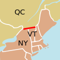
45th parallel US Canada.svg 250 × 250; 32 KB
-
Athens, Vermont.svg 512 × 857; 548 KB
-
LGBT flag map of Vermont.svg 1,567 × 2,550; 18 KB
-
Map of USA VT.svg 286 × 186; 167 KB
-
NRHP Vermont Map.svg 765 × 990; 2.21 MB
-
OtterCreekLocator.svg 744 × 1,052; 6 KB
-
USA Vermont location map.svg 1,277 × 2,100; 259 KB
-
USA Vermont relief location map.svg 1,277 × 2,100; 3.25 MB
-
Vermont county map, cb 500k.svg 810 × 810; 15 KB
-
Vermont Municipal Map.svg 1,407 × 2,274; 100 KB
-
Vermont racial and ethnic map.svg 89 × 154; 12 KB
-
Vermont Timezones Map.svg 92 × 167; 11 KB


