Category:SVG maps of Alaska
Jump to navigation
Jump to search
States of the United States: Alabama · Alaska · Arizona · Arkansas · California · Colorado · Connecticut · Delaware · Florida · Georgia · Hawaii · Idaho · Illinois · Indiana · Iowa · Kansas · Kentucky · Louisiana · Maine · Maryland · Massachusetts · Michigan · Minnesota · Mississippi · Missouri · Montana · Nebraska · Nevada · New Hampshire · New Jersey · New Mexico · New York · North Carolina · North Dakota · Ohio · Oklahoma · Oregon · Pennsylvania · Rhode Island · South Carolina · South Dakota · Tennessee · Texas · Utah · Vermont · Virginia · Washington · West Virginia · Wisconsin · Wyoming – Washington, D.C.
American Samoa · Guam · Northern Mariana Islands · Puerto Rico – Navassa Island · Palmyra Atoll
American Samoa · Guam · Northern Mariana Islands · Puerto Rico – Navassa Island · Palmyra Atoll
A collection of maps of Alaska or portions thereof in SVG format.
Subcategories
This category has the following 2 subcategories, out of 2 total.
Media in category "SVG maps of Alaska"
The following 57 files are in this category, out of 57 total.
-
2009 Yukon Quest map.svg 464 × 399; 61 KB
-
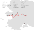
2015 Iditarod checkpoints.svg 1,594 × 1,429; 30 KB
-
Alaska administrative units - ru.svg 1,768 × 975; 179 KB
-
Alaska area compared to conterminous US.svg 1,184 × 758; 221 KB
-
Alaska blank borough map.svg 463 × 267; 45 KB
-
Alaska boroughs and census areas 2008-13.svg 885 × 500; 278 KB
-
Alaska boroughs and census areas 2013-19.svg 816 × 461; 334 KB
-
Alaska boroughs and census areas 2019.svg 2,563 × 1,344; 1.57 MB
-
Alaska boroughs and census areas russian version.svg 1,598 × 869; 316 KB
-
Alaska boroughs and census areas, blank.svg 800 × 488; 1.67 MB
-
Alaska compared to Lower 48.svg 1,085 × 748; 105 KB
-
Alaska Denbigh Site Map.svg 1,050 × 1,050; 138 KB
-
Alaska in its region.svg 2,681 × 1,508; 5.08 MB
-
Alaska Köppen.svg 900 × 990; 862 KB
-
Alaska Legislative Districts Blank.svg 989 × 627; 49 KB
-
Alaska location map.svg 512 × 382; 619 KB
-
Alaska overlaid on US hu.svg 2,059 × 1,258; 717 KB
-
Alaska Portal.svg 1,668 × 480; 149 KB
-
Alaska racial and ethnic map.svg 463 × 267; 24 KB
-
Alaska Senate district A.svg 820 × 443; 1.31 MB
-
Alaska Senate District B.svg 820 × 443; 1.31 MB
-
Alaska Senate District C.svg 820 × 443; 1.31 MB
-
Alaska Senate District D.svg 820 × 443; 1.31 MB
-
Alaska Senate District E.svg 820 × 443; 1.31 MB
-
Alaska Senate District F.svg 820 × 443; 1.31 MB
-
Alaska Senate District G.svg 820 × 443; 1.31 MB
-
Alaska Senate District H.svg 820 × 443; 1.31 MB
-
Alaska Senate District I.svg 820 × 443; 1.31 MB
-
Alaska Senate District J.svg 820 × 443; 1.31 MB
-
Alaska Senate District K.svg 820 × 443; 1.31 MB
-
Alaska Senate District L.svg 820 × 443; 1.31 MB
-
Alaska Senate District M.svg 820 × 443; 1.31 MB
-
Alaska Senate District N.svg 820 × 443; 1.31 MB
-
Alaska Senate District O.svg 820 × 443; 1.31 MB
-
Alaska Senate District P.svg 820 × 443; 1.31 MB
-
Alaska Senate District Q.svg 820 × 443; 1.31 MB
-
Alaska Senate District R.svg 820 × 443; 1.31 MB
-
Alaska Senate District S.svg 820 × 443; 1.31 MB
-
Alaska Senate District T.svg 820 × 443; 1.31 MB
-
Brooks Range.svg 637 × 369; 554 KB
-
Flag map of Alaska.svg 4,372 × 2,304; 349 KB
-
Gibson Islands.svg 274 × 376; 391 KB
-
Gray alaska.svg 2,878 × 1,537; 159 KB
-
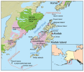
Kodiakislandmap.svg 1,000 × 855; 850 KB
-
LGBT flag map of Alaska.svg 3,036 × 2,187; 9 KB
-
Map of Alaska buroughs and census areas.svg 555 × 352; 51 KB
-
Map of USA AK full.svg 800 × 560; 376 KB
-
Map of USA AK.svg 286 × 186; 167 KB
-
Map of USA highlighting OCA Diocese of Alaska.svg 959 × 593; 78 KB
-
NRHP Alaska Map.svg 792 × 612; 249 KB
-
Superfund sites in Alaska.svg 830 × 436; 42 KB
-
Trans-Alaska Pipeline map.svg 303 × 1,071; 65 KB
-
Trans-Alaska Pipeline work camps.svg 303 × 1,071; 65 KB
-
USA Alaska location map.svg 1,553 × 1,160; 1.24 MB
-
Voyages of Ilya Voznesensky (1840-1848) - es.svg 1,482 × 1,086; 1,011 KB
-
Voyages of Ilya Voznesensky (1840-1848) - ru.svg 1,482 × 1,086; 913 KB


