Category:SVG maps of Arizona
Jump to navigation
Jump to search
States of the United States: Alabama · Alaska · Arizona · Arkansas · California · Colorado · Connecticut · Delaware · Florida · Georgia · Hawaii · Idaho · Illinois · Indiana · Iowa · Kansas · Kentucky · Louisiana · Maine · Maryland · Massachusetts · Michigan · Minnesota · Mississippi · Missouri · Montana · Nebraska · Nevada · New Hampshire · New Jersey · New Mexico · New York · North Carolina · North Dakota · Ohio · Oklahoma · Oregon · Pennsylvania · Rhode Island · South Carolina · South Dakota · Tennessee · Texas · Utah · Vermont · Virginia · Washington · West Virginia · Wisconsin · Wyoming – Washington, D.C.
American Samoa · Guam · Northern Mariana Islands · Puerto Rico – Navassa Island · Palmyra Atoll
American Samoa · Guam · Northern Mariana Islands · Puerto Rico – Navassa Island · Palmyra Atoll
Subcategories
This category has the following 3 subcategories, out of 3 total.
Media in category "SVG maps of Arizona"
The following 64 files are in this category, out of 64 total.
-
 Political divisions of Mexico 1824 (location map scheme).svg 649 × 617; 509 KB
-

-
 2018AZUSHouse.svg 810 × 810; 145 KB
-
 37th parallel US.svg 959 × 593; 67 KB
-
 Arizona counties by race.svg 278 × 323; 9 KB
-
 Arizona county map, cb 500k.svg 810 × 810; 15 KB
-
 Arizona H1N1 Flu Map.svg 5,453 × 6,322; 57 KB
-
 Arizona Hispanic population percentage by county.svg 663 × 768; 59 KB
-
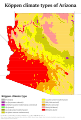 Arizona Köppen.svg 1,080 × 1,595; 795 KB
-
 Arizona Mountains Forests map.svg 1,712 × 1,992; 342 KB
-
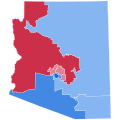
 Arizona Presidential Election Results 1996.svg 810 × 810; 17 KB
-
 Arizona racial and ethnic map.svg 277 × 323; 15 KB
-
 Arizona Regional Hunt Units.svg 5,462 × 6,331; 122 KB
-
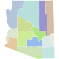
 Arizona regions map.svg 420 × 490; 8 KB
-

-
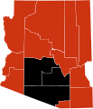
 Arizona Senatorial Election Results by County, 1952.svg 277 × 323; 15 KB
-
 Arizona State Route 377 map.svg 1,001 × 586; 127 KB
-
 Arizona State Route 93.svg 1,028 × 609; 1.07 MB
-
 Arizona and New Mexico Territories 1863.svg 405 × 278; 36 KB
-
 Arizona Wildlife Management Units.svg 5,462 × 6,331; 430 KB
-
 Barry M. Goldwater Range-West Guide.svg 3,600 × 2,699; 18.72 MB
-
 Blank Map of Arizona, pre-1983.svg 277 × 323; 15 KB
-
 Blank Map of Arizona.svg 5,462 × 6,331; 59 KB
-
 COVID-19 outbreak Arizona county map.svg 5,462 × 6,331; 62 KB
-
 COVID-19 outbreak Arizona per capita cases map.svg 5,462 × 6,331; 61 KB
-
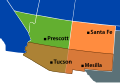
 Extension spanish arizona.svg 856 × 821; 92 KB
-
 Flag map of Arizona.svg 818 × 1,006; 19 KB
-
 LGBT flag map of Arizona.svg 818 × 1,005; 10 KB
-
 Map Anasazi, Hohokam and Mogollon cultures-es.svg 912 × 1,122; 76 KB
-
 Map of Arizona highlighting Apache County.svg 893 × 1,099; 260 KB
-
 Map of Arizona highlighting Cochise County.svg 893 × 1,099; 260 KB
-
 Map of Arizona highlighting Coconino County.svg 893 × 1,099; 260 KB
-
 Map of Arizona highlighting Gadsden Purchase Counties.svg 5,453 × 6,322; 56 KB
-
 Map of Arizona highlighting Gila County.svg 893 × 1,099; 260 KB
-
 Map of Arizona highlighting Graham County.svg 893 × 1,099; 260 KB
-
 Map of Arizona highlighting La Paz County.svg 893 × 1,099; 260 KB
-
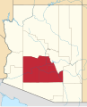
 Map of Arizona highlighting Maricopa County.svg 893 × 1,099; 260 KB
-
 Map of Arizona highlighting Mohave County.svg 893 × 1,099; 260 KB
-
 Map of Arizona highlighting Navajo County.svg 893 × 1,099; 260 KB
-
 Map of Arizona highlighting Pima County.svg 893 × 1,099; 260 KB
-
 Map of Arizona highlighting Pinal County.svg 893 × 1,099; 260 KB
-
 Map of Arizona highlighting Santa Cruz County.svg 893 × 1,099; 260 KB
-
 Map of Arizona highlighting Yavapai County.svg 893 × 1,099; 260 KB
-
 Map of Arizona highlighting Yuma County.svg 893 × 1,099; 260 KB
-
 Map of Phoenix Metropolitan Area Counties (Maricopa and Pinal).svg 893 × 1,099; 243 KB
-
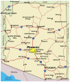
 Map of USA AZ.svg 286 × 186; 167 KB
-
 MapArizona.svg 1,038 × 1,215; 562 KB
-
 Most spoken language in Arizona by county in 2016.svg 5,826 × 6,753; 60 KB
-
 New Mexico Territory 1866 ZP.svg 254 × 154; 43 KB
-
 NRHP Arizona Map.svg 1,056 × 816; 5.61 MB
-
 Petrified Forest National Park.svg 1,000 × 1,000; 3 KB
-
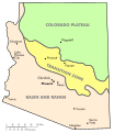 Physiographic regions of Arizona.svg 664 × 768; 229 KB
-
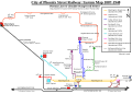 PSRYmap.svg 700 × 497; 79 KB
-
 Southwest Blackout of 2011.svg 1,789 × 2,154; 372 KB
-
 Superfund sites in Arizona.svg 473 × 559; 340 KB
-
 TUS airport diagram.svg 379 × 576; 603 KB
-
 U.S. D. Ariz. Divisions.svg 512 × 630; 73 KB
-
 United States House of Representatives Election 2016 - Arizona.svg 790 × 1,039; 93 KB
-
 USA Arizona location map.svg 893 × 1,099; 142 KB
-
 USA Arizona relief location map.svg 893 × 1,099; 2.51 MB
-
 USA Arizona Southwest Colorado plateau.svg 893 × 1,099; 172 KB
-
 USA-Antilope-Canyon.svg 289 × 189; 117 KB
-
 Wpdms Arizona Territory 1860 ZP.svg 254 × 154; 32 KB
-
 Yaqui location.svg 1,012 × 755; 729 KB
.svg)


.svg)


