Category:SVG maps of South Dakota
Jump to navigation
Jump to search
States of the United States: Alabama · Alaska · Arizona · Arkansas · California · Colorado · Connecticut · Delaware · Florida · Georgia · Hawaii · Idaho · Illinois · Indiana · Iowa · Kansas · Kentucky · Louisiana · Maine · Maryland · Massachusetts · Michigan · Minnesota · Mississippi · Missouri · Montana · Nebraska · Nevada · New Hampshire · New Jersey · New Mexico · New York · North Carolina · North Dakota · Ohio · Oklahoma · Oregon · Pennsylvania · Rhode Island · South Carolina · South Dakota · Tennessee · Texas · Utah · Vermont · Virginia · Washington · West Virginia · Wisconsin · Wyoming – Washington, D.C.
American Samoa · Guam · Northern Mariana Islands · Puerto Rico – Navassa Island · Palmyra Atoll
American Samoa · Guam · Northern Mariana Islands · Puerto Rico – Navassa Island · Palmyra Atoll
Subcategories
This category has the following 3 subcategories, out of 3 total.
Media in category "SVG maps of South Dakota"
The following 15 files are in this category, out of 15 total.
-
 Dakotas.svg 959 × 593; 90 KB
-
 LGBT flag map of South Dakota.svg 6,226 × 3,832; 16 KB
-
 Location of Lower Brule Reservation.svg 6,226 × 3,832; 51 KB
-
 Location of Sisseton Reservation.svg 6,226 × 3,901; 98 KB
-
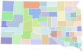
 Map of South Dakota's legislative districts.svg 7,500 × 5,400; 982 KB
-
 Map of USA SD.svg 286 × 186; 167 KB
-
 NSICstates.svg 959 × 593; 52 KB
-
 South Dakota 1916-1945.svg 800 × 497; 30 KB
-

-
 South dakota counties by race.svg 810 × 506; 30 KB
-
 South Dakota county map, cb 500k.svg 810 × 506; 24 KB
-
 South Dakota House Election Results by County, 2016.svg 810 × 506; 30 KB
-
 South Dakota Köppen.svg 1,440 × 1,305; 722 KB
-
 South Dakota racial and ethnic map.svg 243 × 152; 18 KB
-
 USA South Dakota relief location map.svg 1,200 × 788; 1.78 MB


