Category:SVG maps of West Virginia
Jump to navigation
Jump to search
States of the United States: Alabama · Alaska · Arizona · Arkansas · California · Colorado · Connecticut · Delaware · Florida · Georgia · Hawaii · Idaho · Illinois · Indiana · Iowa · Kansas · Kentucky · Louisiana · Maine · Maryland · Massachusetts · Michigan · Minnesota · Mississippi · Missouri · Montana · Nebraska · Nevada · New Hampshire · New Jersey · New Mexico · New York · North Carolina · North Dakota · Ohio · Oklahoma · Oregon · Pennsylvania · Rhode Island · South Carolina · South Dakota · Tennessee · Texas · Utah · Vermont · Virginia · Washington · West Virginia · Wisconsin · Wyoming – Washington, D.C.
American Samoa · Guam · Northern Mariana Islands · Puerto Rico – Navassa Island · Palmyra Atoll
American Samoa · Guam · Northern Mariana Islands · Puerto Rico – Navassa Island · Palmyra Atoll
A collection of maps of West Virginia or portions thereof in SVG format.
Subcategories
This category has the following 2 subcategories, out of 2 total.
Media in category "SVG maps of West Virginia"
The following 40 files are in this category, out of 40 total.
-
2020 West Virginia Attorney General Election Results.svg 810 × 719; 38 KB
-
2020 West Virginia Treasurer Election Results.svg 810 × 719; 38 KB
-
Achalarus lyciades wv map red.svg 1,000 × 750; 177 KB
-
Amblyscirtes hegon wv map red.svg 1,000 × 750; 177 KB
-
Amblyscirtes vialis wv map red.svg 1,000 × 750; 177 KB
-
Anatrytone logan wv map red.svg 1,000 × 750; 177 KB
-
Ancyloxypha numitor wv map red.svg 1,000 × 750; 178 KB
-
Atalopedes campestris wv map red.svg 1,000 × 750; 177 KB
-
Atrytonopsis hianna wv map red.svg 1,000 × 750; 177 KB
-
Autochton cellus wv map red.svg 1,000 × 750; 177 KB
-
Eastern Panhandle of West Virginia Location Map.svg 1,196 × 1,026; 27.81 MB
-
Epargyreus clarus wv map red.svg 1,000 × 750; 178 KB
-
Erynnis brizo wv map red.svg 1,000 × 750; 177 KB
-
Erynnis horatius wv map red.svg 1,000 × 750; 177 KB
-
Erynnis icelus wv map red.svg 1,000 × 750; 178 KB
-
Erynnis juvenalis wv map red.svg 1,000 × 750; 178 KB
-
Erynnis lucilius wv map red.svg 1,000 × 750; 177 KB
-
Erynnis martialis wv map red.svg 1,000 × 750; 177 KB
-
Lampropeltis getula niger.svg 1,000 × 750; 177 KB
-
LGBT flag map of West Virginia.svg 4,270 × 3,805; 55 KB
-
Map of USA WV.svg 286 × 186; 167 KB
-
Maryland Campaign (September 10—13, 1862) - ru.svg 1,332 × 943; 593 KB
-
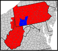
Presbytery of Redstone map.svg 159 × 137; 208 KB
-
Raid on Chambersburg - ru.svg 1,473 × 1,549; 833 KB
-
Romney West Virginia Location Map.svg 2,619 × 2,370; 7.26 MB
-
Synod of the Trinity map - border.svg 159 × 137; 208 KB
-
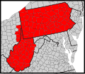
Synod of the Trinity map.svg 130 × 130; 69 KB
-
US federal courts in West Virginia.svg 1,000 × 750; 197 KB
-
USA West Virginia location map.svg 1,201 × 1,118; 523 KB
-
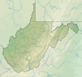
USA West Virginia relief location map.svg 1,201 × 1,118; 5.84 MB
-
Virginia valeriae pulchra wv map red.svg 1,000 × 750; 177 KB
-
Washington Presbytery map.svg 159 × 137; 208 KB
-
West Virginia Counties by race (2020 census).svg 291 × 277; 20 KB
-
West Virginia county map, cb 500k.svg 810 × 719; 33 KB
-
West Virginia in United States (US48).svg 1,181 × 731; 2.36 MB
-
West Virginia in United States.svg 1,181 × 731; 3.46 MB
-
West Virginia racial and ethnic map.svg 290 × 276; 15 KB
-
West Virginia Senate 2022 District Map.svg 512 × 466; 199 KB
-
West Virginia Senate Current.svg 3,436 × 2,019; 140 KB
-
WestVirginiaWith Counties.svg 1,000 × 750; 197 KB


