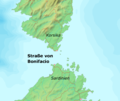
Category:Maps of the Strait of Bonifacio
Jump to navigation
Jump to search
Media in category "Maps of the Strait of Bonifacio"
The following 17 files are in this category, out of 17 total.
-
Strait of Bonifacio - Envisat.jpg 2,621 × 2,000; 2.84 MB
-
Stroossbonifacio.jpg 469 × 580; 35 KB
-
Bouches de Boniface - Roux Joseph - 1804.jpg 1,500 × 1,063; 653 KB
-
Location Strait of Bonifacio.PNG 404 × 263; 9 KB
-
Admiralty Chart No 1131 Island of Corsica, Published 1874.jpg 8,287 × 12,235; 11.82 MB
-
Admiralty Chart No 1189 Bonifacio Strait, Published 1883.jpg 16,388 × 11,295; 49.4 MB
-
Battle of Alalia map.jpg 514 × 673; 155 KB
-
Prolaz bonifacio.svg 920 × 775; 204 KB
-
Bocche di Bonifacio (cropped).png 861 × 593; 50 KB
-
Bocche di Bonifacio.png 861 × 726; 75 KB
-
Bonifacio-strait-EST.svg 920 × 775; 169 KB
-
Périmètre RNC Bouches de Bonifacio rnc147.png 1,236 × 823; 292 KB
-
Strait of bonifacio2.jpg 195 × 283; 12 KB
-
Strait of Bonifaco.jpg 195 × 287; 12 KB
-
Strasse von Bonifacio.png 861 × 726; 61 KB


