Category:Topographic maps of Gabon
Jump to navigation
Jump to search
Subcategories
This category has only the following subcategory.
S
Media in category "Topographic maps of Gabon"
The following 16 files are in this category, out of 16 total.
-
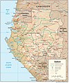
Gabon Physiography.jpg 1,985 × 2,390; 1.46 MB
-
Gabon relief location map.jpg 1,200 × 1,114; 994 KB
-
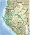
Gabon Topografía.jpg 1,297 × 1,260; 2.33 MB
-
Gabon Topography.png 1,297 × 1,260; 1.62 MB
-
Golf van Guinee.jpg 891 × 557; 78 KB
-
Golf von Guinea.jpg 891 × 557; 53 KB
-
Gulf of Guinea (blank).jpg 891 × 557; 136 KB
-
Gulf of Guinea (English).jpg 891 × 557; 155 KB
-
Gulf of Guinea (pl).jpg 891 × 557; 160 KB
-
Gulf of Guinea es.png 835 × 522; 180 KB
-
Gulf of Guinea fi.jpg 800 × 500; 93 KB
-
Gulf of Guinea ru.jpg 891 × 557; 164 KB
-
Gulf of Guinea-fr.jpg 891 × 557; 164 KB
-
Jineiya wan-zh.png 891 × 557; 513 KB
-
Localisation de Lambaréné.jpg 649 × 768; 316 KB
-
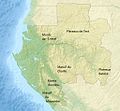
Massifs-montagneux-gabon.jpg 1,024 × 951; 286 KB


