Category:Old maps of Abruzzo
Jump to navigation
Jump to search
- Regions of Italy: Abruzzo · Aosta Valley · Apulia · Basilicata · Calabria · Campania · Emilia-Romagna · Friuli-Venezia Giulia · Lazio · Liguria · Lombardy · Marche · Molise · Piedmont · Sardinia · Sicily · Trentino-South Tyrol · Tuscany · Umbria · Veneto
Use the appropriate category for maps showing all or a large part of Abruzzo. See subcategories for smaller areas:
| If the map shows | Category to use |
|---|---|
| Abruzzo on a recently created map | Category:Maps of Abruzzo or its subcategories |
| Abruzzo on a map created more than 70 years ago | Category:Old maps of Abruzzo or its subcategories |
| the history of Abruzzo on a recently created map | Category:Maps of the history of Abruzzo or its subcategories |
| the history of Abruzzo on a map created more than 70 years ago | Category:Old maps of the history of Abruzzo or its subcategories |
Subcategories
This category has the following 8 subcategories, out of 8 total.
- 18th-century maps of Abruzzo (3 F)
- 19th-century maps of Abruzzo (12 F)
A
- Old maps of L'Aquila (6 F)
- Old maps of Avezzano (17 F)
Pages in category "Old maps of Abruzzo"
This category contains only the following page.
Media in category "Old maps of Abruzzo"
The following 20 files are in this category, out of 20 total.
-
 TabulaPeutingerianaOcriticum.jpg 1,812 × 1,100; 993 KB
-

-

-

-

-
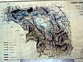
 Contado di Molise et principato vltra (8357189313).jpg 6,630 × 5,553; 38.68 MB
-
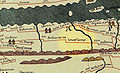
 Lake Fucino Map (Flickr 38955575 20bd3cd7eb o).jpg 2,048 × 1,536; 921 KB
-
 NAPOLITANIA.PNG 504 × 644; 313 KB
-
 Métaure Atlas Historique Schul-Atlas, 1905.JPG 1,137 × 913; 334 KB
-
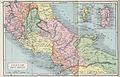 Butler Italiæ Pars Media.jpg 3,234 × 2,082; 2.21 MB
-
 Ancient Frentani.png 579 × 517; 3.39 MB
-
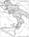
 Italy (South) 1050.jpg 548 × 575; 100 KB
-
 Grande Ciociaria.jpg 729 × 499; 268 KB
-

-
-

-
-
 Meyer‘s Zeitungsatlas 063 – Das Königreich beider Sicilien, Nördliche Hälfte.jpg 7,386 × 6,217; 17.34 MB
-
-


.jpg)
.jpg)


_1050.jpg)


_(14763049552).jpg)
_(14783241153).jpg)